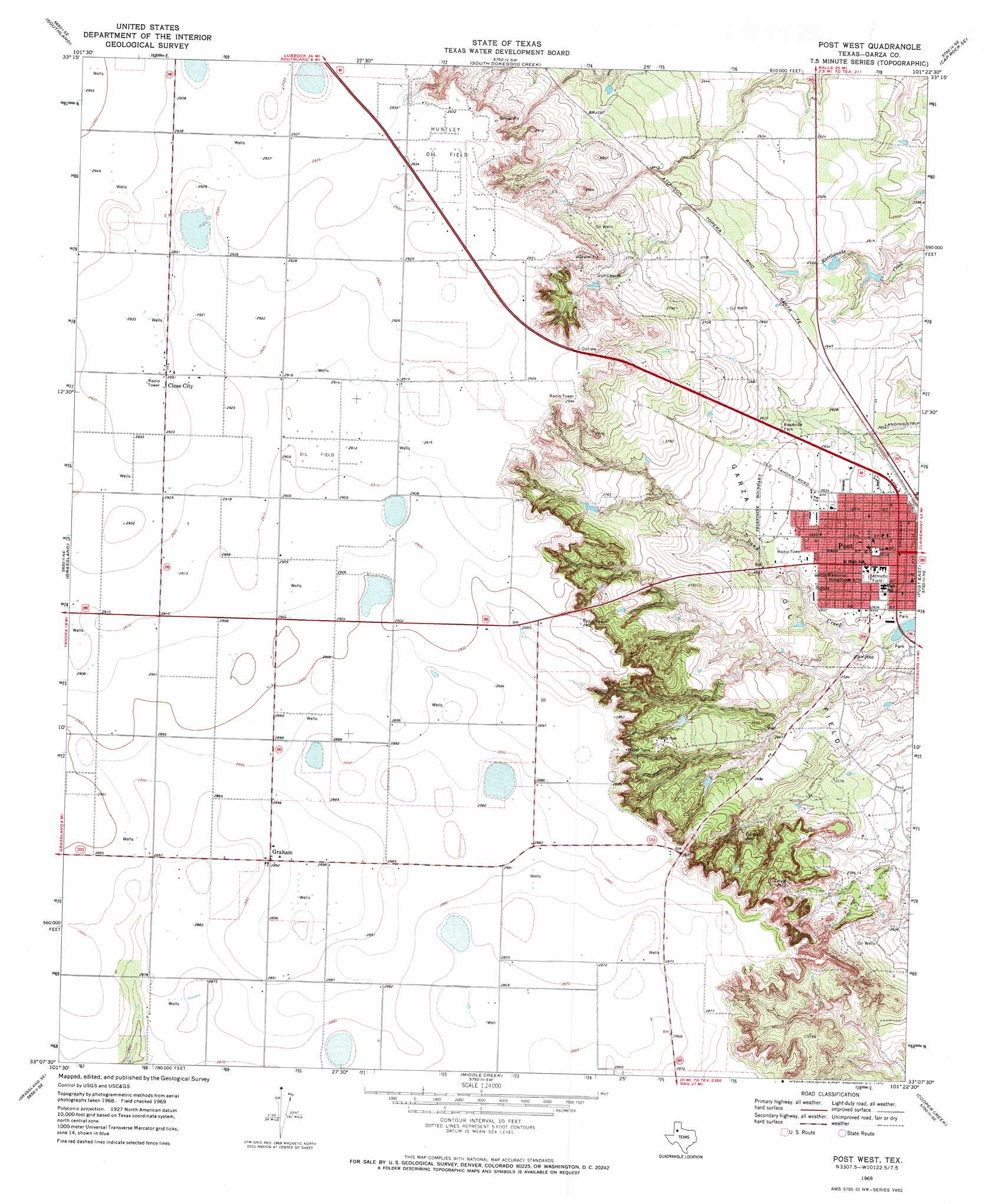
Post West Topo Map Texas
To zoom in, hover over the map of Post West
USGS Topo Quad 33101b4 - 1:24,000 scale
| Topo Map Name: | Post West |
| USGS Topo Quad ID: | 33101b4 |
| Print Size: | ca. 21 1/4" wide x 27" high |
| Southeast Coordinates: | 33.125° N latitude / 101.375° W longitude |
| Map Center Coordinates: | 33.1875° N latitude / 101.4375° W longitude |
| U.S. State: | TX |
| Filename: | o33101b4.jpg |
| Download Map JPG Image: | Post West topo map 1:24,000 scale |
| Map Type: | Topographic |
| Topo Series: | 7.5´ |
| Map Scale: | 1:24,000 |
| Source of Map Images: | United States Geological Survey (USGS) |
| Alternate Map Versions: |
Post West TX 1969, updated 1972 Download PDF Buy paper map Post West TX 2010 Download PDF Buy paper map Post West TX 2012 Download PDF Buy paper map Post West TX 2016 Download PDF Buy paper map |
1:24,000 Topo Quads surrounding Post West
Slaton |
Slaton Ne |
Cap Rock |
Canyon Valley |
Kalgary |
Wilson |
Southland |
South Dokegood Creek |
Cap Rock Se |
Verbena |
New Lynn |
Grassland |
Post West |
Post East |
Justiceburg Nw |
Draw |
Grassland Se |
Middle Creek |
Cooper Creek |
Justiceburg |
Indian Canyon Nw |
Indian Canyon Ne |
Beal Hollow |
Gail Ne |
Fluvanna |
> Back to 33101a1 at 1:100,000 scale
> Back to 33100a1 at 1:250,000 scale
> Back to U.S. Topo Maps home
Post West topo map: Gazetteer
Post West: Oilfields
Huntley Oil Field elevation 894m 2933′Post West: Populated Places
Close City elevation 894m 2933′Graham elevation 882m 2893′
Post elevation 794m 2604′
Post West digital topo map on disk
Buy this Post West topo map showing relief, roads, GPS coordinates and other geographical features, as a high-resolution digital map file on DVD: