Beal Hollow Topo Map Texas
To zoom in, hover over the map of Beal Hollow
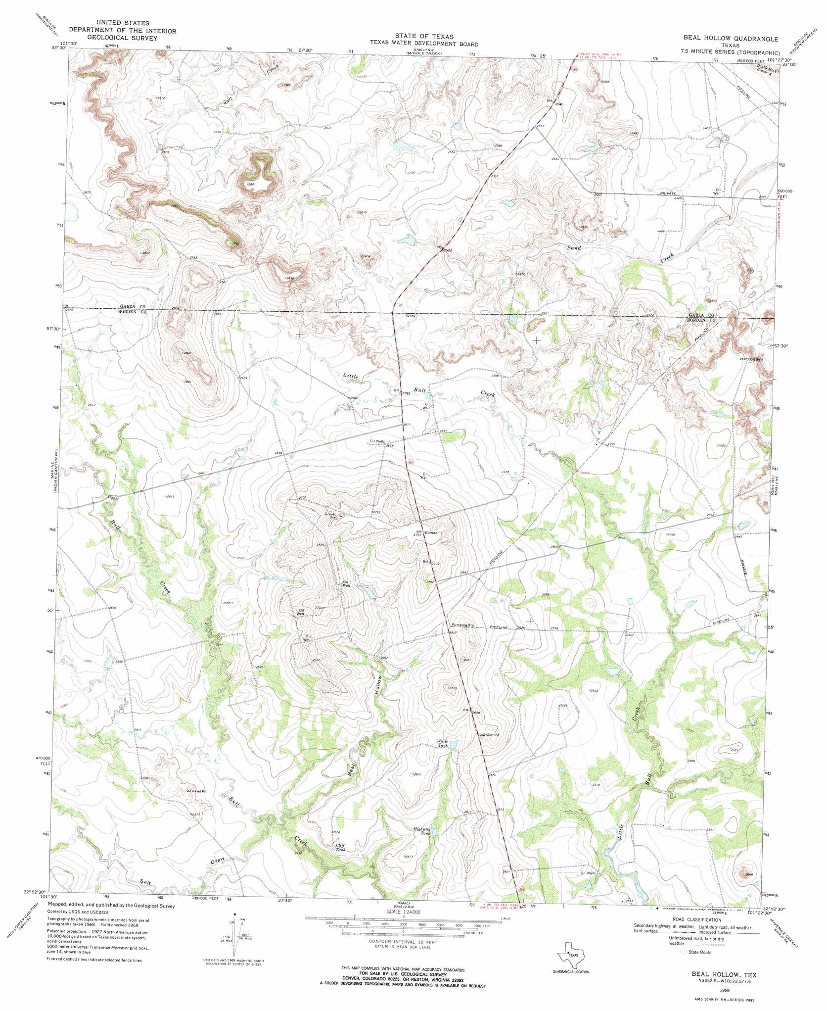
USGS Topo Quad 32101h4 - 1:24,000 scale
| Topo Map Name: | Beal Hollow |
| USGS Topo Quad ID: | 32101h4 |
| Print Size: | ca. 21 1/4" wide x 27" high |
| Southeast Coordinates: | 32.875° N latitude / 101.375° W longitude |
| Map Center Coordinates: | 32.9375° N latitude / 101.4375° W longitude |
| U.S. State: | TX |
| Filename: | o32101h4.jpg |
| Download Map JPG Image: | Beal Hollow topo map 1:24,000 scale |
| Map Type: | Topographic |
| Topo Series: | 7.5´ |
| Map Scale: | 1:24,000 |
| Source of Map Images: | United States Geological Survey (USGS) |
| Alternate Map Versions: |
Beal Hollow TX 1969, updated 1971 Download PDF Buy paper map Beal Hollow TX 2010 Download PDF Buy paper map Beal Hollow TX 2012 Download PDF Buy paper map Beal Hollow TX 2016 Download PDF Buy paper map |
1:24,000 Topo Quads surrounding Beal Hollow
New Lynn |
Grassland |
Post West |
Post East |
Justiceburg Nw |
Draw |
Grassland Se |
Middle Creek |
Cooper Creek |
Justiceburg |
Indian Canyon Nw |
Indian Canyon Ne |
Beal Hollow |
Gail Ne |
Fluvanna |
Indian Canyon |
Holloway Canyon |
Gail |
Fivemile Creek |
Arah |
Sand Creek |
Long Draw |
Mushaway Peak |
Gunsight Draw Ne |
Ira Nw |
> Back to 32101e1 at 1:100,000 scale
> Back to 32100a1 at 1:250,000 scale
> Back to U.S. Topo Maps home
Beal Hollow topo map: Gazetteer
Beal Hollow: Reservoirs
Cliff Tank elevation 775m 2542′Highway Tank elevation 781m 2562′
White Tank elevation 796m 2611′
Beal Hollow: Valleys
Beal Hollow elevation 770m 2526′Salt Draw elevation 767m 2516′
Beal Hollow digital topo map on disk
Buy this Beal Hollow topo map showing relief, roads, GPS coordinates and other geographical features, as a high-resolution digital map file on DVD: