Mescalero Point Topo Map New Mexico
To zoom in, hover over the map of Mescalero Point
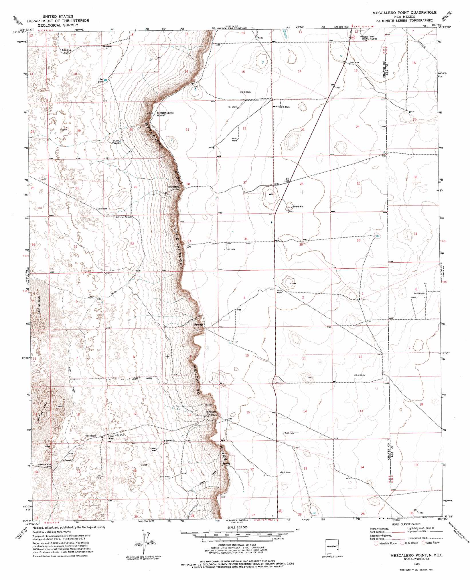
USGS Topo Quad 33103c7 - 1:24,000 scale
| Topo Map Name: | Mescalero Point |
| USGS Topo Quad ID: | 33103c7 |
| Print Size: | ca. 21 1/4" wide x 27" high |
| Southeast Coordinates: | 33.25° N latitude / 103.75° W longitude |
| Map Center Coordinates: | 33.3125° N latitude / 103.8125° W longitude |
| U.S. State: | NM |
| Filename: | o33103c7.jpg |
| Download Map JPG Image: | Mescalero Point topo map 1:24,000 scale |
| Map Type: | Topographic |
| Topo Series: | 7.5´ |
| Map Scale: | 1:24,000 |
| Source of Map Images: | United States Geological Survey (USGS) |
| Alternate Map Versions: |
Mescalero Point NM 1973, updated 1976 Download PDF Buy paper map Mescalero Point NM 2010 Download PDF Buy paper map Mescalero Point NM 2013 Download PDF Buy paper map Mescalero Point NM 2017 Download PDF Buy paper map |
1:24,000 Topo Quads surrounding Mescalero Point
Sardine Lake |
Presler Lake |
Curlew Lake Se |
Button Mesa South |
Flying M Ranch |
Sardine Mountain |
Oasis |
Mescalero Point Ne |
Caprock |
Lane Salt Lake |
Malstrom Ranch |
Culp Ranch |
Mescalero Point |
Soldier Hill |
Dallas Store |
Conner Well |
Vest Camp |
Caudill Ranch |
Cooper-Good Ranch |
Frier Ranch |
King Camp |
Cedar Point |
Cedar Point Se |
Dean Ranch |
Fort Ranch |
> Back to 33103a1 at 1:100,000 scale
> Back to 33102a1 at 1:250,000 scale
> Back to U.S. Topo Maps home
Mescalero Point topo map: Gazetteer
Mescalero Point: Reservoirs
Red Tank elevation 1265m 4150′Sikes Tanks elevation 1274m 4179′
Mescalero Point: Springs
Graham Spring elevation 1308m 4291′Mescalero Spring elevation 1327m 4353′
Mescalero Point: Summits
Mescalero Point elevation 1370m 4494′Mescalero Point: Wells
10648 Water Well elevation 1359m 4458′10654 Water Well elevation 1351m 4432′
Graham Well elevation 1232m 4041′
Mescalero Point digital topo map on disk
Buy this Mescalero Point topo map showing relief, roads, GPS coordinates and other geographical features, as a high-resolution digital map file on DVD: