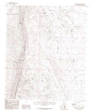
Palomas Gap Topo Map New Mexico
To zoom in, hover over the map of Palomas Gap
USGS Topo Quad 33107a2 - 1:24,000 scale
| Topo Map Name: | Palomas Gap |
| USGS Topo Quad ID: | 33107a2 |
| Print Size: | ca. 21 1/4" wide x 27" high |
| Southeast Coordinates: | 33° N latitude / 107.125° W longitude |
| Map Center Coordinates: | 33.0625° N latitude / 107.1875° W longitude |
| U.S. State: | NM |
| Filename: | o33107a2.jpg |
| Download Map JPG Image: | Palomas Gap topo map 1:24,000 scale |
| Map Type: | Topographic |
| Topo Series: | 7.5´ |
| Map Scale: | 1:24,000 |
| Source of Map Images: | United States Geological Survey (USGS) |
| Alternate Map Versions: |
Palomas Gap NM 1985, updated 1985 Download PDF Buy paper map Palomas Gap NM 1996, updated 2002 Download PDF Buy paper map Palomas Gap NM 2010 Download PDF Buy paper map Palomas Gap NM 2013 Download PDF Buy paper map Palomas Gap NM 2017 Download PDF Buy paper map |
1:24,000 Topo Quads surrounding Palomas Gap
> Back to 33107a1 at 1:100,000 scale
> Back to 33106a1 at 1:250,000 scale
> Back to U.S. Topo Maps home
Palomas Gap topo map: Gazetteer
Palomas Gap: Gaps
Palomas Gap elevation 1455m 4773′Palonas Gap elevation 1469m 4819′
Palomas Gap: Mines
Ashland Mine elevation 1513m 4963′Black Jack Mine elevation 1475m 4839′
Blue Jacket Prospect elevation 1451m 4760′
Carolyn elevation 1550m 5085′
Carroll elevation 1549m 5082′
Carroll Prospect elevation 1638m 5374′
Cox elevation 1727m 5666′
Cox Mine elevation 1625m 5331′
Dakota Mine elevation 1393m 4570′
Dewey elevation 1489m 4885′
Dewey and White Swan Deposit elevation 1498m 4914′
Forty-One and Riverside Mine elevation 1529m 5016′
Forty-One Claim elevation 1406m 4612′
Governor elevation 1423m 4668′
Harding elevation 1506m 4940′
Illinois elevation 1567m 5141′
Independence Mine elevation 1513m 4963′
Lincoln Mine elevation 1393m 4570′
Little Johnnie Mine elevation 1455m 4773′
Little Johnnie Mine elevation 1424m 4671′
Lone Tree Prospect elevation 1550m 5085′
Marian Mine elevation 1550m 5085′
Marian Mine elevation 1683m 5521′
Napolean- Rosa Lee Group elevation 1585m 5200′
Napoleon - Rosa Lee elevation 1614m 5295′
Oakland Vein Mine elevation 1497m 4911′
Oohoo elevation 1543m 5062′
Red Top elevation 1534m 5032′
Riverside Mine elevation 1529m 5016′
Tingley elevation 1549m 5082′
Tingley Prospect elevation 1527m 5009′
Universal Mine elevation 1497m 4911′
Victoria Mine elevation 1551m 5088′
White Star Vein Mine elevation 1497m 4911′
White Swan elevation 1486m 4875′
Wild Horse elevation 1407m 4616′
Yellowjacket Mine Number 1 elevation 1678m 5505′
Yellowjacket Mine Number 2 elevation 1586m 5203′
Palomas Gap: Reservoirs
Little Ohmey Tank elevation 1635m 5364′Red Tank elevation 1552m 5091′
Palomas Gap: Springs
Ash Spring elevation 1463m 4799′Barney Lorio Number 1 Spring elevation 1516m 4973′
Mescal Spring elevation 1378m 4520′
Palomas Gap: Streams
Palomas Gap Creek elevation 1469m 4819′Palomas Gap: Summits
Caballo Cone elevation 1834m 6017′Turtle Mountain elevation 1834m 6017′
Palomas Gap: Valleys
Caballo Canyon elevation 1451m 4760′Hadley Canyon elevation 1567m 5141′
Lead Mine Canyon elevation 1516m 4973′
Palomas Gap digital topo map on disk
Buy this Palomas Gap topo map showing relief, roads, GPS coordinates and other geographical features, as a high-resolution digital map file on DVD:


