Prisor Hill Topo Map New Mexico
To zoom in, hover over the map of Prisor Hill
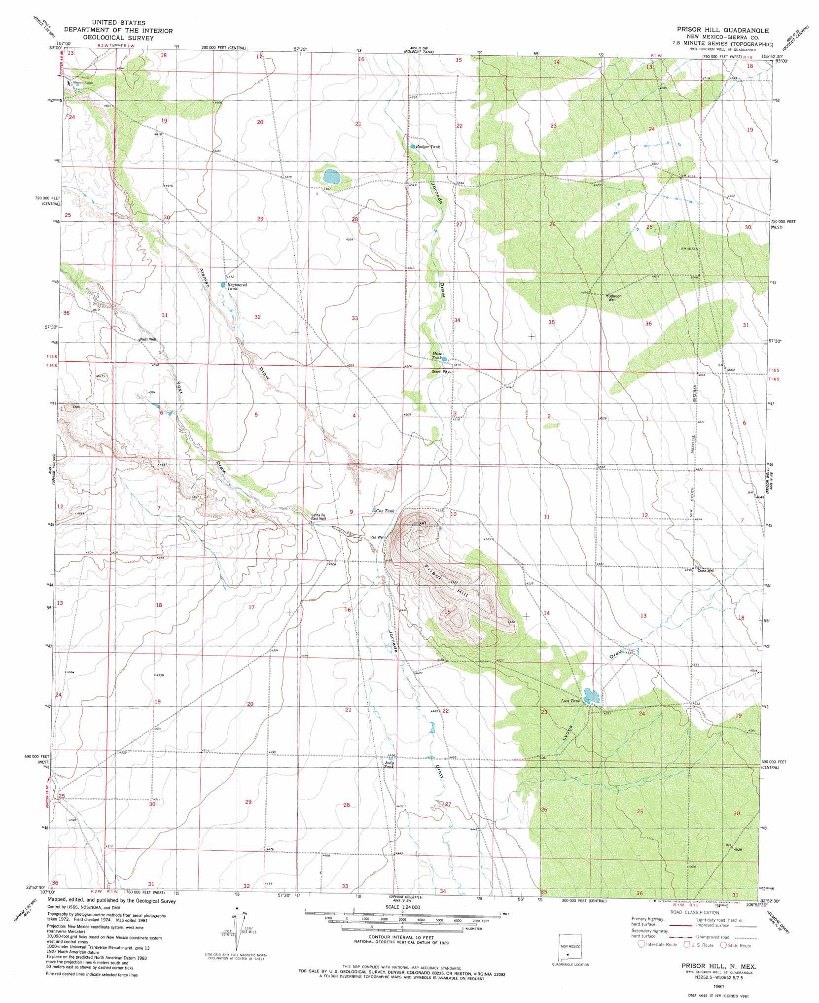
USGS Topo Quad 32106h8 - 1:24,000 scale
| Topo Map Name: | Prisor Hill |
| USGS Topo Quad ID: | 32106h8 |
| Print Size: | ca. 21 1/4" wide x 27" high |
| Southeast Coordinates: | 32.875° N latitude / 106.875° W longitude |
| Map Center Coordinates: | 32.9375° N latitude / 106.9375° W longitude |
| U.S. State: | NM |
| Filename: | o32106h8.jpg |
| Download Map JPG Image: | Prisor Hill topo map 1:24,000 scale |
| Map Type: | Topographic |
| Topo Series: | 7.5´ |
| Map Scale: | 1:24,000 |
| Source of Map Images: | United States Geological Survey (USGS) |
| Alternate Map Versions: |
Prisor Hill NM 1981, updated 1981 Download PDF Buy paper map Prisor Hill NM 1996, updated 2002 Download PDF Buy paper map Prisor Hill NM 2010 Download PDF Buy paper map Prisor Hill NM 2013 Download PDF Buy paper map Prisor Hill NM 2017 Download PDF Buy paper map |
1:24,000 Topo Quads surrounding Prisor Hill
Elephant Butte |
Engle |
Shannon Canyon Nw |
Shannon Canyon |
Hardscrabble Mountains |
Palomas Gap |
Cutter |
Polecat Tank |
Dugout Canyon |
Sulphur Pass |
Apache Gap |
Upham |
Prisor Hill |
Prisor Well |
Hembrillo Basin |
Mcleod Tank |
Alivio |
Upham Hills |
Gilmore Draw |
Fleck Draw |
Hatch |
Rincon |
Thorn Well |
Seldon Canyon Ne |
Goldenburg Draw |
> Back to 32106e1 at 1:100,000 scale
> Back to 32106a1 at 1:250,000 scale
> Back to U.S. Topo Maps home
Prisor Hill topo map: Gazetteer
Prisor Hill: Reservoirs
Cox Tank elevation 1372m 4501′East Tank Number 3 elevation 1378m 4520′
Mose Tank elevation 1377m 4517′
Prisor Hill: Valleys
Aleman Draw elevation 1375m 4511′Yoast Draw elevation 1371m 4498′
Prisor Hill digital topo map on disk
Buy this Prisor Hill topo map showing relief, roads, GPS coordinates and other geographical features, as a high-resolution digital map file on DVD: