Luera Mountains Nw Topo Map New Mexico
To zoom in, hover over the map of Luera Mountains Nw
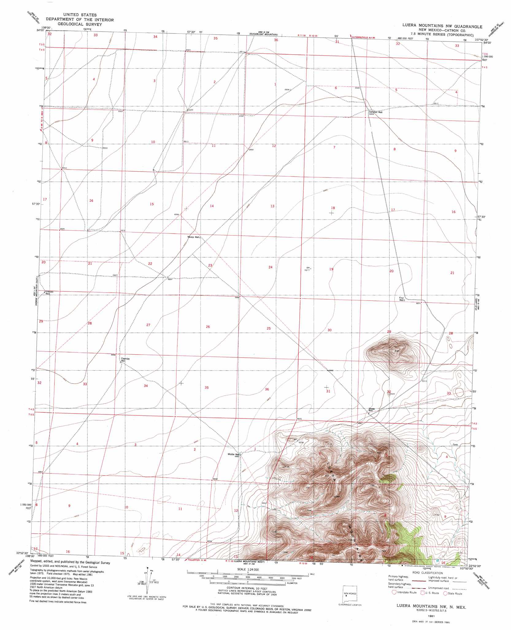
USGS Topo Quad 33107h8 - 1:24,000 scale
| Topo Map Name: | Luera Mountains Nw |
| USGS Topo Quad ID: | 33107h8 |
| Print Size: | ca. 21 1/4" wide x 27" high |
| Southeast Coordinates: | 33.875° N latitude / 107.875° W longitude |
| Map Center Coordinates: | 33.9375° N latitude / 107.9375° W longitude |
| U.S. State: | NM |
| Filename: | o33107h8.jpg |
| Download Map JPG Image: | Luera Mountains Nw topo map 1:24,000 scale |
| Map Type: | Topographic |
| Topo Series: | 7.5´ |
| Map Scale: | 1:24,000 |
| Source of Map Images: | United States Geological Survey (USGS) |
| Alternate Map Versions: |
Luera Mountains NW NM 1981, updated 1981 Download PDF Buy paper map Luera Mountains NW NM 2010 Download PDF Buy paper map Luera Mountains NW NM 2013 Download PDF Buy paper map Luera Mountains NW NM 2017 Download PDF Buy paper map |
1:24,000 Topo Quads surrounding Luera Mountains Nw
Alegres Mountain |
Cox Peak |
Crosby Springs |
Datil |
Lion Mountain Nw |
Wallace Mesa |
Log Canyon |
Sugarloaf Mountain |
Anderson Peak |
Augustine Well |
Horse Mountain West |
Horse Mountain East |
Luera Mountains Nw |
C-N Lake |
Kellog Well |
Fullerton |
Shaw Mountain |
Luera Mountains West |
Luera Mountains East |
Oak Peak |
Rail Canyon |
Pelona Mountain |
Mojonera Canyon |
Paddys Hole |
Dusty |
> Back to 33107e1 at 1:100,000 scale
> Back to 33106a1 at 1:250,000 scale
> Back to U.S. Topo Maps home
Luera Mountains Nw topo map: Gazetteer
Luera Mountains Nw: Wells
Chamiza Well elevation 2102m 6896′First Well elevation 2095m 6873′
Granoso Well elevation 2109m 6919′
Middle Water Well elevation 2093m 6866′
Navajo Water Well elevation 2103m 6899′
Navajo Well elevation 2103m 6899′
Sanchez Well elevation 2104m 6902′
Sheep Water Well elevation 2102m 6896′
Windmill L Water Well elevation 2110m 6922′
Windmill M Water Well elevation 2110m 6922′
Luera Mountains Nw digital topo map on disk
Buy this Luera Mountains Nw topo map showing relief, roads, GPS coordinates and other geographical features, as a high-resolution digital map file on DVD: