Warsaw South Topo Map North Carolina
To zoom in, hover over the map of Warsaw South
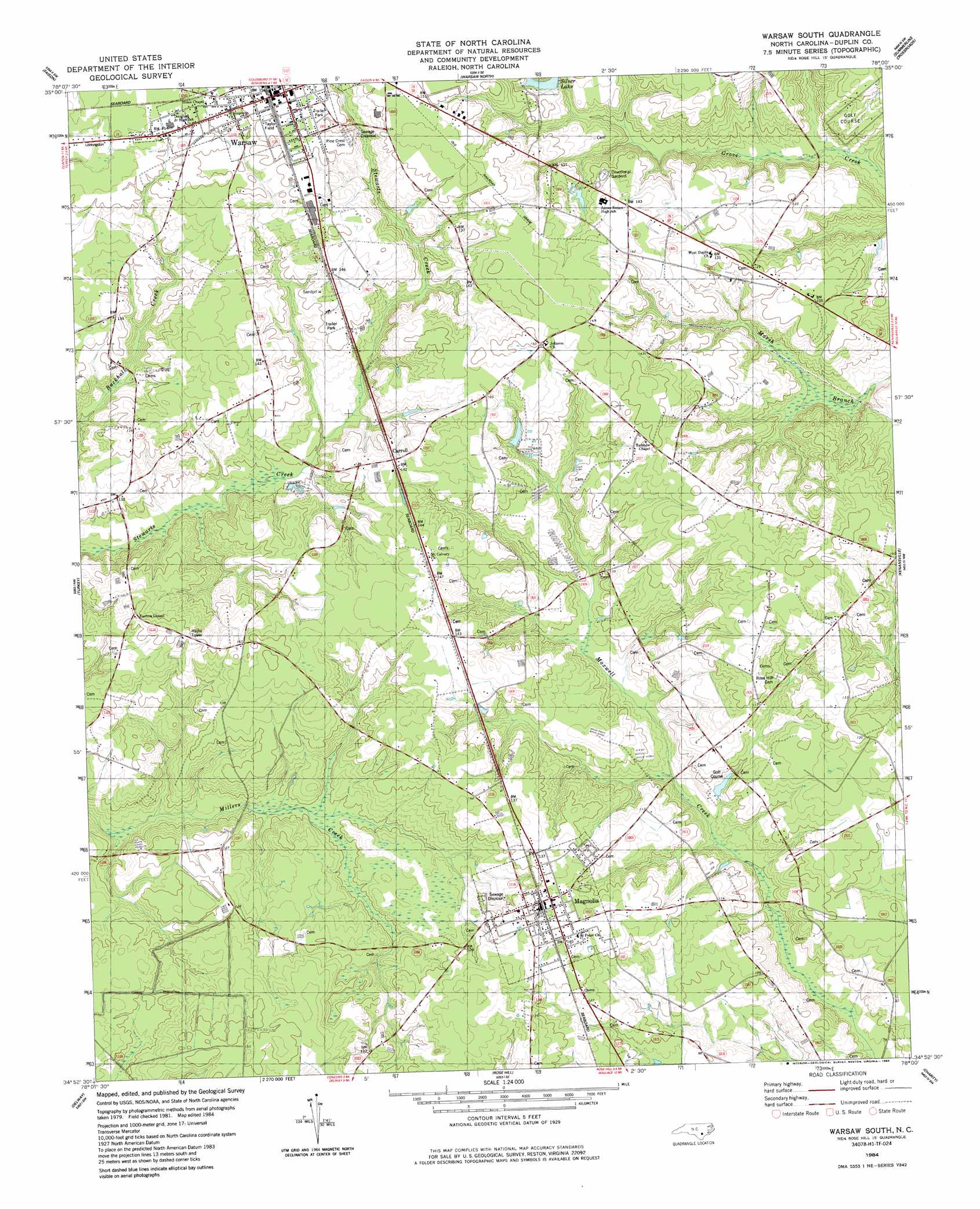
USGS Topo Quad 34078h1 - 1:24,000 scale
| Topo Map Name: | Warsaw South |
| USGS Topo Quad ID: | 34078h1 |
| Print Size: | ca. 21 1/4" wide x 27" high |
| Southeast Coordinates: | 34.875° N latitude / 78° W longitude |
| Map Center Coordinates: | 34.9375° N latitude / 78.0625° W longitude |
| U.S. State: | NC |
| Filename: | o34078h1.jpg |
| Download Map JPG Image: | Warsaw South topo map 1:24,000 scale |
| Map Type: | Topographic |
| Topo Series: | 7.5´ |
| Map Scale: | 1:24,000 |
| Source of Map Images: | United States Geological Survey (USGS) |
| Alternate Map Versions: |
Warsaw South NC 1984, updated 1984 Download PDF Buy paper map Warsaw South NC 2010 Download PDF Buy paper map Warsaw South NC 2013 Download PDF Buy paper map Warsaw South NC 2016 Download PDF Buy paper map |
1:24,000 Topo Quads surrounding Warsaw South
Newton Grove South |
Dobbersville |
Mount Olive |
Williams |
Seven Springs |
Clinton North |
Faison |
Warsaw North |
Summerlins Crossroads |
Albertson |
Clinton South |
Turkey |
Warsaw South |
Kenansville |
Beulaville |
Ingold |
Delway |
Rose Hill |
Charity |
Chinquapin |
Tomahawk |
Harrells |
Wallace West |
Wallace East |
Pin Hook |
> Back to 34078e1 at 1:100,000 scale
> Back to 34078a1 at 1:250,000 scale
> Back to U.S. Topo Maps home
Warsaw South topo map: Gazetteer
Warsaw South: Lakes
Beasleys Millpond elevation 28m 91′Warsaw South: Parks
Taylor Field elevation 47m 154′Warsaw South: Populated Places
Carroll elevation 42m 137′Magnolia elevation 42m 137′
Warsaw elevation 47m 154′
Warsaw South: Post Offices
Magnolia Post Office elevation 40m 131′Warsaw South digital topo map on disk
Buy this Warsaw South topo map showing relief, roads, GPS coordinates and other geographical features, as a high-resolution digital map file on DVD:
South Carolina, Western North Carolina & Northeastern Georgia
Buy digital topo maps: South Carolina, Western North Carolina & Northeastern Georgia