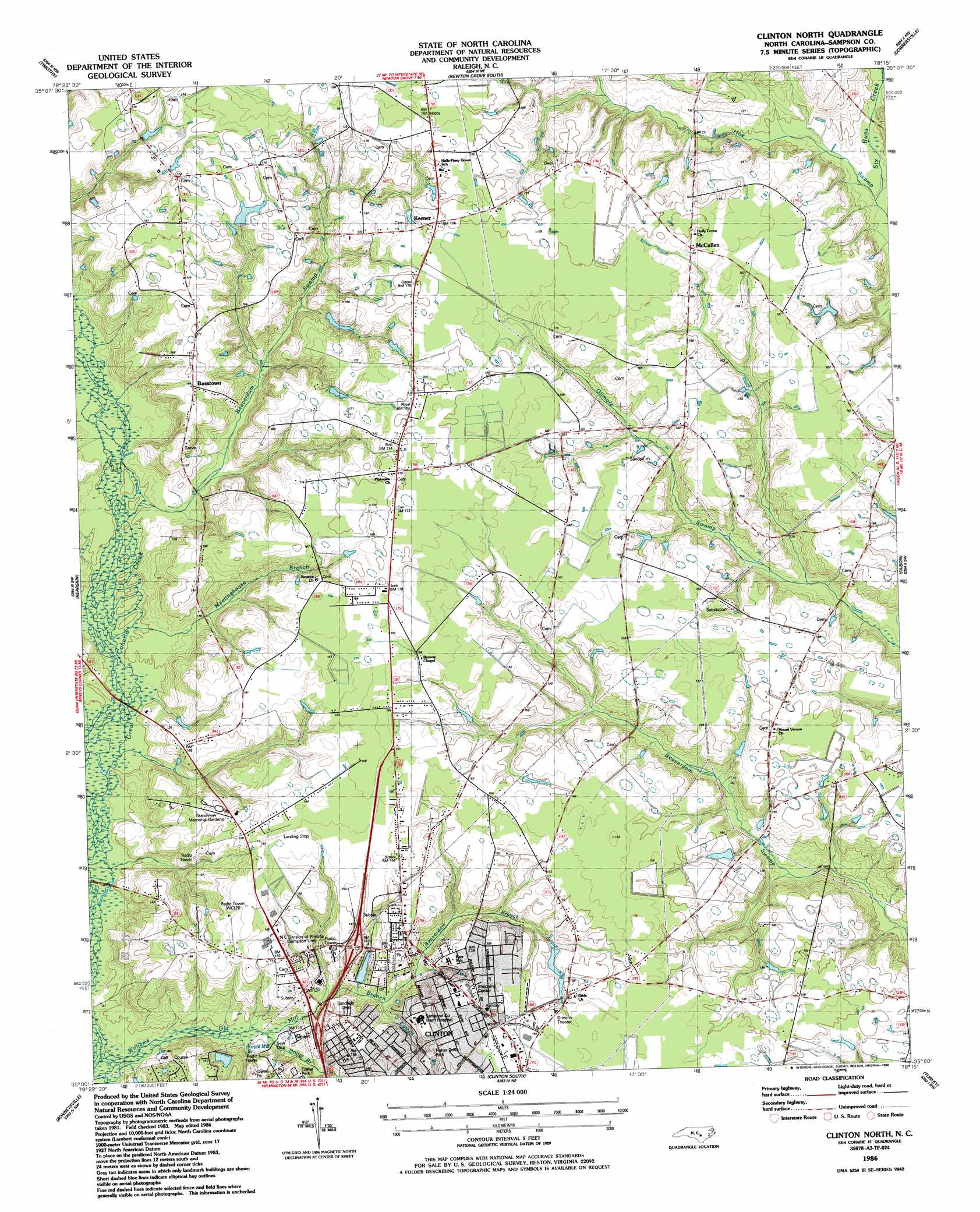
Clinton North Topo Map North Carolina
To zoom in, hover over the map of Clinton North
USGS Topo Quad 35078a3 - 1:24,000 scale
| Topo Map Name: | Clinton North |
| USGS Topo Quad ID: | 35078a3 |
| Print Size: | ca. 21 1/4" wide x 27" high |
| Southeast Coordinates: | 35° N latitude / 78.25° W longitude |
| Map Center Coordinates: | 35.0625° N latitude / 78.3125° W longitude |
| U.S. State: | NC |
| Filename: | o35078a3.jpg |
| Download Map JPG Image: | Clinton North topo map 1:24,000 scale |
| Map Type: | Topographic |
| Topo Series: | 7.5´ |
| Map Scale: | 1:24,000 |
| Source of Map Images: | United States Geological Survey (USGS) |
| Alternate Map Versions: |
Clinton North NC 1986, updated 1986 Download PDF Buy paper map Clinton North NC 2010 Download PDF Buy paper map Clinton North NC 2013 Download PDF Buy paper map Clinton North NC 2016 Download PDF Buy paper map |
1:24,000 Topo Quads surrounding Clinton North
Dunn |
Peacocks Crossroads |
Newton Grove North |
Grantham |
Southwest Goldsboro |
Mingo |
Timothy |
Newton Grove South |
Dobbersville |
Mount Olive |
Salemburg |
Bearskin |
Clinton North |
Faison |
Warsaw North |
Roseboro |
Bonnetsville |
Clinton South |
Turkey |
Warsaw South |
Ammon |
Garland |
Ingold |
Delway |
Rose Hill |
> Back to 35078a1 at 1:100,000 scale
> Back to 35078a1 at 1:250,000 scale
> Back to U.S. Topo Maps home
Clinton North topo map: Gazetteer
Clinton North: Airports
Lowers Airport elevation 48m 157′Sampson Memorial Hospital Airport elevation 48m 157′
Clinton North: Bridges
New Bridge elevation 28m 91′Stevens Bridge elevation 31m 101′
Clinton North: Parks
Fisher Drive Park elevation 40m 131′Clinton North: Populated Places
Basstown elevation 50m 164′Keener elevation 54m 177′
McCullen elevation 51m 167′
Clinton North: Streams
Beaverdam Branch elevation 35m 114′Beaverdam Swamp elevation 31m 101′
Cattail Branch elevation 33m 108′
Dollar Branch elevation 30m 98′
Hoe Swamp elevation 35m 114′
Kings Branch elevation 36m 118′
Meetinghouse Branch elevation 30m 98′
Royal Mill Branch elevation 30m 98′
Williams Old Mill Branch elevation 27m 88′
Clinton North digital topo map on disk
Buy this Clinton North topo map showing relief, roads, GPS coordinates and other geographical features, as a high-resolution digital map file on DVD:
South Carolina, Western North Carolina & Northeastern Georgia
Buy digital topo maps: South Carolina, Western North Carolina & Northeastern Georgia