Haynes Topo Map Arkansas
To zoom in, hover over the map of Haynes
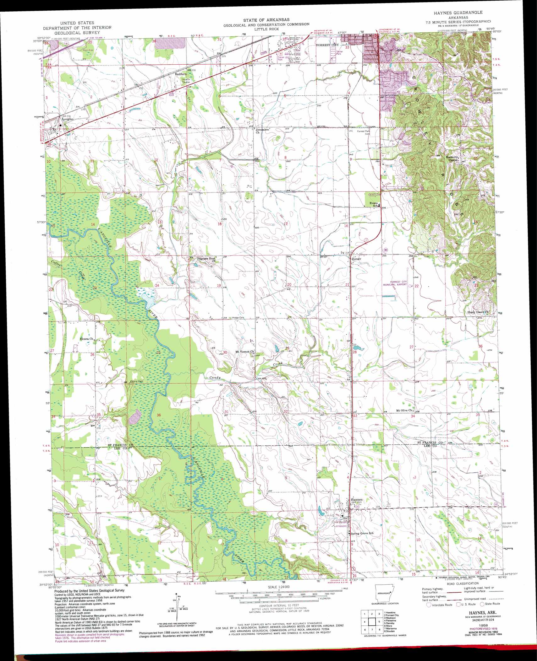
USGS Topo Quad 34090h7 - 1:24,000 scale
| Topo Map Name: | Haynes |
| USGS Topo Quad ID: | 34090h7 |
| Print Size: | ca. 21 1/4" wide x 27" high |
| Southeast Coordinates: | 34.875° N latitude / 90.75° W longitude |
| Map Center Coordinates: | 34.9375° N latitude / 90.8125° W longitude |
| U.S. State: | AR |
| Filename: | o34090h7.jpg |
| Download Map JPG Image: | Haynes topo map 1:24,000 scale |
| Map Type: | Topographic |
| Topo Series: | 7.5´ |
| Map Scale: | 1:24,000 |
| Source of Map Images: | United States Geological Survey (USGS) |
| Alternate Map Versions: |
Haynes AR 1958, updated 1959 Download PDF Buy paper map Haynes AR 1958, updated 1977 Download PDF Buy paper map Haynes AR 1958, updated 1993 Download PDF Buy paper map Haynes AR 2011 Download PDF Buy paper map Haynes AR 2014 Download PDF Buy paper map |
1:24,000 Topo Quads surrounding Haynes
Fair Oaks |
Hamlin |
Wynne |
Wittsburg |
Gieseck |
Hunter East |
Hawkins |
Forrest City |
Madison |
Round Pond |
Wheatley |
Palestine |
Haynes |
Dansby |
Mud Lake |
Garrett Grove |
Moro |
Marianna |
Soudan |
Brickeys |
Monroe |
Aubrey |
Rondo |
Lagrange |
Stubbs Island |
> Back to 34090e1 at 1:100,000 scale
> Back to 34090a1 at 1:250,000 scale
> Back to U.S. Topo Maps home
Haynes topo map: Gazetteer
Haynes: Airports
Forrest City Municipal Airport elevation 76m 249′Haynes: Parks
Sycamore Street Park elevation 91m 298′Haynes: Populated Places
Becks elevation 67m 219′Bonair elevation 70m 229′
Bryanville elevation 65m 213′
Elcana elevation 66m 216′
Four Forks elevation 61m 200′
Haynes elevation 67m 219′
Heustess elevation 74m 242′
Longino elevation 66m 216′
Monica elevation 81m 265′
Poplar Grove elevation 68m 223′
Redfern elevation 67m 219′
Haynes: Streams
Candy Creek elevation 58m 190′Caney Creek elevation 59m 193′
Coffee Creek elevation 59m 193′
Hinton Creek elevation 63m 206′
Haynes digital topo map on disk
Buy this Haynes topo map showing relief, roads, GPS coordinates and other geographical features, as a high-resolution digital map file on DVD: