Bear Mountain Topo Map Oklahoma
To zoom in, hover over the map of Bear Mountain
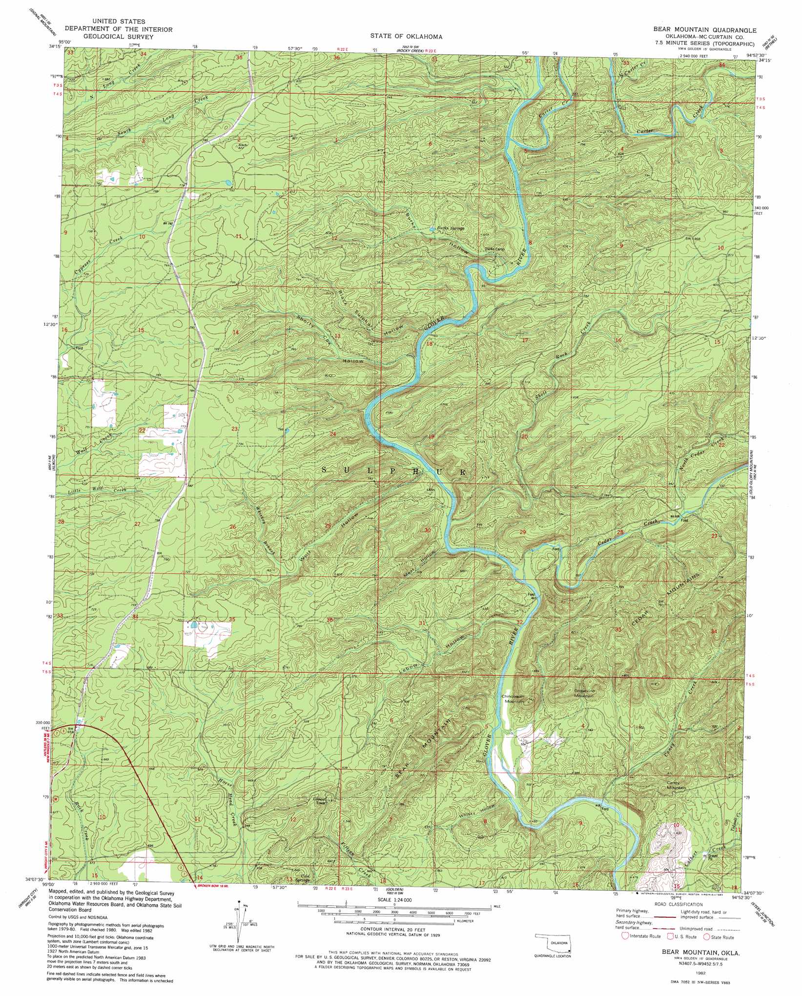
USGS Topo Quad 34094b8 - 1:24,000 scale
| Topo Map Name: | Bear Mountain |
| USGS Topo Quad ID: | 34094b8 |
| Print Size: | ca. 21 1/4" wide x 27" high |
| Southeast Coordinates: | 34.125° N latitude / 94.875° W longitude |
| Map Center Coordinates: | 34.1875° N latitude / 94.9375° W longitude |
| U.S. State: | OK |
| Filename: | o34094b8.jpg |
| Download Map JPG Image: | Bear Mountain topo map 1:24,000 scale |
| Map Type: | Topographic |
| Topo Series: | 7.5´ |
| Map Scale: | 1:24,000 |
| Source of Map Images: | United States Geological Survey (USGS) |
| Alternate Map Versions: |
Bear Mountain OK 1982, updated 1983 Download PDF Buy paper map Bear Mountain OK 2010 Download PDF Buy paper map Bear Mountain OK 2013 Download PDF Buy paper map Bear Mountain OK 2016 Download PDF Buy paper map |
| FStopo: | US Forest Service topo Bear Mountain is available: Download FStopo PDF Download FStopo TIF |
1:24,000 Topo Quads surrounding Bear Mountain
Nashoba |
Clebit |
Battiest |
White Rock Mountain |
Smithville |
Caney Mountain |
Signal Mountain |
Rockey Creek |
Bethel |
Hee Creek |
Sobol |
Alikchi |
Bear Mountain |
Old Glory Mountain |
Stephens Gap |
Swink |
Wright City |
Golden |
Steel Junction |
Broken Bow |
Kiomatia |
Millerton |
Garvin |
Idabel |
Shults |
> Back to 34094a1 at 1:100,000 scale
> Back to 34094a1 at 1:250,000 scale
> Back to U.S. Topo Maps home
Bear Mountain topo map: Gazetteer
Bear Mountain: Springs
Burks Springs elevation 187m 613′Cold Springs elevation 172m 564′
Bear Mountain: Streams
Caney Creek elevation 125m 410′Carter Creek elevation 162m 531′
Cedar Creek elevation 134m 439′
North Carter Creek elevation 181m 593′
North Cedar Creek elevation 160m 524′
Shell Rock Creek elevation 138m 452′
Tidwell Creek elevation 134m 439′
Whisky Branch elevation 177m 580′
Bear Mountain: Summits
Bear Mountain elevation 241m 790′Caney Mountain elevation 210m 688′
Chinquapin Mountain elevation 229m 751′
Grapevine Mountain elevation 242m 793′
Bear Mountain: Valleys
Black Sulphur Hollow elevation 153m 501′Burks Hollow elevation 157m 515′
Lebow Hollow elevation 134m 439′
Meat Hollow elevation 140m 459′
Shorty Cox Hollow elevation 161m 528′
Whisky Hollow elevation 131m 429′
Wolf Hollow elevation 146m 479′
Bear Mountain digital topo map on disk
Buy this Bear Mountain topo map showing relief, roads, GPS coordinates and other geographical features, as a high-resolution digital map file on DVD: