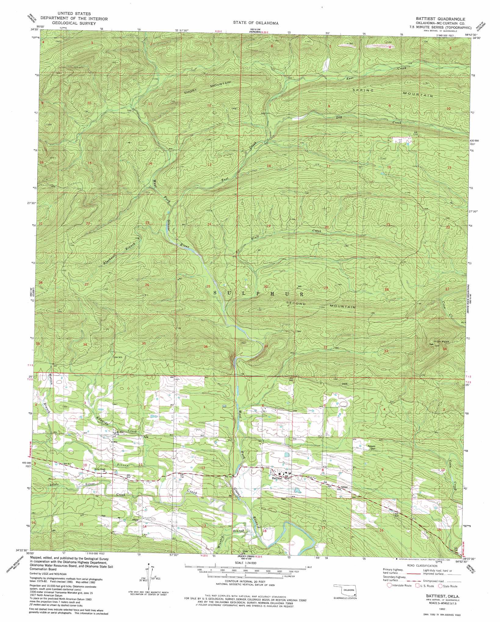
Battiest Topo Map Oklahoma
To zoom in, hover over the map of Battiest
USGS Topo Quad 34094d8 - 1:24,000 scale
| Topo Map Name: | Battiest |
| USGS Topo Quad ID: | 34094d8 |
| Print Size: | ca. 21 1/4" wide x 27" high |
| Southeast Coordinates: | 34.375° N latitude / 94.875° W longitude |
| Map Center Coordinates: | 34.4375° N latitude / 94.9375° W longitude |
| U.S. State: | OK |
| Filename: | o34094d8.jpg |
| Download Map JPG Image: | Battiest topo map 1:24,000 scale |
| Map Type: | Topographic |
| Topo Series: | 7.5´ |
| Map Scale: | 1:24,000 |
| Source of Map Images: | United States Geological Survey (USGS) |
| Alternate Map Versions: |
Battiest OK 1982, updated 1983 Download PDF Buy paper map Battiest OK 2010 Download PDF Buy paper map Battiest OK 2012 Download PDF Buy paper map Battiest OK 2016 Download PDF Buy paper map |
1:24,000 Topo Quads surrounding Battiest
Kiamichi |
Albion |
Whitesboro |
Muse |
Big Cedar |
Albion Sw |
Albion Se |
Honobia |
Ludlow |
Octavia |
Nashoba |
Clebit |
Battiest |
White Rock Mountain |
Smithville |
Caney Mountain |
Signal Mountain |
Rockey Creek |
Bethel |
Hee Creek |
Sobol |
Alikchi |
Bear Mountain |
Old Glory Mountain |
Stephens Gap |
> Back to 34094a1 at 1:100,000 scale
> Back to 34094a1 at 1:250,000 scale
> Back to U.S. Topo Maps home
Battiest topo map: Gazetteer
Battiest: Populated Places
Battiest elevation 251m 823′Battiest: Streams
Blackwell Branch elevation 265m 869′Bluff Creek elevation 254m 833′
Dog Creek elevation 305m 1000′
East Creek elevation 272m 892′
Edwards Creek elevation 233m 764′
Little Silver Creek elevation 226m 741′
Silver Creek elevation 220m 721′
Watson Branch elevation 244m 800′
Winship Branch elevation 220m 721′
Battiest: Summits
High Peak elevation 429m 1407′Second Mountain elevation 387m 1269′
Short Mountain elevation 438m 1437′
Battiest digital topo map on disk
Buy this Battiest topo map showing relief, roads, GPS coordinates and other geographical features, as a high-resolution digital map file on DVD: