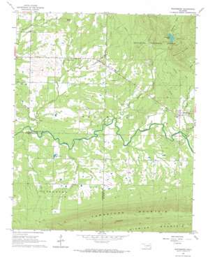
Whitesboro Topo Map Oklahoma
To zoom in, hover over the map of Whitesboro
USGS Topo Quad 34094f8 - 1:24,000 scale
| Topo Map Name: | Whitesboro |
| USGS Topo Quad ID: | 34094f8 |
| Print Size: | ca. 21 1/4" wide x 27" high |
| Southeast Coordinates: | 34.625° N latitude / 94.875° W longitude |
| Map Center Coordinates: | 34.6875° N latitude / 94.9375° W longitude |
| U.S. State: | OK |
| Filename: | o34094f8.jpg |
| Download Map JPG Image: | Whitesboro topo map 1:24,000 scale |
| Map Type: | Topographic |
| Topo Series: | 7.5´ |
| Map Scale: | 1:24,000 |
| Source of Map Images: | United States Geological Survey (USGS) |
| Alternate Map Versions: |
Whitesboro OK 1966, updated 1967 Download PDF Buy paper map Whitesboro OK 2011 Download PDF Buy paper map Whitesboro OK 2012 Download PDF Buy paper map Whitesboro OK 2016 Download PDF Buy paper map |
| FStopo: | US Forest Service topo Whitesboro is available: Download FStopo PDF Download FStopo TIF |
1:24,000 Topo Quads surrounding Whitesboro
> Back to 34094e1 at 1:100,000 scale
> Back to 34094a1 at 1:250,000 scale
> Back to U.S. Topo Maps home
Whitesboro topo map: Gazetteer
Whitesboro: Dams
Bohannon Lake Dam elevation 259m 849′Whitesboro: Populated Places
Whitesboro elevation 210m 688′Whitesboro: Reservoirs
Bohannon Lake elevation 259m 849′Byhannon Lake elevation 259m 849′
Whitesboro: Streams
Birney Creek elevation 197m 646′Bohannon Creek elevation 190m 623′
Buzzard Creek elevation 188m 616′
Deadman Creek elevation 199m 652′
Frazier Creek elevation 189m 620′
Post Oak Creek elevation 189m 620′
Tombstone Creek elevation 187m 613′
Woods Creek elevation 198m 649′
Whitesboro: Summits
Cedar Knob elevation 255m 836′Chancellor Mountain elevation 385m 1263′
Tombstone Mountain elevation 568m 1863′
Whitesboro digital topo map on disk
Buy this Whitesboro topo map showing relief, roads, GPS coordinates and other geographical features, as a high-resolution digital map file on DVD:


