North Windmill Topo Map Texas
To zoom in, hover over the map of North Windmill
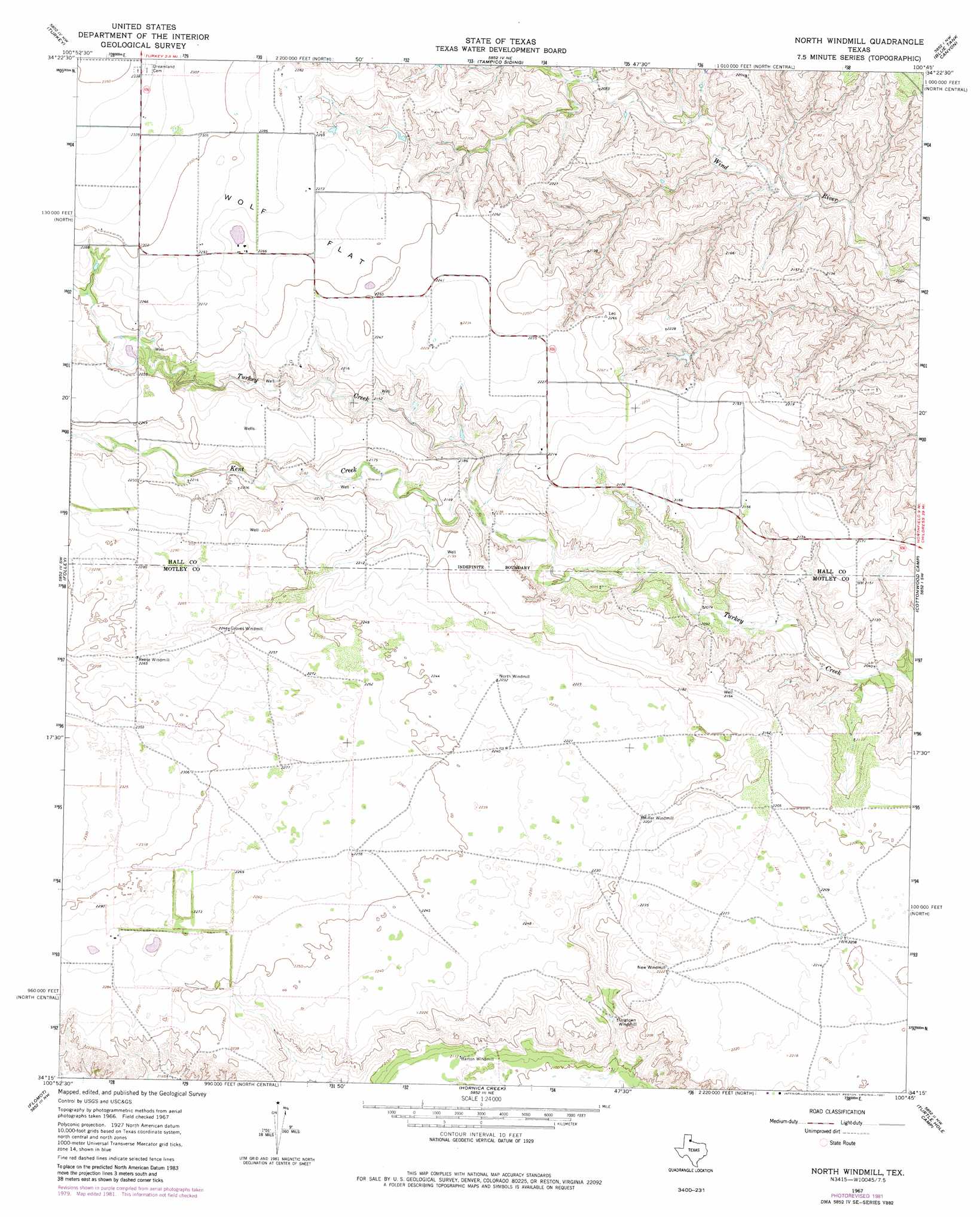
USGS Topo Quad 34100c7 - 1:24,000 scale
| Topo Map Name: | North Windmill |
| USGS Topo Quad ID: | 34100c7 |
| Print Size: | ca. 21 1/4" wide x 27" high |
| Southeast Coordinates: | 34.25° N latitude / 100.75° W longitude |
| Map Center Coordinates: | 34.3125° N latitude / 100.8125° W longitude |
| U.S. State: | TX |
| Filename: | o34100c7.jpg |
| Download Map JPG Image: | North Windmill topo map 1:24,000 scale |
| Map Type: | Topographic |
| Topo Series: | 7.5´ |
| Map Scale: | 1:24,000 |
| Source of Map Images: | United States Geological Survey (USGS) |
| Alternate Map Versions: |
North Windmill TX 1967, updated 1969 Download PDF Buy paper map North Windmill TX 1967, updated 1981 Download PDF Buy paper map North Windmill TX 2010 Download PDF Buy paper map North Windmill TX 2012 Download PDF Buy paper map North Windmill TX 2016 Download PDF Buy paper map |
1:24,000 Topo Quads surrounding North Windmill
Schott Mountain |
Hughes Canyon |
Heel Fly Draw |
Plaska |
Parnell |
Lake Theo |
Turkey |
Tampico Siding |
Blue Tank Canyon |
Badger Nest Tank |
Quitaque |
Folley |
North Windmill |
Cottonwood Camp |
Northfield |
Quitaque Peaks |
Flomot |
Hornica Creek |
Turtle Hole Camp |
Fields Canyon |
Dick Moore Canyon |
Whiteflat |
Matador |
Ballard Camp |
Tee Pee City |
> Back to 34100a1 at 1:100,000 scale
> Back to 34100a1 at 1:250,000 scale
> Back to U.S. Topo Maps home
North Windmill topo map: Gazetteer
North Windmill: Flats
Wolf Flat elevation 693m 2273′North Windmill: Streams
Kent Creek elevation 650m 2132′North Windmill digital topo map on disk
Buy this North Windmill topo map showing relief, roads, GPS coordinates and other geographical features, as a high-resolution digital map file on DVD: