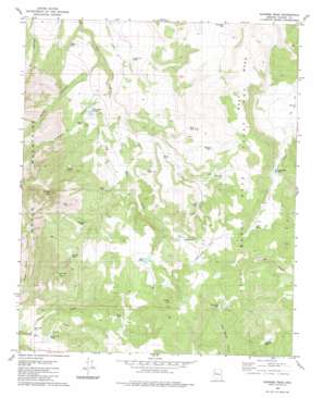
Sunrise Peak Topo Map Arizona
To zoom in, hover over the map of Sunrise Peak
USGS Topo Quad 34113h2 - 1:24,000 scale
| Topo Map Name: | Sunrise Peak |
| USGS Topo Quad ID: | 34113h2 |
| Print Size: | ca. 21 1/4" wide x 27" high |
| Southeast Coordinates: | 34.875° N latitude / 113.125° W longitude |
| Map Center Coordinates: | 34.9375° N latitude / 113.1875° W longitude |
| U.S. State: | AZ |
| Filename: | o34113h2.jpg |
| Download Map JPG Image: | Sunrise Peak topo map 1:24,000 scale |
| Map Type: | Topographic |
| Topo Series: | 7.5´ |
| Map Scale: | 1:24,000 |
| Source of Map Images: | United States Geological Survey (USGS) |
| Alternate Map Versions: |
Sunrise Peak AZ 1980, updated 1980 Download PDF Buy paper map Sunrise Peak AZ 2011 Download PDF Buy paper map Sunrise Peak AZ 2014 Download PDF Buy paper map |
1:24,000 Topo Quads surrounding Sunrise Peak
> Back to 34113e1 at 1:100,000 scale
> Back to 34112a1 at 1:250,000 scale
> Back to U.S. Topo Maps home
Sunrise Peak topo map: Gazetteer
Sunrise Peak: Basins
Jackass Basin elevation 1653m 5423′Sunrise Peak: Flats
Johnson Flat elevation 1814m 5951′Sunrise Peak: Reservoirs
Bear Creek Tank elevation 1702m 5583′Big Ikie Tank elevation 1764m 5787′
Bobs Tank elevation 1767m 5797′
Brett Tank elevation 1697m 5567′
Cherry Tree Tank elevation 1765m 5790′
Cottonwood Tank elevation 1729m 5672′
Cripple Cat Tank elevation 1658m 5439′
Encino Tank elevation 1794m 5885′
Illa Tank elevation 1767m 5797′
Jolly Tank elevation 1784m 5853′
Jones Tank elevation 1702m 5583′
Little Cottonwood Tank elevation 1804m 5918′
Malpais Tank elevation 1749m 5738′
Oak Tank elevation 1737m 5698′
Rimrock Tank elevation 1770m 5807′
Sheep Tank elevation 1759m 5770′
Triangle N Tank elevation 1675m 5495′
Walker Tank elevation 1638m 5374′
West Mesa Tank elevation 1779m 5836′
West Split Tank elevation 1728m 5669′
Wildman Tank elevation 1655m 5429′
Sunrise Peak: Springs
Sunrise Spring elevation 1816m 5958′Sunrise Peak: Streams
Sheep Creek elevation 1674m 5492′Sunrise Peak: Summits
Indian Hill elevation 1884m 6181′Sunrise Peak elevation 2115m 6938′
West Mesa elevation 1888m 6194′
Sunrise Peak: Valleys
Moffit Canyon elevation 1619m 5311′Triangle N Canyon elevation 1644m 5393′
Sunrise Peak: Wells
Well Number Six elevation 1699m 5574′Sunrise Peak digital topo map on disk
Buy this Sunrise Peak topo map showing relief, roads, GPS coordinates and other geographical features, as a high-resolution digital map file on DVD:


