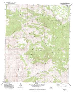
Elephant Mountain Topo Map Arizona
To zoom in, hover over the map of Elephant Mountain
USGS Topo Quad 34113f4 - 1:24,000 scale
| Topo Map Name: | Elephant Mountain |
| USGS Topo Quad ID: | 34113f4 |
| Print Size: | ca. 21 1/4" wide x 27" high |
| Southeast Coordinates: | 34.625° N latitude / 113.375° W longitude |
| Map Center Coordinates: | 34.6875° N latitude / 113.4375° W longitude |
| U.S. State: | AZ |
| Filename: | o34113f4.jpg |
| Download Map JPG Image: | Elephant Mountain topo map 1:24,000 scale |
| Map Type: | Topographic |
| Topo Series: | 7.5´ |
| Map Scale: | 1:24,000 |
| Source of Map Images: | United States Geological Survey (USGS) |
| Alternate Map Versions: |
Elephant Mtn AZ 1980, updated 1980 Download PDF Buy paper map Elephant Mountain AZ 2011 Download PDF Buy paper map Elephant Mountain AZ 2014 Download PDF Buy paper map |
1:24,000 Topo Quads surrounding Elephant Mountain
> Back to 34113e1 at 1:100,000 scale
> Back to 34112a1 at 1:250,000 scale
> Back to U.S. Topo Maps home
Elephant Mountain topo map: Gazetteer
Elephant Mountain: Basins
Brushy Basin elevation 1094m 3589′Elephant Mountain: Cliffs
Burro Cliffs elevation 1213m 3979′Elephant Mountain: Reservoirs
Dead Cow Tank elevation 1057m 3467′Slaughter Tank elevation 1396m 4580′
Elephant Mountain: Springs
Arrowhead Spring elevation 1203m 3946′Arrowweed Springs elevation 1248m 4094′
Burro Spring elevation 1343m 4406′
Chalk Spring elevation 1213m 3979′
Hillside Spring elevation 1379m 4524′
Hobo Spring elevation 1156m 3792′
Lion Spring elevation 1225m 4019′
Rock Spring elevation 1252m 4107′
Elephant Mountain: Streams
Bitter Creek elevation 1176m 3858′East Fork Sycamore Creek elevation 1226m 4022′
West Fork Sycamore Creek elevation 1271m 4169′
Elephant Mountain: Summits
Elephant Mountain elevation 1600m 5249′Grey Mountain elevation 1586m 5203′
Muley Mountain elevation 1452m 4763′
Neale Mesa elevation 1516m 4973′
Elephant Mountain: Valleys
Arrowweed Canyon elevation 1095m 3592′Chalk Spring Canyon elevation 893m 2929′
Kimble Canyon elevation 926m 3038′
Elephant Mountain: Wells
Box Canyon Well elevation 1069m 3507′Brushy Basin Well elevation 1133m 3717′
Kimble Canyon Well elevation 986m 3234′
Rincon Wells elevation 959m 3146′
Trinidad Well elevation 1093m 3585′
Upper Bitter Creek Well elevation 1243m 4078′
Upper Cornwall Well elevation 1136m 3727′
Elephant Mountain digital topo map on disk
Buy this Elephant Mountain topo map showing relief, roads, GPS coordinates and other geographical features, as a high-resolution digital map file on DVD:


