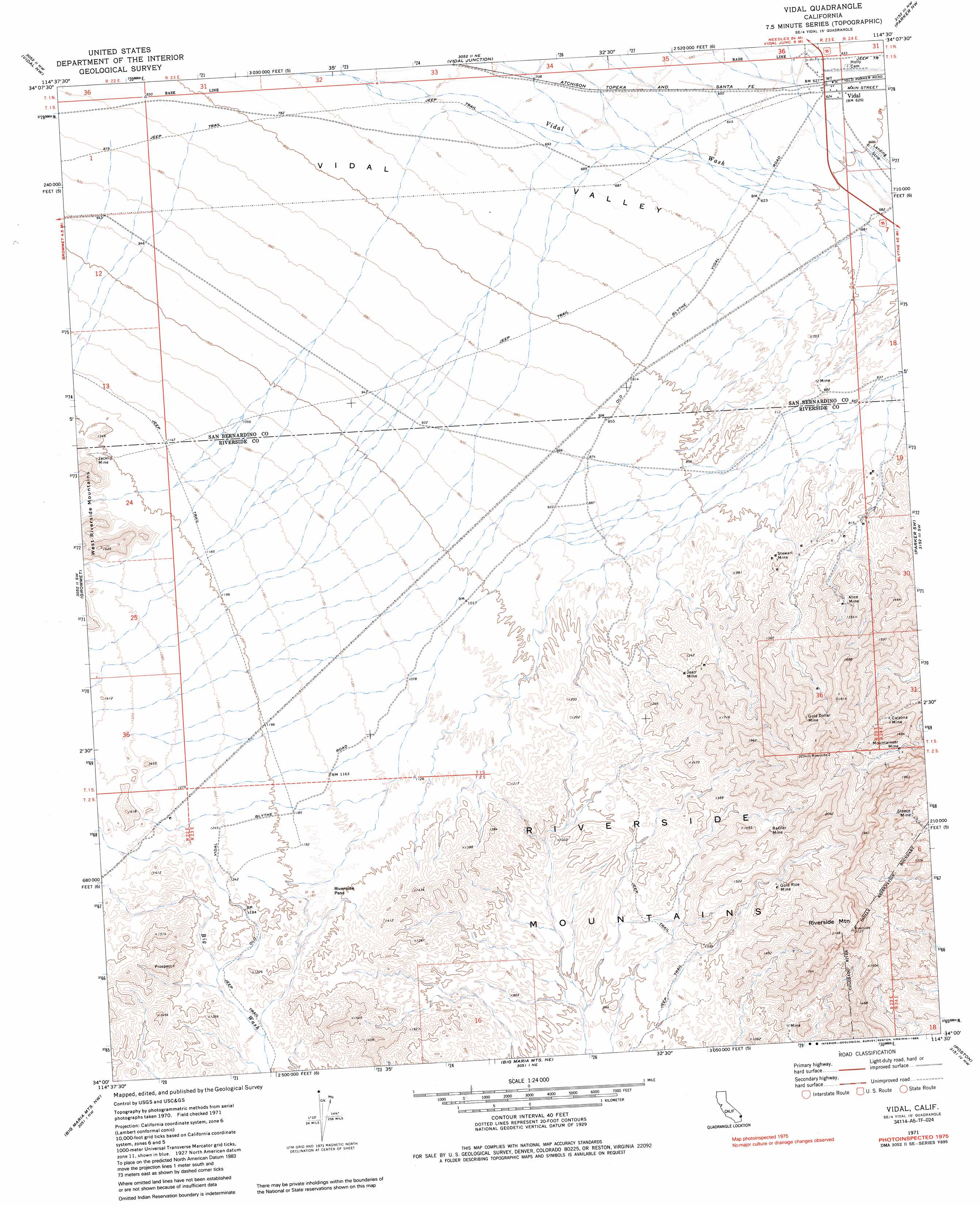
Vidal Topo Map California
To zoom in, hover over the map of Vidal
USGS Topo Quad 34114a5 - 1:24,000 scale
| Topo Map Name: | Vidal |
| USGS Topo Quad ID: | 34114a5 |
| Print Size: | ca. 21 1/4" wide x 27" high |
| Southeast Coordinates: | 34° N latitude / 114.5° W longitude |
| Map Center Coordinates: | 34.0625° N latitude / 114.5625° W longitude |
| U.S. State: | CA |
| Filename: | o34114a5.jpg |
| Download Map JPG Image: | Vidal topo map 1:24,000 scale |
| Map Type: | Topographic |
| Topo Series: | 7.5´ |
| Map Scale: | 1:24,000 |
| Source of Map Images: | United States Geological Survey (USGS) |
| Alternate Map Versions: |
Vidal CA 1971, updated 1973 Download PDF Buy paper map Vidal CA 1971, updated 1985 Download PDF Buy paper map Vidal CA 2012 Download PDF Buy paper map Vidal CA 2015 Download PDF Buy paper map |
1:24,000 Topo Quads surrounding Vidal
Mopah Peaks |
Savahia Peak Sw |
Savahia Peak |
Whipple Mountains Sw |
Whipple Wash |
Horn Spring |
Vidal Nw |
Vidal Junction |
Parker Nw |
Parker |
Rice |
Grommet |
Vidal |
Parker Sw |
Parker Se |
Styx |
Big Maria Mountains Nw |
Big Maria Mountains Ne |
Poston |
Moon Mountain Ne |
Inca |
Big Maria Mountains Sw |
Big Maria Mountains Se |
Moon Mountain |
Moon Mountain Se |
> Back to 34114a1 at 1:100,000 scale
> Back to 34114a1 at 1:250,000 scale
> Back to U.S. Topo Maps home
Vidal topo map: Gazetteer
Vidal: Gaps
Riverside Pass elevation 361m 1184′Vidal: Mines
Alice Mine elevation 315m 1033′Calzona Mine elevation 282m 925′
Gold Dollar Mine elevation 506m 1660′
Gold Rice Mine elevation 399m 1309′
Jacklin Mine elevation 405m 1328′
Jean Mine elevation 341m 1118′
Mountaineer Mine elevation 313m 1026′
Rattler Mine elevation 406m 1332′
Steece Mine elevation 269m 882′
Stewart Mine elevation 273m 895′
Vidal: Populated Places
Vidal elevation 191m 626′Vidal: Ranges
Riverside Mountains elevation 317m 1040′Vidal: Summits
Riverside Mountain elevation 652m 2139′Vidal digital topo map on disk
Buy this Vidal topo map showing relief, roads, GPS coordinates and other geographical features, as a high-resolution digital map file on DVD: