Macon Topo Map Tennessee
To zoom in, hover over the map of Macon
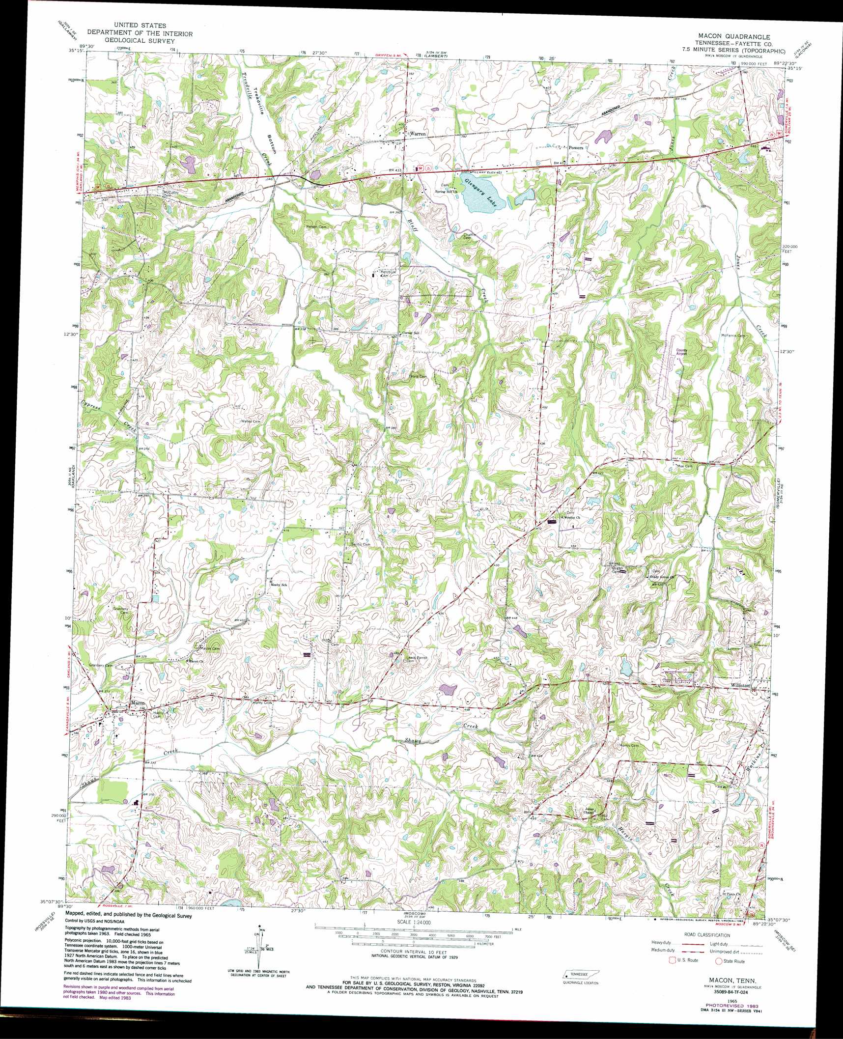
USGS Topo Quad 35089b4 - 1:24,000 scale
| Topo Map Name: | Macon |
| USGS Topo Quad ID: | 35089b4 |
| Print Size: | ca. 21 1/4" wide x 27" high |
| Southeast Coordinates: | 35.125° N latitude / 89.375° W longitude |
| Map Center Coordinates: | 35.1875° N latitude / 89.4375° W longitude |
| U.S. State: | TN |
| Filename: | o35089b4.jpg |
| Download Map JPG Image: | Macon topo map 1:24,000 scale |
| Map Type: | Topographic |
| Topo Series: | 7.5´ |
| Map Scale: | 1:24,000 |
| Source of Map Images: | United States Geological Survey (USGS) |
| Alternate Map Versions: |
Macon TN 1965, updated 1966 Download PDF Buy paper map Macon TN 1965, updated 1983 Download PDF Buy paper map Macon TN 2010 Download PDF Buy paper map Macon TN 2013 Download PDF Buy paper map Macon TN 2016 Download PDF Buy paper map |
1:24,000 Topo Quads surrounding Macon
Brighton |
Mason |
Stanton |
Dancyville |
Hillville |
Arlington |
Gallaway |
Lambert |
Laconia |
Whiteville |
Eads |
Oakland |
Macon |
Somerville |
Hickory Valley |
Collierville |
Rossville |
Moscow |
Moscow Se |
Grand Junction |
Byhalia Nw |
Mount Pleasant |
Slayden |
Lamar |
Canaan |
> Back to 35089a1 at 1:100,000 scale
> Back to 35088a1 at 1:250,000 scale
> Back to U.S. Topo Maps home
Macon topo map: Gazetteer
Macon: Airports
Fayette County Airport elevation 128m 419′Macon: Dams
Double W Ranch Lake Dam elevation 133m 436′Glengary Lake Dam elevation 122m 400′
Macon: Populated Places
Macon elevation 123m 403′Powers elevation 124m 406′
Warren elevation 125m 410′
Macon: Post Offices
Macon Post Office elevation 120m 393′Macon: Reservoirs
Double W Ranch Lake elevation 133m 436′Glengary Lake elevation 122m 400′
Macon: Streams
Bluff Creek elevation 101m 331′Macon digital topo map on disk
Buy this Macon topo map showing relief, roads, GPS coordinates and other geographical features, as a high-resolution digital map file on DVD: