Oakland Topo Map Tennessee
To zoom in, hover over the map of Oakland
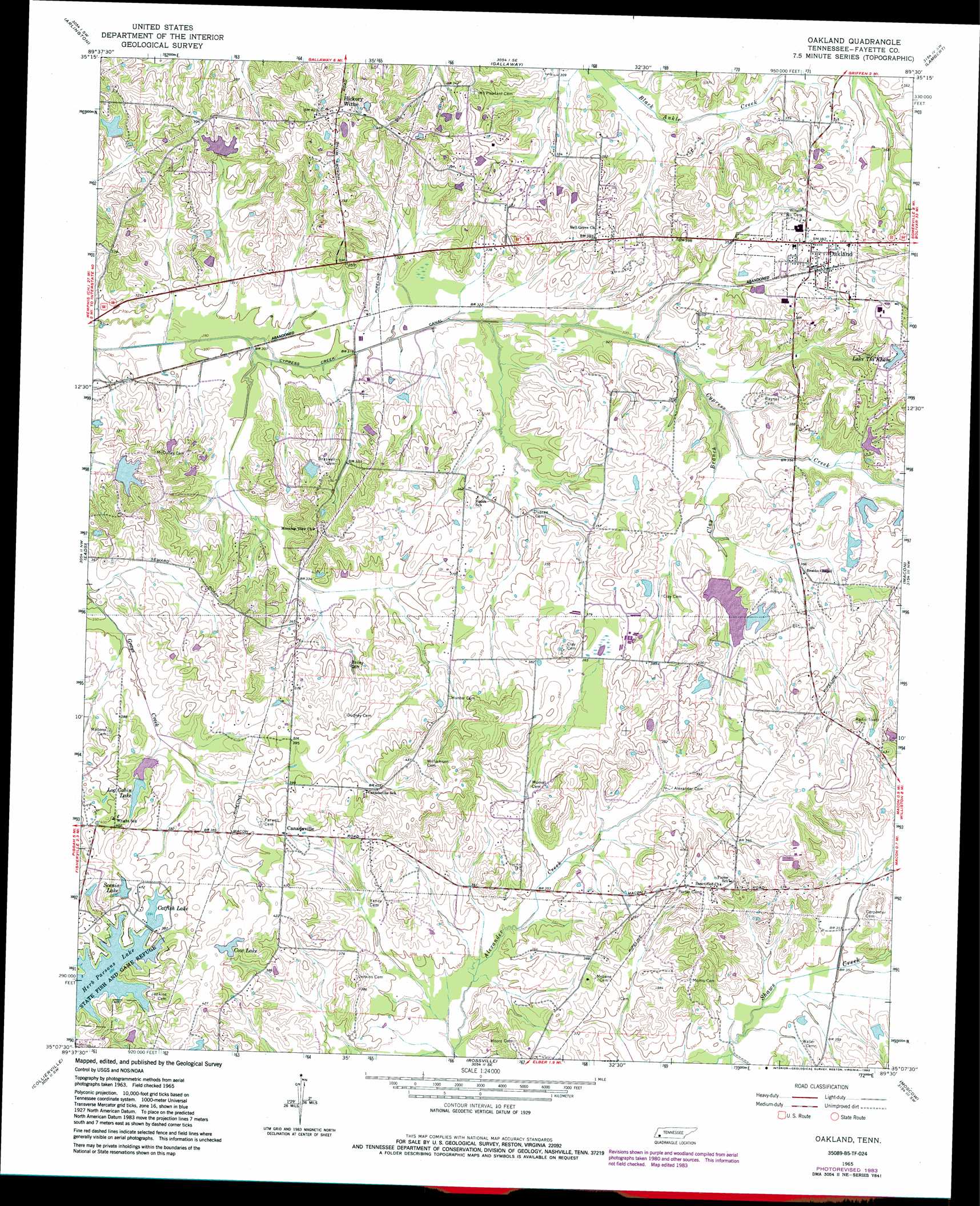
USGS Topo Quad 35089b5 - 1:24,000 scale
| Topo Map Name: | Oakland |
| USGS Topo Quad ID: | 35089b5 |
| Print Size: | ca. 21 1/4" wide x 27" high |
| Southeast Coordinates: | 35.125° N latitude / 89.5° W longitude |
| Map Center Coordinates: | 35.1875° N latitude / 89.5625° W longitude |
| U.S. State: | TN |
| Filename: | o35089b5.jpg |
| Download Map JPG Image: | Oakland topo map 1:24,000 scale |
| Map Type: | Topographic |
| Topo Series: | 7.5´ |
| Map Scale: | 1:24,000 |
| Source of Map Images: | United States Geological Survey (USGS) |
| Alternate Map Versions: |
Oakland TN 1965, updated 1966 Download PDF Buy paper map Oakland TN 1965, updated 1974 Download PDF Buy paper map Oakland TN 1965, updated 1983 Download PDF Buy paper map Oakland TN 2010 Download PDF Buy paper map Oakland TN 2013 Download PDF Buy paper map Oakland TN 2016 Download PDF Buy paper map |
1:24,000 Topo Quads surrounding Oakland
Munford |
Brighton |
Mason |
Stanton |
Dancyville |
Brunswick |
Arlington |
Gallaway |
Lambert |
Laconia |
Ellendale |
Eads |
Oakland |
Macon |
Somerville |
Germantown |
Collierville |
Rossville |
Moscow |
Moscow Se |
Olive Branch |
Byhalia Nw |
Mount Pleasant |
Slayden |
Lamar |
> Back to 35089a1 at 1:100,000 scale
> Back to 35088a1 at 1:250,000 scale
> Back to U.S. Topo Maps home
Oakland topo map: Gazetteer
Oakland: Dams
Big Bell Estates Lake Dam elevation 104m 341′Catfish Lake Dam elevation 119m 390′
Catfish Lake Two Dam elevation 124m 406′
Cow Lake Dam elevation 123m 403′
Fore Lake Dam elevation 110m 360′
Hall Lake Dam elevation 107m 351′
Lake Tia Khata Dam elevation 126m 413′
Log Cabin Lake Dam elevation 117m 383′
Salmon Lake Dam elevation 113m 370′
Scenic Lake Dam elevation 121m 396′
Oakland: Populated Places
Canadaville elevation 120m 393′Hickory Withe elevation 124m 406′
Oakland elevation 116m 380′
Oakland: Post Offices
Hickory Withe Post Office elevation 124m 406′Oakland: Reservoirs
Big Bell Estates Lake elevation 104m 341′Catfish Lake elevation 119m 390′
Catfish Lake Two elevation 124m 406′
Cow Lake elevation 123m 403′
Fore Lake elevation 110m 360′
Hall Lake elevation 107m 351′
Lake Tia Khata elevation 126m 413′
Log Cabin Lake elevation 117m 383′
Salmon Lake elevation 113m 370′
Scenic Lake elevation 121m 396′
Oakland: Streams
Clay Branch elevation 97m 318′Oakland digital topo map on disk
Buy this Oakland topo map showing relief, roads, GPS coordinates and other geographical features, as a high-resolution digital map file on DVD: