Brighton Topo Map Tennessee
To zoom in, hover over the map of Brighton
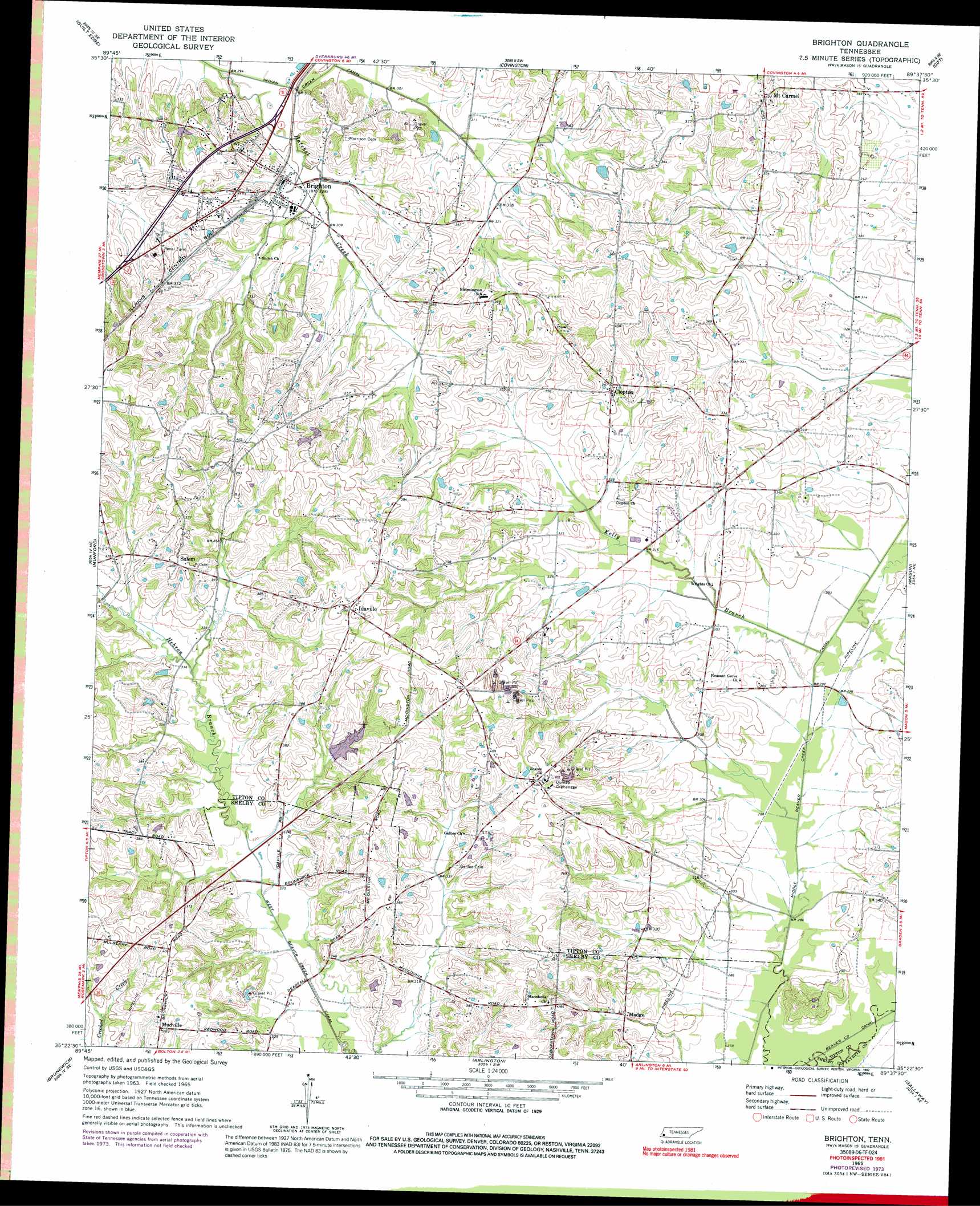
USGS Topo Quad 35089d6 - 1:24,000 scale
| Topo Map Name: | Brighton |
| USGS Topo Quad ID: | 35089d6 |
| Print Size: | ca. 21 1/4" wide x 27" high |
| Southeast Coordinates: | 35.375° N latitude / 89.625° W longitude |
| Map Center Coordinates: | 35.4375° N latitude / 89.6875° W longitude |
| U.S. State: | TN |
| Filename: | o35089d6.jpg |
| Download Map JPG Image: | Brighton topo map 1:24,000 scale |
| Map Type: | Topographic |
| Topo Series: | 7.5´ |
| Map Scale: | 1:24,000 |
| Source of Map Images: | United States Geological Survey (USGS) |
| Alternate Map Versions: |
Brighton TN 1965, updated 1966 Download PDF Buy paper map Brighton TN 1965, updated 1974 Download PDF Buy paper map Brighton TN 1965, updated 1992 Download PDF Buy paper map Brighton TN 2010 Download PDF Buy paper map Brighton TN 2013 Download PDF Buy paper map Brighton TN 2016 Download PDF Buy paper map |
1:24,000 Topo Quads surrounding Brighton
Osceola |
Golddust |
Fort Pillow |
Ripley South |
Durhamville |
Nodena |
Gilt Edge |
Covington |
Gift |
Turnpike |
Drummonds |
Munford |
Brighton |
Mason |
Stanton |
Millington |
Brunswick |
Arlington |
Gallaway |
Lambert |
Northeast Memphis |
Ellendale |
Eads |
Oakland |
Macon |
> Back to 35089a1 at 1:100,000 scale
> Back to 35088a1 at 1:250,000 scale
> Back to U.S. Topo Maps home
Brighton topo map: Gazetteer
Brighton: Dams
Lake Ellen Dam elevation 115m 377′Brighton: Populated Places
Brighton elevation 104m 341′Clopton elevation 106m 347′
Idaville elevation 121m 396′
Madge elevation 96m 314′
Mount Carmel elevation 129m 423′
Mudville elevation 118m 387′
Salem elevation 123m 403′
Brighton: Post Offices
Brighton Post Office elevation 101m 331′Brighton: Reservoirs
Lake Ellen elevation 115m 377′Brighton: Streams
Hatchel Creek elevation 85m 278′Hebron Branch elevation 95m 311′
Kelly Branch elevation 85m 278′
Smith Branch elevation 89m 291′
Brighton digital topo map on disk
Buy this Brighton topo map showing relief, roads, GPS coordinates and other geographical features, as a high-resolution digital map file on DVD: