Brazil Topo Map Tennessee
To zoom in, hover over the map of Brazil
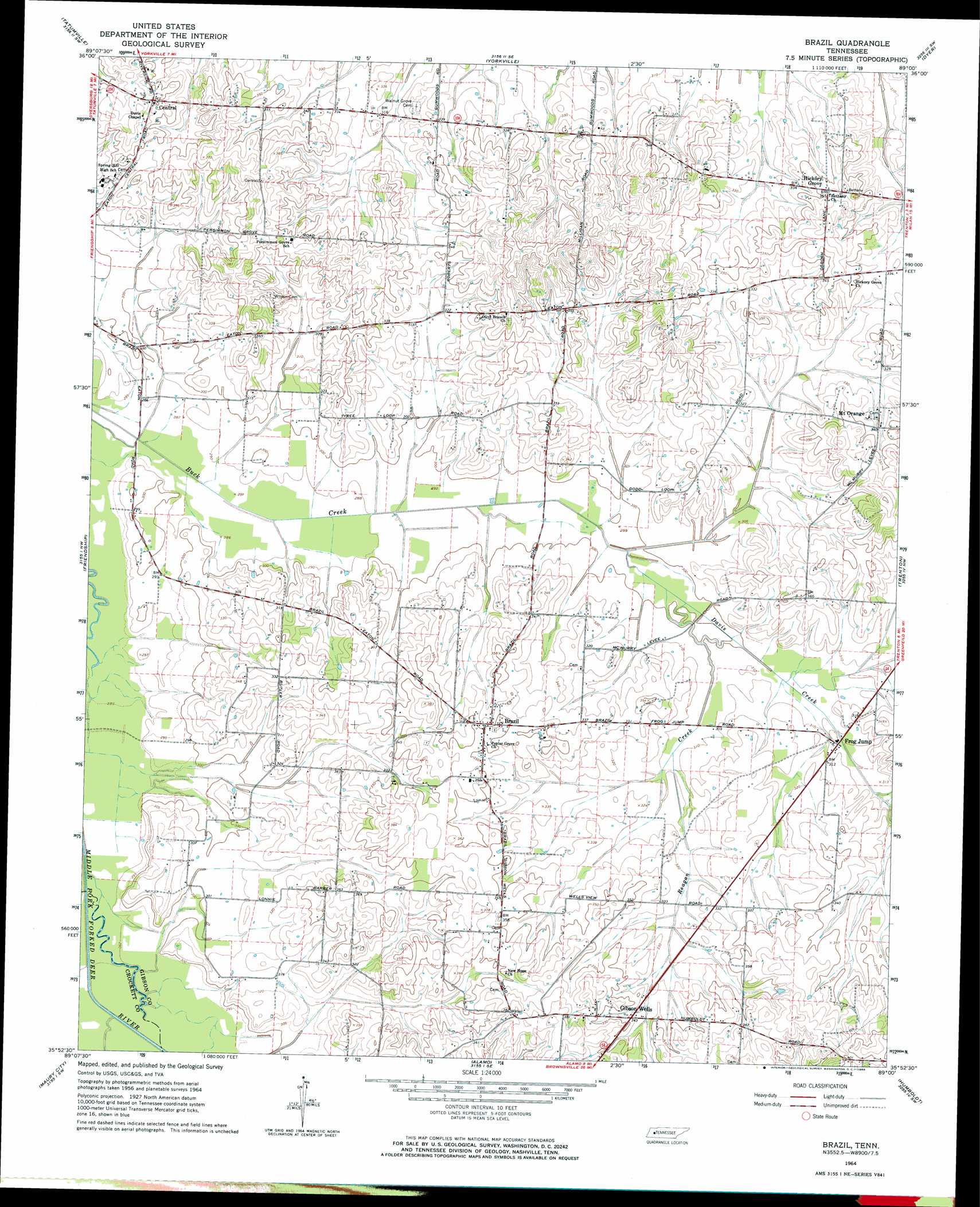
USGS Topo Quad 35089h1 - 1:24,000 scale
| Topo Map Name: | Brazil |
| USGS Topo Quad ID: | 35089h1 |
| Print Size: | ca. 21 1/4" wide x 27" high |
| Southeast Coordinates: | 35.875° N latitude / 89° W longitude |
| Map Center Coordinates: | 35.9375° N latitude / 89.0625° W longitude |
| U.S. State: | TN |
| Filename: | o35089h1.jpg |
| Download Map JPG Image: | Brazil topo map 1:24,000 scale |
| Map Type: | Topographic |
| Topo Series: | 7.5´ |
| Map Scale: | 1:24,000 |
| Source of Map Images: | United States Geological Survey (USGS) |
| Alternate Map Versions: |
Brazil TN 1964, updated 1966 Download PDF Buy paper map Brazil TN 2010 Download PDF Buy paper map Brazil TN 2013 Download PDF Buy paper map Brazil TN 2016 Download PDF Buy paper map |
1:24,000 Topo Quads surrounding Brazil
Lane |
Trimble |
Kenton |
Rutherford |
Greenfield |
Newbern |
Tatumville |
Yorkville |
Dyer |
Bradford |
Bonicord |
Friendship |
Brazil |
Trenton |
Milan |
Chestnut Bluff |
Maury City |
Alamo |
Humboldt |
Medina |
Tibbs |
Jones |
Bells |
Adair |
Jackson North |
> Back to 35089e1 at 1:100,000 scale
> Back to 35088a1 at 1:250,000 scale
> Back to U.S. Topo Maps home
Brazil topo map: Gazetteer
Brazil: Dams
W H Bowers Lake Dam elevation 104m 341′Brazil: Populated Places
Brazil elevation 104m 341′Frog Jump elevation 95m 311′
Gibson Wells elevation 104m 341′
Hickory Grove elevation 108m 354′
Mount Orange elevation 103m 337′
Spring Hill elevation 97m 318′
Brazil: Reservoirs
W H Bowers Lake elevation 104m 341′Brazil: Streams
Davis Creek elevation 89m 291′Reagan Creek elevation 89m 291′
Brazil digital topo map on disk
Buy this Brazil topo map showing relief, roads, GPS coordinates and other geographical features, as a high-resolution digital map file on DVD: