Friendship Topo Map Tennessee
To zoom in, hover over the map of Friendship
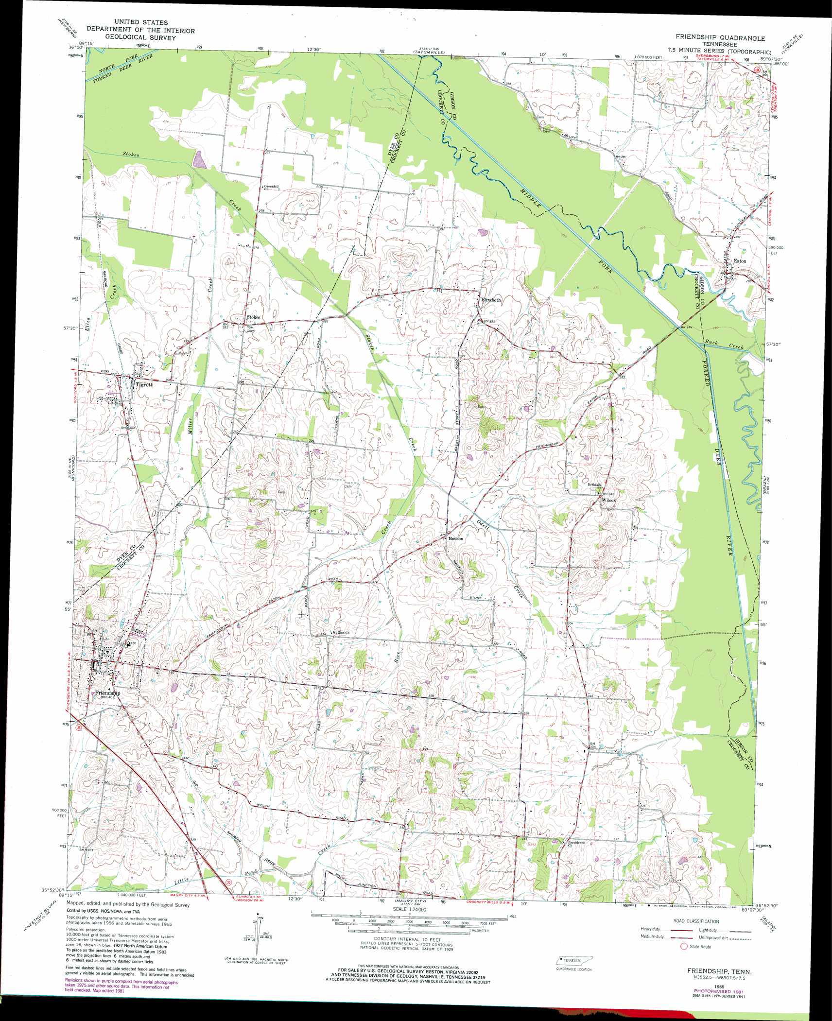
USGS Topo Quad 35089h2 - 1:24,000 scale
| Topo Map Name: | Friendship |
| USGS Topo Quad ID: | 35089h2 |
| Print Size: | ca. 21 1/4" wide x 27" high |
| Southeast Coordinates: | 35.875° N latitude / 89.125° W longitude |
| Map Center Coordinates: | 35.9375° N latitude / 89.1875° W longitude |
| U.S. State: | TN |
| Filename: | o35089h2.jpg |
| Download Map JPG Image: | Friendship topo map 1:24,000 scale |
| Map Type: | Topographic |
| Topo Series: | 7.5´ |
| Map Scale: | 1:24,000 |
| Source of Map Images: | United States Geological Survey (USGS) |
| Alternate Map Versions: |
Friendship TN 1965, updated 1967 Download PDF Buy paper map Friendship TN 1965, updated 1981 Download PDF Buy paper map Friendship TN 2010 Download PDF Buy paper map Friendship TN 2013 Download PDF Buy paper map Friendship TN 2016 Download PDF Buy paper map |
1:24,000 Topo Quads surrounding Friendship
Miston |
Lane |
Trimble |
Kenton |
Rutherford |
Dyersburg |
Newbern |
Tatumville |
Yorkville |
Dyer |
Fowlkes |
Bonicord |
Friendship |
Brazil |
Trenton |
Gates |
Chestnut Bluff |
Maury City |
Alamo |
Humboldt |
Durhamville |
Tibbs |
Jones |
Bells |
Adair |
> Back to 35089e1 at 1:100,000 scale
> Back to 35088a1 at 1:250,000 scale
> Back to U.S. Topo Maps home
Friendship topo map: Gazetteer
Friendship: Populated Places
Eaton elevation 94m 308′Elizabeth elevation 94m 308′
Friendship elevation 122m 400′
Hodson elevation 96m 314′
Stokes elevation 93m 305′
Tigrett elevation 88m 288′
Wilcox elevation 108m 354′
Friendship: Post Offices
Eaton Post Office elevation 94m 308′Tigrett Post Office elevation 88m 288′
Friendship: Streams
Buck Creek elevation 85m 278′Miller Creek elevation 82m 269′
Odell Creek elevation 87m 285′
Rice Creek elevation 87m 285′
Tucker Creek elevation 100m 328′
Friendship digital topo map on disk
Buy this Friendship topo map showing relief, roads, GPS coordinates and other geographical features, as a high-resolution digital map file on DVD: