Stella Topo Map Oklahoma
To zoom in, hover over the map of Stella
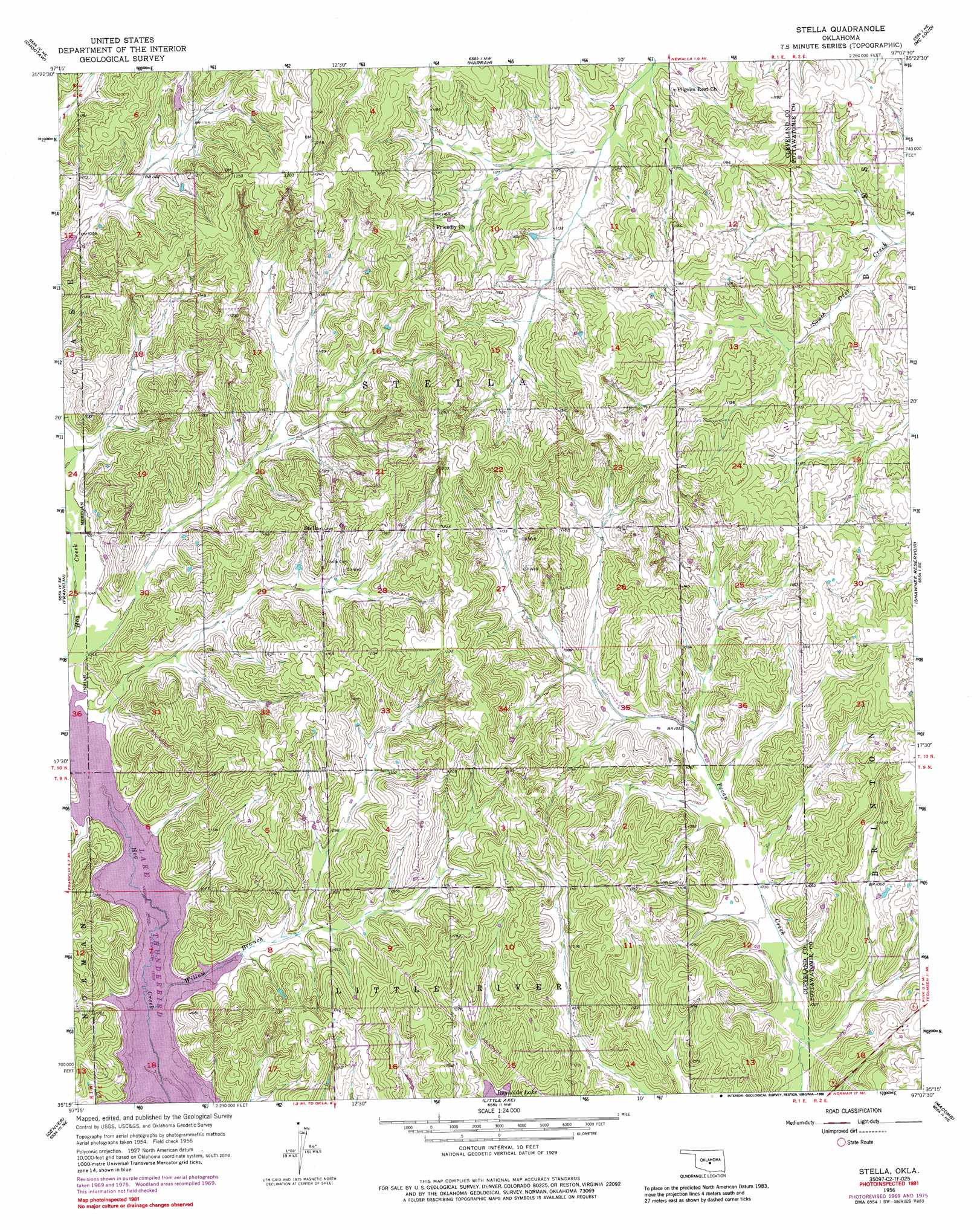
USGS Topo Quad 35097c2 - 1:24,000 scale
| Topo Map Name: | Stella |
| USGS Topo Quad ID: | 35097c2 |
| Print Size: | ca. 21 1/4" wide x 27" high |
| Southeast Coordinates: | 35.25° N latitude / 97.125° W longitude |
| Map Center Coordinates: | 35.3125° N latitude / 97.1875° W longitude |
| U.S. State: | OK |
| Filename: | o35097c2.jpg |
| Download Map JPG Image: | Stella topo map 1:24,000 scale |
| Map Type: | Topographic |
| Topo Series: | 7.5´ |
| Map Scale: | 1:24,000 |
| Source of Map Images: | United States Geological Survey (USGS) |
| Alternate Map Versions: |
Stella OK 1956, updated 1957 Download PDF Buy paper map Stella OK 1956, updated 1970 Download PDF Buy paper map Stella OK 1956, updated 1976 Download PDF Buy paper map Stella OK 1956, updated 1988 Download PDF Buy paper map Stella OK 2009 Download PDF Buy paper map Stella OK 2012 Download PDF Buy paper map Stella OK 2016 Download PDF Buy paper map |
1:24,000 Topo Quads surrounding Stella
Spencer |
Jones |
Horseshoe Lake |
Luther Se |
Meeker |
Midwest City |
Choctaw |
Harrah |
Mcloud |
Aydelotte |
Moore |
Franklin |
Stella |
Shawnee Reservoir |
Shawnee |
Norman |
Denver |
Little Axe |
Macomb |
Brooksville |
Washington |
Purcell |
Eason |
Tribbey |
Pearson |
> Back to 35097a1 at 1:100,000 scale
> Back to 35096a1 at 1:250,000 scale
> Back to U.S. Topo Maps home
Stella topo map: Gazetteer
Stella: Dams
Oknoname 103005 Dam elevation 352m 1154′Upper Black Bear Creek Site 10 Dam elevation 352m 1154′
Stella: Populated Places
Stella elevation 369m 1210′Stella: Reservoirs
Oknoname 103005 Reservoir elevation 352m 1154′Upper Black Bear Creek Site 10 Reservoir elevation 352m 1154′
Stella: Streams
Willow Branch elevation 315m 1033′Stella digital topo map on disk
Buy this Stella topo map showing relief, roads, GPS coordinates and other geographical features, as a high-resolution digital map file on DVD: