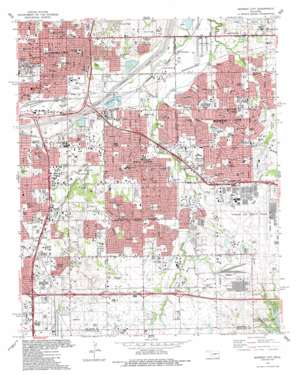
Midwest City Topo Map Oklahoma
To zoom in, hover over the map of Midwest City
USGS Topo Quad 35097d4 - 1:24,000 scale
| Topo Map Name: | Midwest City |
| USGS Topo Quad ID: | 35097d4 |
| Print Size: | ca. 21 1/4" wide x 27" high |
| Southeast Coordinates: | 35.375° N latitude / 97.375° W longitude |
| Map Center Coordinates: | 35.4375° N latitude / 97.4375° W longitude |
| U.S. State: | OK |
| Filename: | o35097d4.jpg |
| Download Map JPG Image: | Midwest City topo map 1:24,000 scale |
| Map Type: | Topographic |
| Topo Series: | 7.5´ |
| Map Scale: | 1:24,000 |
| Source of Map Images: | United States Geological Survey (USGS) |
| Alternate Map Versions: |
Crutcho Creek OK 1934 Download PDF Buy paper map Midwest City OK 1956, updated 1957 Download PDF Buy paper map Midwest City OK 1956, updated 1970 Download PDF Buy paper map Midwest City OK 1956, updated 1976 Download PDF Buy paper map Midwest City OK 1986, updated 1987 Download PDF Buy paper map Midwest City OK 1995, updated 2000 Download PDF Buy paper map Midwest City OK 2010 Download PDF Buy paper map Midwest City OK 2012 Download PDF Buy paper map Midwest City OK 2016 Download PDF Buy paper map |
1:24,000 Topo Quads surrounding Midwest City
> Back to 35097a1 at 1:100,000 scale
> Back to 35096a1 at 1:250,000 scale
> Back to U.S. Topo Maps home
Midwest City topo map: Gazetteer
Midwest City: Airports
James Pasture Airport elevation 393m 1289′Love Field Heliport elevation 360m 1181′
Midwest City Regional Hospital Heliport elevation 367m 1204′
OMH Heliport elevation 373m 1223′
Tinker Air Force Base elevation 381m 1250′
Midwest City: Dams
Oknoname 083030 Dam elevation 399m 1309′Oknoname 5 Dam elevation 385m 1263′
Midwest City: Lakes
Thompson Lake elevation 354m 1161′Midwest City: Parks
Akers Park elevation 380m 1246′Diggs Park elevation 373m 1223′
Douglas Park elevation 354m 1161′
Edwards Park elevation 355m 1164′
ESA Park elevation 366m 1200′
Harden Park elevation 371m 1217′
Hathaway Park elevation 381m 1250′
Hayden Park elevation 368m 1207′
Kiwanis Park elevation 375m 1230′
Lions Park elevation 366m 1200′
Mecham Park elevation 377m 1236′
Nichols Court Park elevation 378m 1240′
Pecan Grove Park elevation 360m 1181′
Phillips Park elevation 361m 1184′
Pitts Park elevation 372m 1220′
Poore Park elevation 359m 1177′
Quinlan Park elevation 363m 1190′
Regional Park elevation 363m 1190′
Sequoah Park elevation 375m 1230′
Sunnylane Park elevation 378m 1240′
Trosper Park elevation 367m 1204′
Washington Park elevation 360m 1181′
Midwest City: Populated Places
Del City elevation 366m 1200′Flynn elevation 388m 1272′
Midway Village elevation 364m 1194′
Midwest City elevation 382m 1253′
Smith Village elevation 371m 1217′
Valley Brook elevation 384m 1259′
Midwest City: Reservoirs
Oknoname 083030 Reservoir elevation 399m 1309′Oknoname 5 Reservoir elevation 385m 1263′
Midwest City: Streams
Cherry Creek elevation 347m 1138′Crooked Oak Creek elevation 354m 1161′
Soldier Creek elevation 354m 1161′
Midwest City digital topo map on disk
Buy this Midwest City topo map showing relief, roads, GPS coordinates and other geographical features, as a high-resolution digital map file on DVD:


