Texola Topo Map Oklahoma
To zoom in, hover over the map of Texola
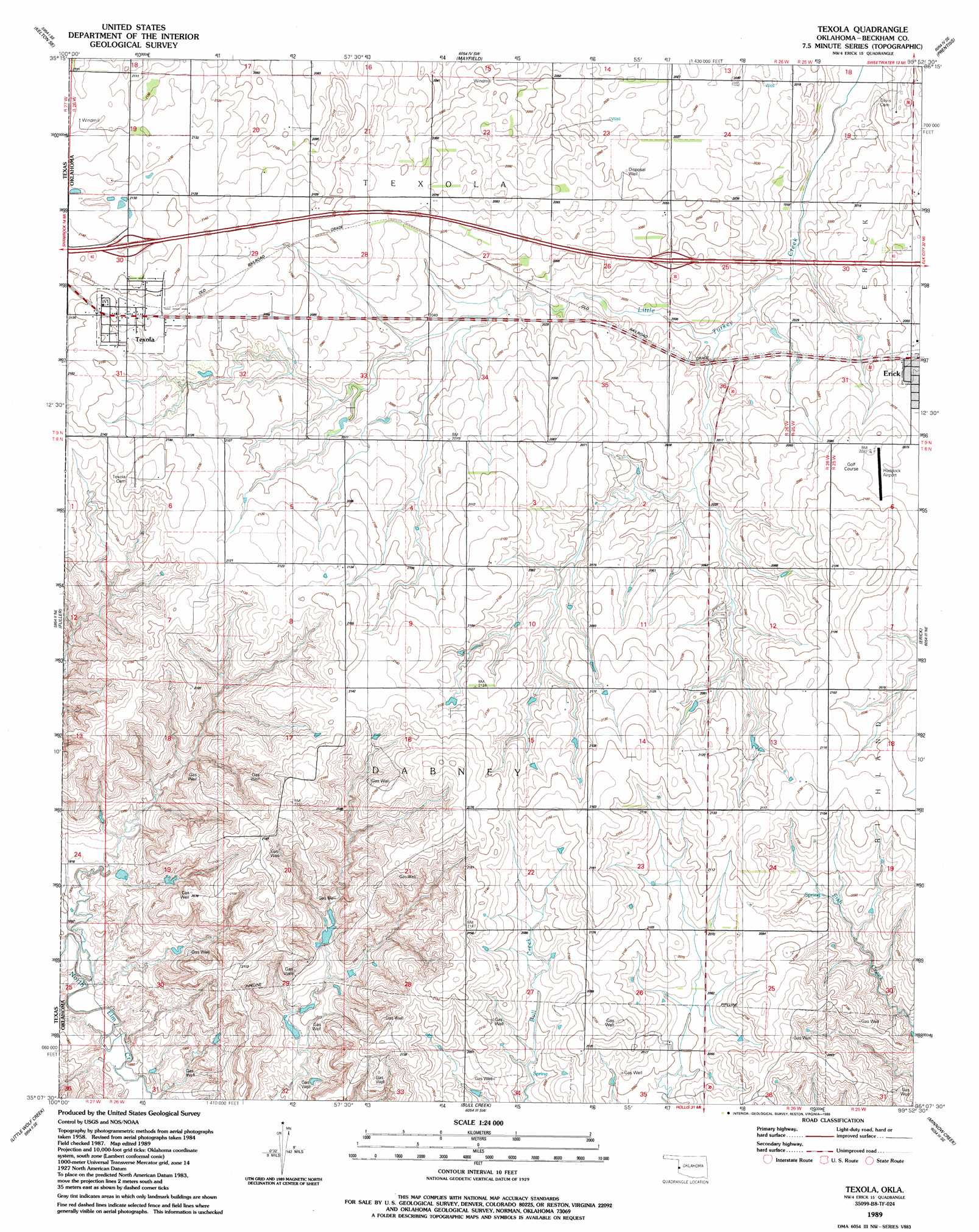
USGS Topo Quad 35099b8 - 1:24,000 scale
| Topo Map Name: | Texola |
| USGS Topo Quad ID: | 35099b8 |
| Print Size: | ca. 21 1/4" wide x 27" high |
| Southeast Coordinates: | 35.125° N latitude / 99.875° W longitude |
| Map Center Coordinates: | 35.1875° N latitude / 99.9375° W longitude |
| U.S. State: | OK |
| Filename: | o35099b8.jpg |
| Download Map JPG Image: | Texola topo map 1:24,000 scale |
| Map Type: | Topographic |
| Topo Series: | 7.5´ |
| Map Scale: | 1:24,000 |
| Source of Map Images: | United States Geological Survey (USGS) |
| Alternate Map Versions: |
Texola OK 1989, updated 1989 Download PDF Buy paper map Texola OK 2010 Download PDF Buy paper map Texola OK 2012 Download PDF Buy paper map Texola OK 2016 Download PDF Buy paper map |
1:24,000 Topo Quads surrounding Texola
Kelton Nw |
Kelton |
Sweetwater |
Grimes |
Berlin |
Twitty |
Kelton Se |
Mayfield |
Prentiss |
Sayre |
Shamrock East |
Fuller |
Texola |
Erick |
Dehli |
Lutie |
Little Wolf Creek |
Bull Creek |
Minnow Creek |
Plainview |
Wellington Nw |
Shinnery Creek |
Madge |
Vinson |
Reed |
> Back to 35099a1 at 1:100,000 scale
> Back to 35098a1 at 1:250,000 scale
> Back to U.S. Topo Maps home
Texola topo map: Gazetteer
Texola: Airports
Haddock Field elevation 639m 2096′Texola: Dams
Oren Number 1 Dam elevation 605m 1984′Oren Number 2 Dam elevation 653m 2142′
Oren Number 3 Dam elevation 608m 1994′
Texola: Populated Places
Texola elevation 654m 2145′Texola: Reservoirs
Oren Number 1 Reservoir elevation 605m 1984′Oren Number 2 Reservoir elevation 653m 2142′
Oren Number 3 Reservoir elevation 608m 1994′
Texola digital topo map on disk
Buy this Texola topo map showing relief, roads, GPS coordinates and other geographical features, as a high-resolution digital map file on DVD: