Mayfield Topo Map Oklahoma
To zoom in, hover over the map of Mayfield
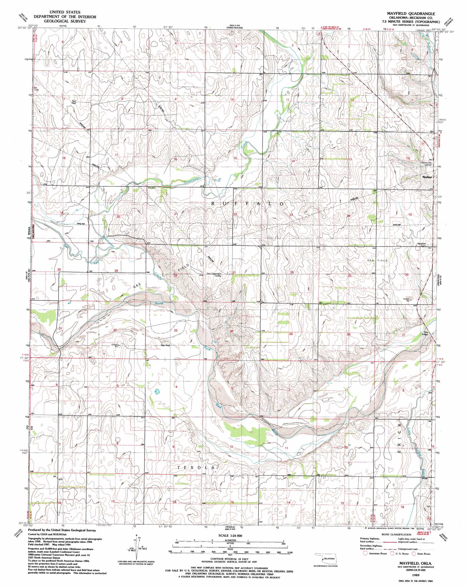
USGS Topo Quad 35099c8 - 1:24,000 scale
| Topo Map Name: | Mayfield |
| USGS Topo Quad ID: | 35099c8 |
| Print Size: | ca. 21 1/4" wide x 27" high |
| Southeast Coordinates: | 35.25° N latitude / 99.875° W longitude |
| Map Center Coordinates: | 35.3125° N latitude / 99.9375° W longitude |
| U.S. State: | OK |
| Filename: | o35099c8.jpg |
| Download Map JPG Image: | Mayfield topo map 1:24,000 scale |
| Map Type: | Topographic |
| Topo Series: | 7.5´ |
| Map Scale: | 1:24,000 |
| Source of Map Images: | United States Geological Survey (USGS) |
| Alternate Map Versions: |
Mayfield OK 1989, updated 1989 Download PDF Buy paper map Mayfield OK 2010 Download PDF Buy paper map Mayfield OK 2012 Download PDF Buy paper map Mayfield OK 2016 Download PDF Buy paper map |
1:24,000 Topo Quads surrounding Mayfield
Allison Sw |
Allison |
Reydon Sw |
Dempsey |
Cheyenne |
Kelton Nw |
Kelton |
Sweetwater |
Grimes |
Berlin |
Twitty |
Kelton Se |
Mayfield |
Prentiss |
Sayre |
Shamrock East |
Fuller |
Texola |
Erick |
Dehli |
Lutie |
Little Wolf Creek |
Bull Creek |
Minnow Creek |
Plainview |
> Back to 35099a1 at 1:100,000 scale
> Back to 35098a1 at 1:250,000 scale
> Back to U.S. Topo Maps home
Mayfield topo map: Gazetteer
Mayfield: Bridges
Tittle Bridge elevation 585m 1919′Mayfield: Dams
Cow Creek Site 4 Dam elevation 615m 2017′Cow Creek Site 6 Dam elevation 620m 2034′
Cow Creek Site 7 Dam elevation 598m 1961′
Mayfield: Populated Places
Mayfield elevation 611m 2004′Mayfield: Reservoirs
Cow Creek Site 4 Reservoir elevation 615m 2017′Cow Creek Site 6 Reservoir elevation 620m 2034′
Cow Creek Site 7 Reservoir elevation 598m 1961′
Mayfield: Streams
Salt Creek elevation 607m 1991′Salt Creek elevation 607m 1991′
Sweetwater Creek elevation 603m 1978′
Sweetwater Creek elevation 603m 1978′
Mayfield digital topo map on disk
Buy this Mayfield topo map showing relief, roads, GPS coordinates and other geographical features, as a high-resolution digital map file on DVD: