Alanreed Topo Map Texas
To zoom in, hover over the map of Alanreed
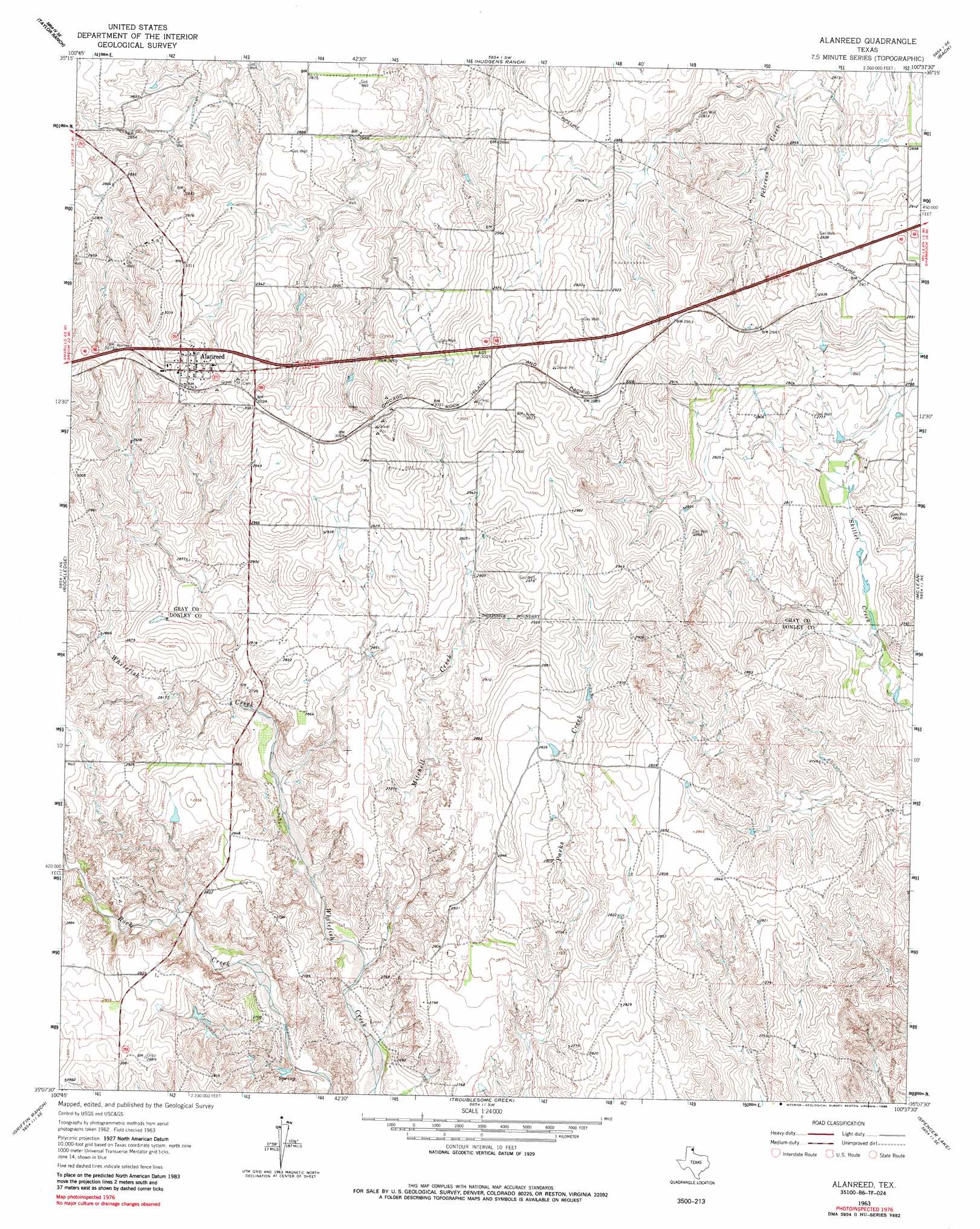
USGS Topo Quad 35100b6 - 1:24,000 scale
| Topo Map Name: | Alanreed |
| USGS Topo Quad ID: | 35100b6 |
| Print Size: | ca. 21 1/4" wide x 27" high |
| Southeast Coordinates: | 35.125° N latitude / 100.625° W longitude |
| Map Center Coordinates: | 35.1875° N latitude / 100.6875° W longitude |
| U.S. State: | TX |
| Filename: | o35100b6.jpg |
| Download Map JPG Image: | Alanreed topo map 1:24,000 scale |
| Map Type: | Topographic |
| Topo Series: | 7.5´ |
| Map Scale: | 1:24,000 |
| Source of Map Images: | United States Geological Survey (USGS) |
| Alternate Map Versions: |
Alanreed TX 1963, updated 1967 Download PDF Buy paper map Alanreed TX 1963, updated 1986 Download PDF Buy paper map Alanreed TX 2010 Download PDF Buy paper map Alanreed TX 2012 Download PDF Buy paper map Alanreed TX 2016 Download PDF Buy paper map |
1:24,000 Topo Quads surrounding Alanreed
Bowers City |
Lefors |
Pond Creek Nw |
Pond Creek |
Spring Creek |
Deep Lake |
Taylor Ranch |
Hudgens Ranch |
Back |
Pakan |
Jericho |
Rockledge |
Alanreed |
Mclean |
Ramsdell |
Roach Ranch |
Griffin Ranch |
Troublesome Creek |
Spencer Lake |
Abra |
Clarendon |
Lelia Lake |
Lelia Lake Creek |
Mcknight |
Quail |
> Back to 35100a1 at 1:100,000 scale
> Back to 35100a1 at 1:250,000 scale
> Back to U.S. Topo Maps home
Alanreed topo map: Gazetteer
Alanreed: Dams
Cubine Lake Dam elevation 875m 2870′Alanreed: Populated Places
Alanreed elevation 923m 3028′Alanreed: Reservoirs
Cubine Lake elevation 875m 2870′Alanreed: Streams
Mitchell Creek elevation 817m 2680′Alanreed digital topo map on disk
Buy this Alanreed topo map showing relief, roads, GPS coordinates and other geographical features, as a high-resolution digital map file on DVD: