Horse Creek North Topo Map Texas
To zoom in, hover over the map of Horse Creek North
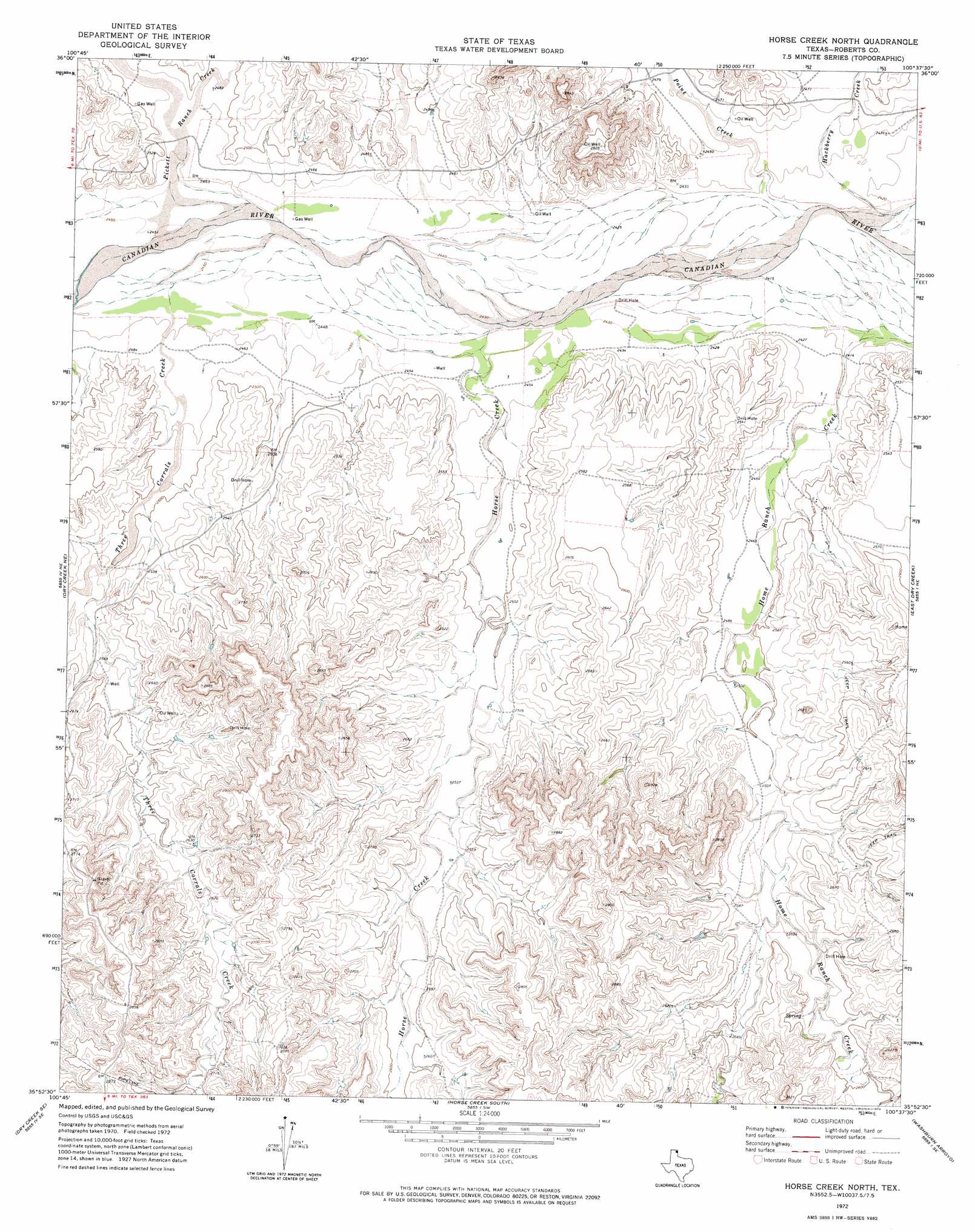
USGS Topo Quad 35100h6 - 1:24,000 scale
| Topo Map Name: | Horse Creek North |
| USGS Topo Quad ID: | 35100h6 |
| Print Size: | ca. 21 1/4" wide x 27" high |
| Southeast Coordinates: | 35.875° N latitude / 100.625° W longitude |
| Map Center Coordinates: | 35.9375° N latitude / 100.6875° W longitude |
| U.S. State: | TX |
| Filename: | o35100h6.jpg |
| Download Map JPG Image: | Horse Creek North topo map 1:24,000 scale |
| Map Type: | Topographic |
| Topo Series: | 7.5´ |
| Map Scale: | 1:24,000 |
| Source of Map Images: | United States Geological Survey (USGS) |
| Alternate Map Versions: |
Horse Creek North TX 1972, updated 1974 Download PDF Buy paper map Horse Creek North TX 2010 Download PDF Buy paper map Horse Creek North TX 2012 Download PDF Buy paper map Horse Creek North TX 2016 Download PDF Buy paper map |
1:24,000 Topo Quads surrounding Horse Creek North
Sourdough Creek Nw |
Sourdough Creek Ne |
Lake Fryer |
Lake Fryer Ne |
Barton Corners |
Sourdough Creek Sw |
Sourdough Creek |
Pickett Ranch Creek |
Barton Creek |
Lipscomb Sw |
Dry Creek North |
Dry Creek Ne |
Horse Creek North |
East Dry Creek |
Canadian West |
Dry Creek South |
Dry Creek Se |
Horse Creek South |
Washburn Arroyo |
Mendota |
Pampa Nw |
Pampa Ne |
Miami |
Lora |
Young Ranch |
> Back to 35100e1 at 1:100,000 scale
> Back to 35100a1 at 1:250,000 scale
> Back to U.S. Topo Maps home
Horse Creek North topo map: Gazetteer
Horse Creek North: Dams
McMordie Lake Dam elevation 783m 2568′Horse Creek North: Reservoirs
McMordie Lake elevation 783m 2568′Horse Creek North: Streams
Horse Creek elevation 740m 2427′Pickett Ranch Creek elevation 745m 2444′
Point Creek elevation 735m 2411′
Three Corrals Creek elevation 740m 2427′
Horse Creek North digital topo map on disk
Buy this Horse Creek North topo map showing relief, roads, GPS coordinates and other geographical features, as a high-resolution digital map file on DVD: