Rosebud Topo Map New Mexico
To zoom in, hover over the map of Rosebud
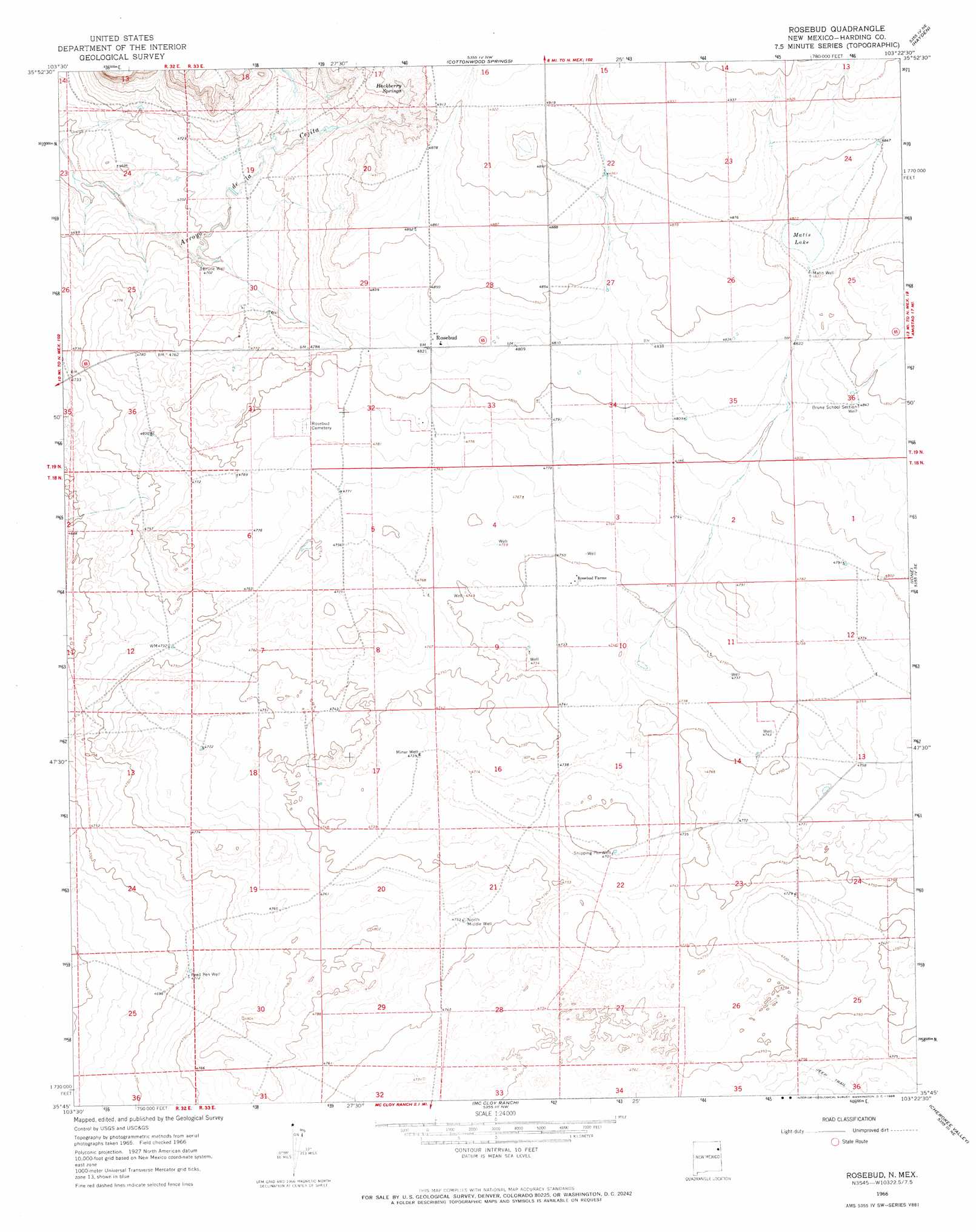
USGS Topo Quad 35103g4 - 1:24,000 scale
| Topo Map Name: | Rosebud |
| USGS Topo Quad ID: | 35103g4 |
| Print Size: | ca. 21 1/4" wide x 27" high |
| Southeast Coordinates: | 35.75° N latitude / 103.375° W longitude |
| Map Center Coordinates: | 35.8125° N latitude / 103.4375° W longitude |
| U.S. State: | NM |
| Filename: | o35103g4.jpg |
| Download Map JPG Image: | Rosebud topo map 1:24,000 scale |
| Map Type: | Topographic |
| Topo Series: | 7.5´ |
| Map Scale: | 1:24,000 |
| Source of Map Images: | United States Geological Survey (USGS) |
| Alternate Map Versions: |
Rosebud NM 1966, updated 1968 Download PDF Buy paper map Rosebud NM 2010 Download PDF Buy paper map Rosebud NM 2013 Download PDF Buy paper map Rosebud NM 2017 Download PDF Buy paper map |
1:24,000 Topo Quads surrounding Rosebud
Beenham Sw |
Minnie Butte |
Pedernal Creek |
Skull Mesa |
Stead |
Bueyeros |
Bueyeros Ne |
Cottonwood Springs |
Hayden |
Amistad |
Circle Bar Ranch |
Indian Bathtub |
Rosebud |
Ione |
Centerville Corner |
Buffalo Springs |
Gallegos Ne |
Mccloy Ranch |
Cherokee Valley |
Kerlin Hill |
Gallegos |
Fuentes Ranch |
Mccarty Ranch |
Lockney |
Obar |
> Back to 35103e1 at 1:100,000 scale
> Back to 35102a1 at 1:250,000 scale
> Back to U.S. Topo Maps home
Rosebud topo map: Gazetteer
Rosebud: Airports
Rosebud Airport elevation 1463m 4799′Rosebud: Lakes
Matis Lake elevation 1468m 4816′Rosebud: Populated Places
Rosebud elevation 1471m 4826′Rosebud Farms elevation 1448m 4750′
Rosebud: Post Offices
Rosebud Post Office (historical) elevation 1471m 4826′Rosebud: Springs
Hackberry Springs elevation 1475m 4839′Rosebud: Wells
Brune School Section Well elevation 1476m 4842′Brune Well elevation 1434m 4704′
Freed Pen Well elevation 1437m 4714′
Matis Well elevation 1471m 4826′
Miner Well elevation 1445m 4740′
North Middle Well elevation 1451m 4760′
Shipping Pen Well elevation 1434m 4704′
Rosebud digital topo map on disk
Buy this Rosebud topo map showing relief, roads, GPS coordinates and other geographical features, as a high-resolution digital map file on DVD: