Centerville Corner Topo Map New Mexico
To zoom in, hover over the map of Centerville Corner
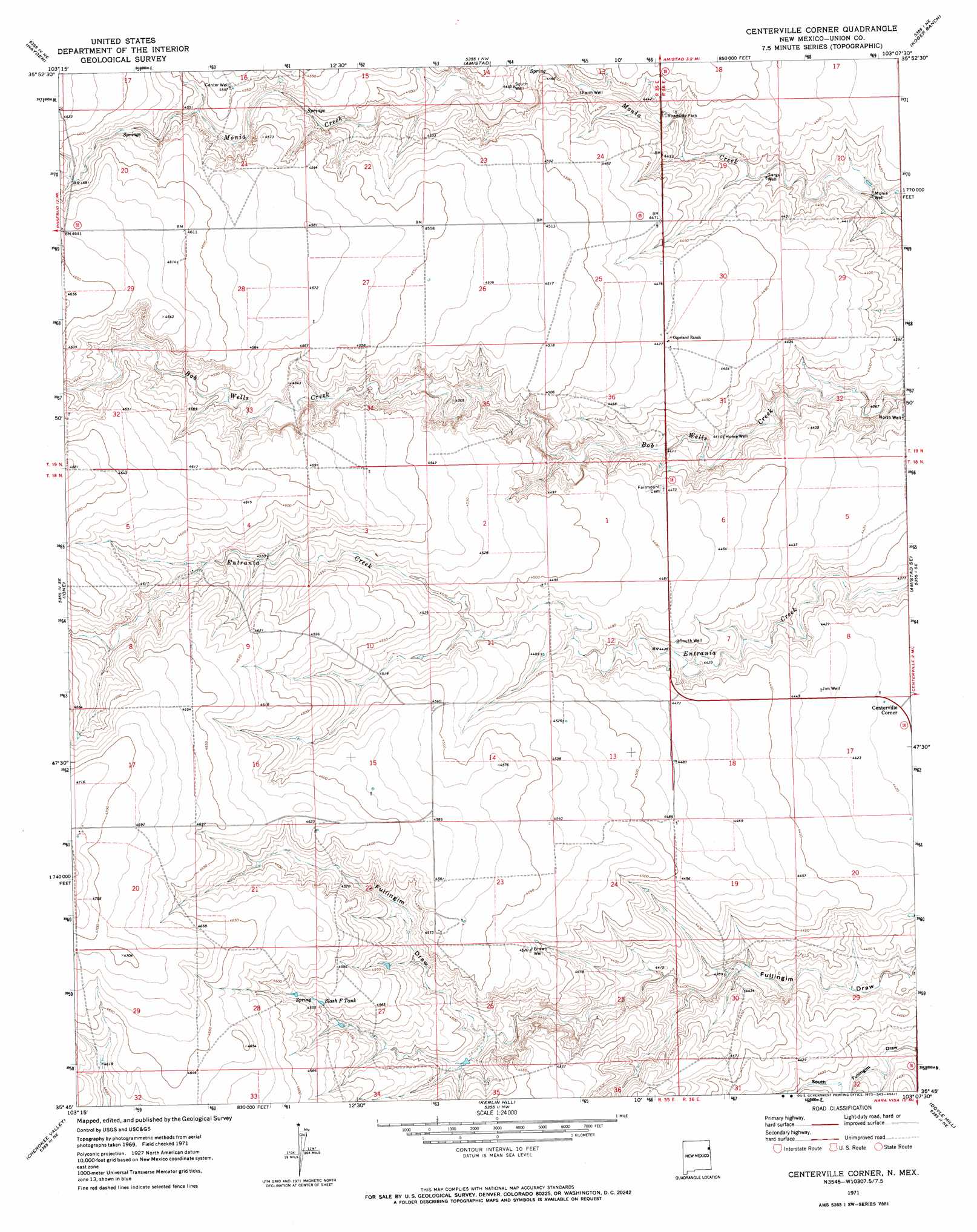
USGS Topo Quad 35103g2 - 1:24,000 scale
| Topo Map Name: | Centerville Corner |
| USGS Topo Quad ID: | 35103g2 |
| Print Size: | ca. 21 1/4" wide x 27" high |
| Southeast Coordinates: | 35.75° N latitude / 103.125° W longitude |
| Map Center Coordinates: | 35.8125° N latitude / 103.1875° W longitude |
| U.S. State: | NM |
| Filename: | o35103g2.jpg |
| Download Map JPG Image: | Centerville Corner topo map 1:24,000 scale |
| Map Type: | Topographic |
| Topo Series: | 7.5´ |
| Map Scale: | 1:24,000 |
| Source of Map Images: | United States Geological Survey (USGS) |
| Alternate Map Versions: |
Centerville Corner NM 1971, updated 1973 Download PDF Buy paper map Centerville Corner NM 2010 Download PDF Buy paper map Centerville Corner NM 2013 Download PDF Buy paper map Centerville Corner NM 2017 Download PDF Buy paper map |
1:24,000 Topo Quads surrounding Centerville Corner
Pedernal Creek |
Skull Mesa |
Stead |
Sedan Se |
Windy Hill |
Cottonwood Springs |
Hayden |
Amistad |
Koger Ranch |
Beck Ranch |
Rosebud |
Ione |
Centerville Corner |
Amistad Se |
Whiteaker Ranch |
Mccloy Ranch |
Cherokee Valley |
Kerlin Hill |
Doyle Hill |
Romero |
Mccarty Ranch |
Lockney |
Obar |
Nara Visa |
Knoblaw |
> Back to 35103e1 at 1:100,000 scale
> Back to 35102a1 at 1:250,000 scale
> Back to U.S. Topo Maps home
Centerville Corner topo map: Gazetteer
Centerville Corner: Populated Places
Centerville Corner elevation 1346m 4416′Centerville Corner: Reservoirs
Slash F Tank elevation 1387m 4550′Centerville Corner: Wells
Brown Well elevation 1379m 4524′Center Well elevation 1390m 4560′
Farm Well elevation 1349m 4425′
Gargul Well elevation 1341m 4399′
Home Well elevation 1344m 4409′
Jim Well elevation 1353m 4438′
Monia Well elevation 1326m 4350′
North Well elevation 1333m 4373′
South Well elevation 1359m 4458′
South Well elevation 1357m 4452′
Centerville Corner digital topo map on disk
Buy this Centerville Corner topo map showing relief, roads, GPS coordinates and other geographical features, as a high-resolution digital map file on DVD: