Roy Topo Map New Mexico
To zoom in, hover over the map of Roy
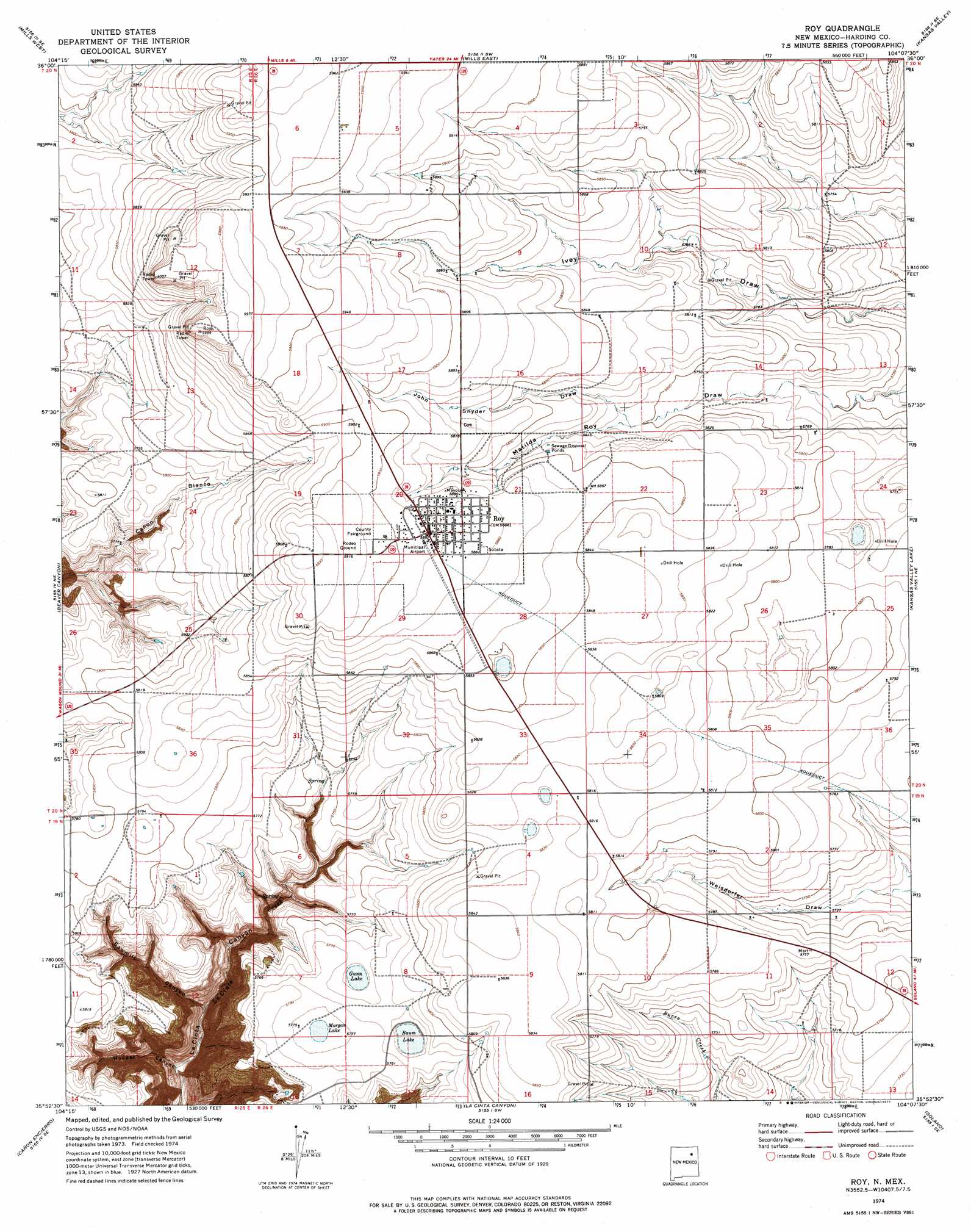
USGS Topo Quad 35104h2 - 1:24,000 scale
| Topo Map Name: | Roy |
| USGS Topo Quad ID: | 35104h2 |
| Print Size: | ca. 21 1/4" wide x 27" high |
| Southeast Coordinates: | 35.875° N latitude / 104.125° W longitude |
| Map Center Coordinates: | 35.9375° N latitude / 104.1875° W longitude |
| U.S. State: | NM |
| Filename: | o35104h2.jpg |
| Download Map JPG Image: | Roy topo map 1:24,000 scale |
| Map Type: | Topographic |
| Topo Series: | 7.5´ |
| Map Scale: | 1:24,000 |
| Source of Map Images: | United States Geological Survey (USGS) |
| Alternate Map Versions: |
Roy NM 1974, updated 1977 Download PDF Buy paper map Roy NM 2010 Download PDF Buy paper map Roy NM 2013 Download PDF Buy paper map Roy NM 2017 Download PDF Buy paper map |
1:24,000 Topo Quads surrounding Roy
Jaritas Ranch |
Abbott Lake |
Spear Hills |
Divine Lake |
Yates |
Canon Colorado |
Mills West |
Mills East |
Kansas Valley |
Valencia Spring |
Canon Las Cuevas |
Beaver Canyon |
Roy |
Kansas Valley Lake |
Sabino |
Alamito |
Canon Encierro |
La Cinta Canyon |
Solano |
Mosquero |
Sabinoso |
Arroyo Alamocito |
Montoya Point |
Waggoner Ranch |
Chinaberry Canyon |
> Back to 35104e1 at 1:100,000 scale
> Back to 35104a1 at 1:250,000 scale
> Back to U.S. Topo Maps home
Roy topo map: Gazetteer
Roy: Airports
Roy Municipal Airport elevation 1793m 5882′Stinebaugh Drilling, Inc Airport elevation 1785m 5856′
Roy: Lakes
Baum Lake elevation 1755m 5757′Gunn Lake elevation 1755m 5757′
Morgan Lake elevation 1762m 5780′
Roy: Populated Places
Roy elevation 1797m 5895′Roy: Post Offices
Roy Post Office elevation 1797m 5895′Roy: Valleys
Hooper Canyon elevation 1610m 5282′John Snyder Draw elevation 1771m 5810′
Sawmill Canyon elevation 1633m 5357′
Roy digital topo map on disk
Buy this Roy topo map showing relief, roads, GPS coordinates and other geographical features, as a high-resolution digital map file on DVD: