Grand Falls Topo Map Arizona
To zoom in, hover over the map of Grand Falls
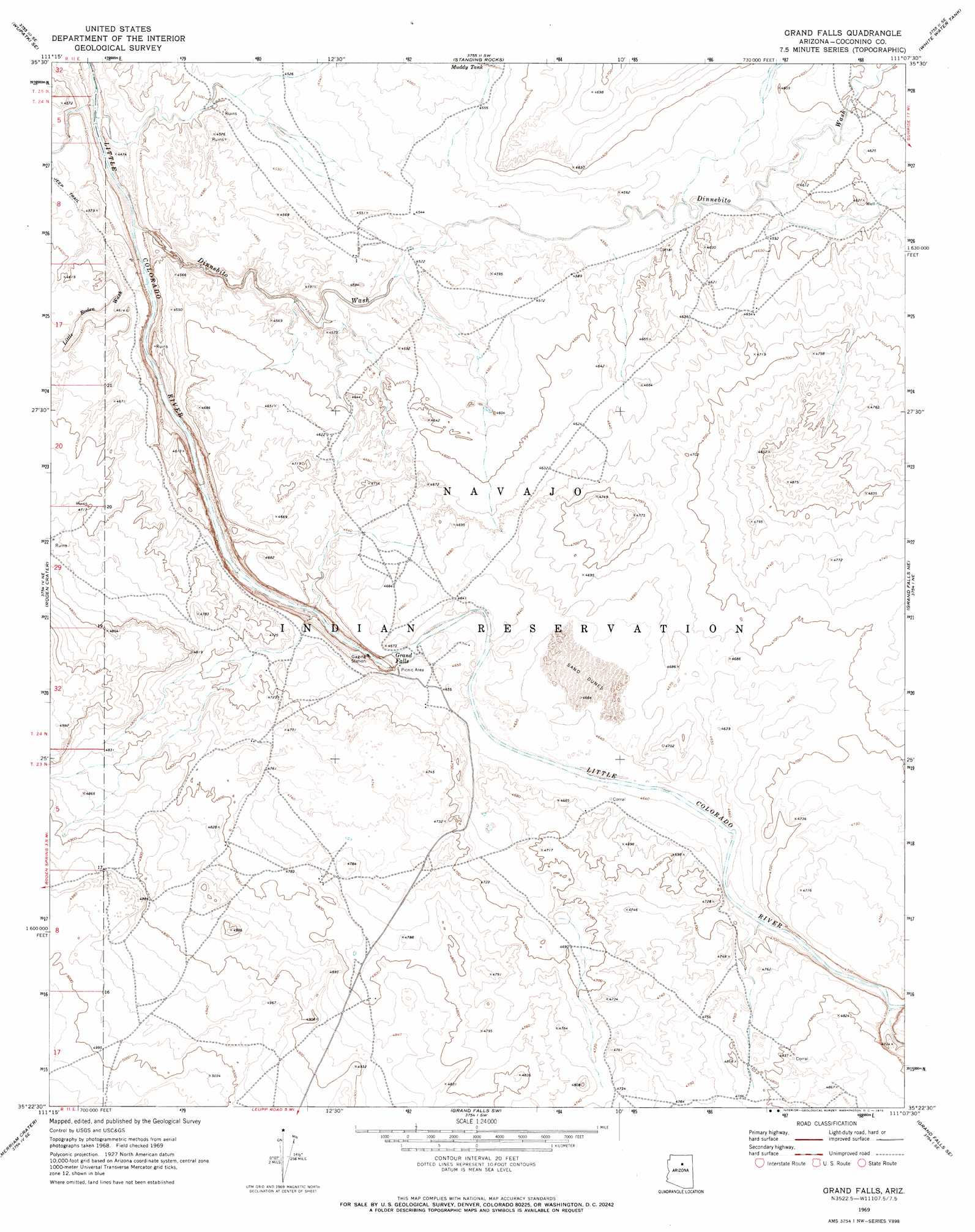
USGS Topo Quad 35111d2 - 1:24,000 scale
| Topo Map Name: | Grand Falls |
| USGS Topo Quad ID: | 35111d2 |
| Print Size: | ca. 21 1/4" wide x 27" high |
| Southeast Coordinates: | 35.375° N latitude / 111.125° W longitude |
| Map Center Coordinates: | 35.4375° N latitude / 111.1875° W longitude |
| U.S. State: | AZ |
| Filename: | o35111d2.jpg |
| Download Map JPG Image: | Grand Falls topo map 1:24,000 scale |
| Map Type: | Topographic |
| Topo Series: | 7.5´ |
| Map Scale: | 1:24,000 |
| Source of Map Images: | United States Geological Survey (USGS) |
| Alternate Map Versions: |
Grand Falls AZ 1969, updated 1972 Download PDF Buy paper map Grand Falls AZ 1969, updated 1972 Download PDF Buy paper map Grand Falls AZ 2011 Download PDF Buy paper map Grand Falls AZ 2014 Download PDF Buy paper map |
1:24,000 Topo Quads surrounding Grand Falls
Gray Mountain |
Wupatki Ne |
Badger Spring |
Rock Head |
Sand Springs |
Wupatki Sw |
Wupatki Se |
Standing Rocks |
White Water Tank |
Monument Point |
Strawberry Crater |
Roden Crater |
Grand Falls |
Grand Falls Ne |
Newberry Mesa |
Sunset Crater East |
Merriam Crater |
Grand Falls Sw |
Grand Falls Se |
Old Leupp |
Winona |
Angell |
Babbitt Wash |
Canyon Diablo |
Tucker Mesa Nw |
> Back to 35111a1 at 1:100,000 scale
> Back to 35110a1 at 1:250,000 scale
> Back to U.S. Topo Maps home
Grand Falls topo map: Gazetteer
Grand Falls: Airports
Cahoots Airport elevation 1510m 4954′Grand Falls: Arroyos
Dinnebito Wash elevation 1330m 4363′Grand Falls: Falls
Grand Falls elevation 1371m 4498′Grand Falls: Reservoirs
Muddy Tank elevation 1393m 4570′Grand Falls: Streams
Little Roden Wash elevation 1345m 4412′Grand Falls digital topo map on disk
Buy this Grand Falls topo map showing relief, roads, GPS coordinates and other geographical features, as a high-resolution digital map file on DVD: