Dove Spring Topo Map California
To zoom in, hover over the map of Dove Spring
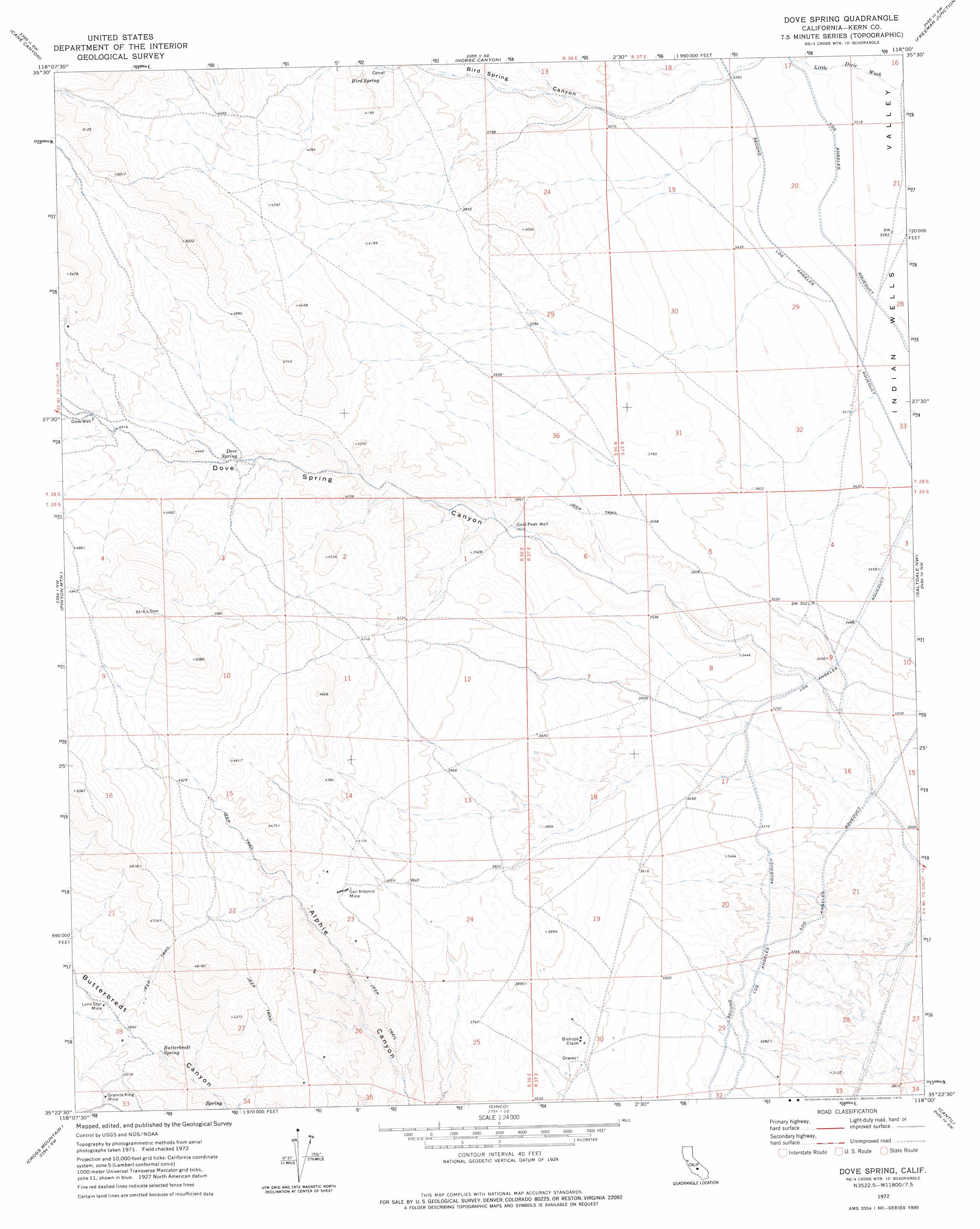
USGS Topo Quad 35118d1 - 1:24,000 scale
| Topo Map Name: | Dove Spring |
| USGS Topo Quad ID: | 35118d1 |
| Print Size: | ca. 21 1/4" wide x 27" high |
| Southeast Coordinates: | 35.375° N latitude / 118° W longitude |
| Map Center Coordinates: | 35.4375° N latitude / 118.0625° W longitude |
| U.S. State: | CA |
| Filename: | o35118d1.jpg |
| Download Map JPG Image: | Dove Spring topo map 1:24,000 scale |
| Map Type: | Topographic |
| Topo Series: | 7.5´ |
| Map Scale: | 1:24,000 |
| Source of Map Images: | United States Geological Survey (USGS) |
| Alternate Map Versions: |
Dove Spring CA 1972, updated 1975 Download PDF Buy paper map Dove Spring CA 1972, updated 1994 Download PDF Buy paper map Dove Spring CA 2012 Download PDF Buy paper map Dove Spring CA 2015 Download PDF Buy paper map |
1:24,000 Topo Quads surrounding Dove Spring
Weldon |
Onyx |
Walker Pass |
Owens Peak |
Inyokern |
Woolstalf Creek |
Cane Canyon |
Horse Canyon |
Freeman Junction |
Inyokern Se |
Claraville |
Pinyon Mountain |
Dove Spring |
Saltdale Nw |
Garlock |
Emerald Mountain |
Cross Mountain |
Cinco |
Cantil |
Saltdale Se |
Tehachapi Ne |
Cache Peak |
Mojave Ne |
California City North |
Galileo Hill |
> Back to 35118a1 at 1:100,000 scale
> Back to 35118a1 at 1:250,000 scale
> Back to U.S. Topo Maps home
Dove Spring topo map: Gazetteer
Dove Spring: Mines
Bishops Claim elevation 1121m 3677′Granite King Mine elevation 1285m 4215′
Lone Star Mine elevation 1209m 3966′
San Antonio Mine elevation 1247m 4091′
Dove Spring: Populated Places
Little Dixie (historical) elevation 998m 3274′Dove Spring: Springs
Bird Spring elevation 1174m 3851′Butterbredt Spring elevation 1161m 3809′
Dove Spring elevation 1279m 4196′
Dove Spring: Valleys
Bird Spring Canyon elevation 1038m 3405′Dove Spring Canyon elevation 927m 3041′
Dove Spring: Wells
Dove Well elevation 1398m 4586′Gold Peak Well elevation 1108m 3635′
Dove Spring digital topo map on disk
Buy this Dove Spring topo map showing relief, roads, GPS coordinates and other geographical features, as a high-resolution digital map file on DVD:
Southern Sierra Nevada, California & Southern Nevada
Buy digital topo maps: Southern Sierra Nevada, California & Southern Nevada