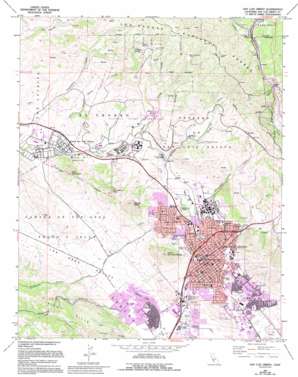
San Luis Obispo Topo Map California
To zoom in, hover over the map of San Luis Obispo
USGS Topo Quad 35120c6 - 1:24,000 scale
| Topo Map Name: | San Luis Obispo |
| USGS Topo Quad ID: | 35120c6 |
| Print Size: | ca. 21 1/4" wide x 27" high |
| Southeast Coordinates: | 35.25° N latitude / 120.625° W longitude |
| Map Center Coordinates: | 35.3125° N latitude / 120.6875° W longitude |
| U.S. State: | CA |
| Filename: | o35120c6.jpg |
| Download Map JPG Image: | San Luis Obispo topo map 1:24,000 scale |
| Map Type: | Topographic |
| Topo Series: | 7.5´ |
| Map Scale: | 1:24,000 |
| Source of Map Images: | United States Geological Survey (USGS) |
| Alternate Map Versions: |
San Luis Obispo CA 1965, updated 1967 Download PDF Buy paper map San Luis Obispo CA 1965, updated 1979 Download PDF Buy paper map San Luis Obispo CA 1965, updated 1986 Download PDF Buy paper map San Luis Obispo CA 1965, updated 1994 Download PDF Buy paper map San Luis Obispo CA 1976, updated 1980 Download PDF Buy paper map San Luis Obispo CA 1995, updated 2000 Download PDF Buy paper map San Luis Obispo CA 2012 Download PDF Buy paper map San Luis Obispo CA 2015 Download PDF Buy paper map |
| FStopo: | US Forest Service topo San Luis Obispo is available: Download FStopo PDF Download FStopo TIF |
1:24,000 Topo Quads surrounding San Luis Obispo
> Back to 35120a1 at 1:100,000 scale
> Back to 35120a1 at 1:250,000 scale
> Back to U.S. Topo Maps home
San Luis Obispo topo map: Gazetteer
San Luis Obispo: Airports
Camp San Luis Obispo Airfield elevation 67m 219′Clark Field (historical) elevation 40m 131′
San Luis Obispo: Areas
Tixlini elevation 62m 203′San Luis Obispo: Dams
Chorro Creek 1-072 Dam elevation 178m 583′San Luis Obispo: Gaps
Cuesta Pass elevation 472m 1548′San Luis Obispo: Mines
Castro Mine elevation 499m 1637′La Trinidad Mine elevation 514m 1686′
Pick and Shovel Mine elevation 560m 1837′
Primera Mine elevation 402m 1318′
San Luis Obispo: Parks
Cuesta Canyon County Park elevation 97m 318′Cuesta County Park elevation 109m 357′
Hawthorne Park elevation 61m 200′
Johnson Park elevation 90m 295′
Laguna Hills Park elevation 55m 180′
Laguna Lake Park elevation 39m 127′
Meadow Park elevation 56m 183′
Mission Plaza elevation 62m 203′
Mitchell Park elevation 68m 223′
Mustang Stadium elevation 85m 278′
San Luis Obispo Baseball Stadium elevation 75m 246′
Santa Rosa Park elevation 72m 236′
Sinsheimer Park elevation 81m 265′
Smith Park elevation 41m 134′
Throop Park elevation 80m 262′
Triangle Park elevation 70m 229′
San Luis Obispo: Populated Places
Chorro elevation 203m 666′Goldtree elevation 143m 469′
San Luis Obispo elevation 71m 232′
Serrano elevation 292m 958′
Thyle elevation 387m 1269′
San Luis Obispo: Post Offices
Los Padres Post Office elevation 135m 442′San Luis Obispo Post Office elevation 64m 209′
San Luis Obispo: Reservoirs
Chorro Reservoir elevation 178m 583′Laguna Lake elevation 37m 121′
San Luis Obispo: Springs
Dughi Spring elevation 531m 1742′Whiskey Spring elevation 452m 1482′
San Luis Obispo: Streams
Brizzolara Creek elevation 76m 249′Dairy Creek elevation 74m 242′
Old Garden Creek elevation 58m 190′
Stenner Creek elevation 50m 164′
San Luis Obispo: Summits
Bishop Peak elevation 455m 1492′Cerro Romualdo elevation 363m 1190′
Cerro San Luis Obispo elevation 387m 1269′
Chumash Peak elevation 241m 790′
Terrace Hill elevation 152m 498′
San Luis Obispo: Valleys
Prefumo Canyon elevation 50m 164′Reservoir Canyon elevation 125m 410′
Sycamore Canyon elevation 55m 180′
San Luis Obispo digital topo map on disk
Buy this San Luis Obispo topo map showing relief, roads, GPS coordinates and other geographical features, as a high-resolution digital map file on DVD:


