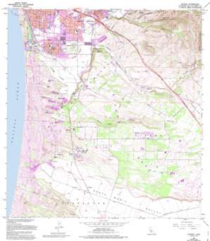
Oceano Topo Map California
To zoom in, hover over the map of Oceano
USGS Topo Quad 35120a5 - 1:24,000 scale
| Topo Map Name: | Oceano |
| USGS Topo Quad ID: | 35120a5 |
| Print Size: | ca. 21 1/4" wide x 27" high |
| Southeast Coordinates: | 35° N latitude / 120.5° W longitude |
| Map Center Coordinates: | 35.0625° N latitude / 120.5625° W longitude |
| U.S. State: | CA |
| Filename: | o35120a5.jpg |
| Download Map JPG Image: | Oceano topo map 1:24,000 scale |
| Map Type: | Topographic |
| Topo Series: | 7.5´ |
| Map Scale: | 1:24,000 |
| Source of Map Images: | United States Geological Survey (USGS) |
| Alternate Map Versions: |
Oceano CA 2012 Download PDF Buy paper map Oceano CA 2015 Download PDF Buy paper map |
1:24,000 Topo Quads surrounding Oceano
> Back to 35120a1 at 1:100,000 scale
> Back to 35120a1 at 1:250,000 scale
> Back to U.S. Topo Maps home
Oceano topo map: Gazetteer
Oceano: Airports
Oceano County Airport elevation 4m 13′Oceano: Areas
Callender Dunes elevation 24m 78′Guadalupe Dunes elevation 18m 59′
Oceano: Lakes
Big Pocket Lake elevation 4m 13′Big Twin Lake elevation 3m 9′
Black Lake elevation 9m 29′
Bolsa Chica Lake elevation 5m 16′
Celery Lake elevation 5m 16′
Dune Lakes elevation 20m 65′
Hospital Lake elevation 3m 9′
Jack Lake elevation 9m 29′
Lettuce Lake elevation 9m 29′
Little Oso Flaco Lake elevation 6m 19′
Mud Lake elevation 4m 13′
Oso Flaco Lake elevation 5m 16′
Pipeline Lake elevation 4m 13′
Small Twin Lake elevation 4m 13′
White Lake elevation 3m 9′
Willow Lake elevation 3m 9′
Oceano: Parks
Christmas Tree Island Park elevation 33m 108′Dower Wayside Park elevation 37m 121′
El Camino Real Park elevation 44m 144′
Elm Street Park elevation 27m 88′
Grover City Park elevation 21m 68′
La Mesa Village Park elevation 21m 68′
Mentone Drainage Basin Park elevation 17m 55′
Oceano Dunes State Vehicular Recreation Area elevation 13m 42′
Ramona Gardens Park elevation 23m 75′
Sixteenth Street Park elevation 19m 62′
Soto Sprots Complex elevation 25m 82′
Tiger Tail Park elevation 27m 88′
Village Green Park elevation 34m 111′
Woodland Park elevation 19m 62′
Oceano: Populated Places
Arroyo Grande elevation 36m 118′ARroyo Trailer Park elevation 35m 114′
Bromela elevation 16m 52′
Callender elevation 31m 101′
Cienega Seabreeze Mobile Home Park elevation 10m 32′
Cuna Vista Mobile Home Park elevation 12m 39′
Fairoaks elevation 29m 95′
Grande Mobile Manor Mobile Home Park elevation 25m 82′
Grover Beach elevation 18m 59′
Halcyon elevation 20m 65′
Ken Mar Gardens Mobile Home Park elevation 22m 72′
Los Berros elevation 63m 206′
Newsom Springs elevation 123m 403′
Oaks elevation 34m 111′
Oceano elevation 9m 29′
Portico Mobile Home and Garden Park elevation 13m 42′
Rancho del Arroyo Mobile Home Park elevation 14m 45′
Summit (historical) elevation 123m 403′
Oceano: Post Offices
Arroyo Grande Post Office elevation 33m 108′Grover Beach Post Office elevation 21m 68′
Halcyon Post Office elevation 19m 62′
Oceano Post Office elevation 10m 32′
Oceano: Springs
Newsom Springs elevation 133m 436′Oceano: Streams
Los Berros Creek elevation 19m 62′Mehlschau Creek elevation 104m 341′
Oceano: Summits
Nipomo Hill elevation 125m 410′Nipomo Mesa elevation 116m 380′
Picacho elevation 278m 912′
Oceano: Valleys
Adobe Canyon elevation 109m 357′Black Lake Canyon elevation 12m 39′
Corbit Canyon elevation 26m 85′
Guaya Canyon elevation 49m 160′
Los Berros Canyon elevation 22m 72′
Newsom Canyon elevation 68m 223′
Oceano digital topo map on disk
Buy this Oceano topo map showing relief, roads, GPS coordinates and other geographical features, as a high-resolution digital map file on DVD:


