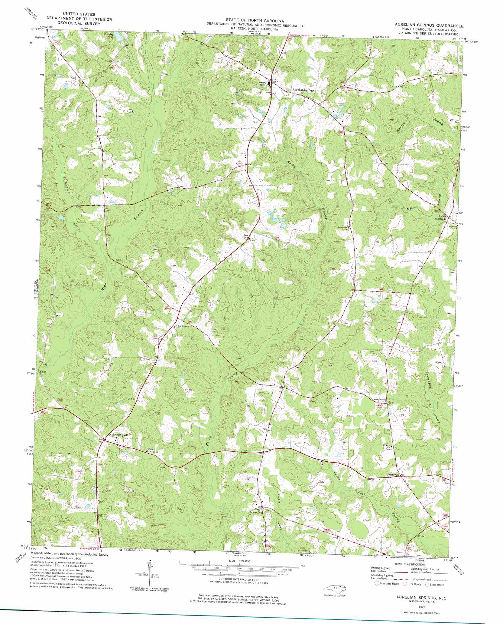
Aurelian Springs Topo Map North Carolina
To zoom in, hover over the map of Aurelian Springs
USGS Topo Quad 36077c7 - 1:24,000 scale
| Topo Map Name: | Aurelian Springs |
| USGS Topo Quad ID: | 36077c7 |
| Print Size: | ca. 21 1/4" wide x 27" high |
| Southeast Coordinates: | 36.25° N latitude / 77.75° W longitude |
| Map Center Coordinates: | 36.3125° N latitude / 77.8125° W longitude |
| U.S. State: | NC |
| Filename: | o36077c7.jpg |
| Download Map JPG Image: | Aurelian Springs topo map 1:24,000 scale |
| Map Type: | Topographic |
| Topo Series: | 7.5´ |
| Map Scale: | 1:24,000 |
| Source of Map Images: | United States Geological Survey (USGS) |
| Alternate Map Versions: |
Aurelian Springs NC 1973, updated 1977 Download PDF Buy paper map Aurelian Springs NC 2010 Download PDF Buy paper map Aurelian Springs NC 2013 Download PDF Buy paper map Aurelian Springs NC 2016 Download PDF Buy paper map |
1:24,000 Topo Quads surrounding Aurelian Springs
South Hill Se |
Gasburg |
Valentines |
Barley |
Skippers |
Macon |
Littleton |
Thelma |
Roanoke Rapids |
Weldon |
Inez |
Hollister |
Aurelian Springs |
Darlington |
Halifax |
Centerville |
Essex |
Ringwood |
Enfield |
Dawson Crossroads |
Castalia |
Red Oak |
Drake |
Whitakers |
Draughn |
> Back to 36077a1 at 1:100,000 scale
> Back to 36076a1 at 1:250,000 scale
> Back to U.S. Topo Maps home
Aurelian Springs topo map: Gazetteer
Aurelian Springs: Dams
Crawleys Pond Dam elevation 93m 305′Warrens Pond Dam elevation 68m 223′
Aurelian Springs: Populated Places
Aurelian Springs elevation 102m 334′Brinkleyville elevation 84m 275′
Heathsville elevation 63m 206′
Lewis Crossroads elevation 64m 209′
Aurelian Springs: Reservoirs
Crawleys Pond elevation 93m 305′Warrens Pond elevation 68m 223′
Aurelian Springs: Streams
Butterwood Creek elevation 51m 167′Aurelian Springs digital topo map on disk
Buy this Aurelian Springs topo map showing relief, roads, GPS coordinates and other geographical features, as a high-resolution digital map file on DVD:
Atlantic Coast (NY, NJ, PA, DE, MD, VA, NC)
Buy digital topo maps: Atlantic Coast (NY, NJ, PA, DE, MD, VA, NC)
 map DVD")