Osage Ne Topo Map Arkansas
To zoom in, hover over the map of Osage Ne
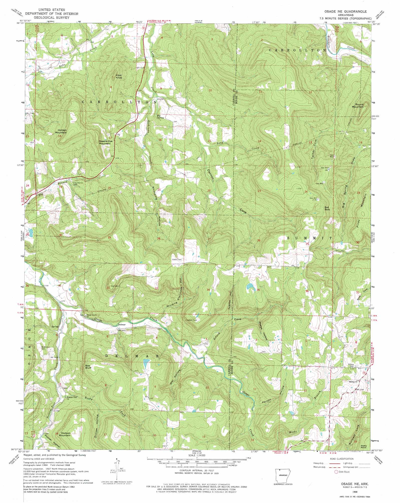
USGS Topo Quad 36093b3 - 1:24,000 scale
| Topo Map Name: | Osage Ne |
| USGS Topo Quad ID: | 36093b3 |
| Print Size: | ca. 21 1/4" wide x 27" high |
| Southeast Coordinates: | 36.125° N latitude / 93.25° W longitude |
| Map Center Coordinates: | 36.1875° N latitude / 93.3125° W longitude |
| U.S. State: | AR |
| Filename: | o36093b3.jpg |
| Download Map JPG Image: | Osage Ne topo map 1:24,000 scale |
| Map Type: | Topographic |
| Topo Series: | 7.5´ |
| Map Scale: | 1:24,000 |
| Source of Map Images: | United States Geological Survey (USGS) |
| Alternate Map Versions: |
Osage NE AR 1968, updated 1969 Download PDF Buy paper map Osage NE AR 1968, updated 1981 Download PDF Buy paper map Osage NE AR 2011 Download PDF Buy paper map Osage NE AR 2014 Download PDF Buy paper map |
1:24,000 Topo Quads surrounding Osage Ne
Grandview |
Blue Eye |
Denver |
Omaha |
Omaha Ne |
Berryville |
Green Forest |
Alpena |
Batavia |
Bergman |
Marble |
Osage |
Osage Ne |
Gaither |
Harrison |
Kingston |
Osage Sw |
Ponca |
Jasper |
Hasty |
Weathers |
Boxley |
Murray |
Parthenon |
Mount Judea |
> Back to 36093a1 at 1:100,000 scale
> Back to 36092a1 at 1:250,000 scale
> Back to U.S. Topo Maps home
Osage Ne topo map: Gazetteer
Osage Ne: Cliffs
Bee Bluff elevation 632m 2073′Osage Ne: Dams
Brewer Lake Dam elevation 644m 2112′Osage Ne: Populated Places
Delmar elevation 437m 1433′Hill Top elevation 659m 2162′
Red Bank elevation 647m 2122′
Osage Ne: Reservoirs
Brewer Lake elevation 644m 2112′Osage Ne: Springs
Big Spring elevation 391m 1282′Osage Ne: Streams
Dishrown Creek elevation 382m 1253′Micks Branch elevation 502m 1646′
Possum Trot Creek elevation 413m 1354′
Rocky Fork elevation 448m 1469′
Osage Ne: Summits
Dodson Mountain elevation 654m 2145′Holden Mountain elevation 614m 2014′
Needle Eye Mountain elevation 606m 1988′
Pilot Knob elevation 529m 1735′
Round Mountain elevation 581m 1906′
Osage Ne: Valleys
Alford Cove elevation 477m 1564′Big Spring Draw elevation 425m 1394′
Butler Cove elevation 596m 1955′
Denton Cove elevation 403m 1322′
Ferguson Hollow elevation 499m 1637′
Outlaw Hollow elevation 491m 1610′
Owl Hollow elevation 466m 1528′
Parton Hollow elevation 499m 1637′
Phelps Hollow elevation 533m 1748′
Pitcher Hollow elevation 472m 1548′
Tucker Cove elevation 463m 1519′
Whooping Hollow elevation 420m 1377′
Winding Staircase Hollow elevation 455m 1492′
Osage Ne digital topo map on disk
Buy this Osage Ne topo map showing relief, roads, GPS coordinates and other geographical features, as a high-resolution digital map file on DVD: