Big Cabin Topo Map Oklahoma
To zoom in, hover over the map of Big Cabin
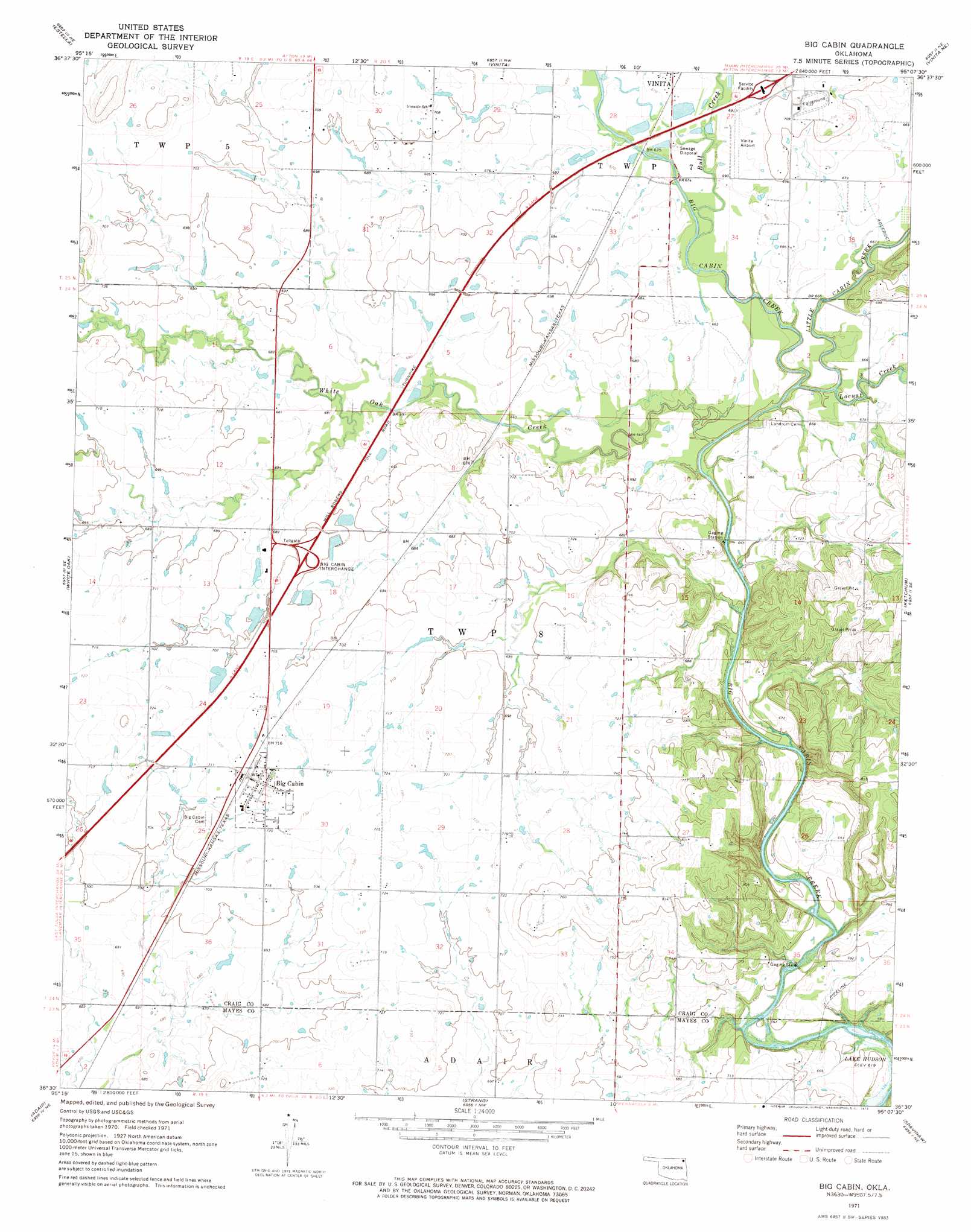
USGS Topo Quad 36095e2 - 1:24,000 scale
| Topo Map Name: | Big Cabin |
| USGS Topo Quad ID: | 36095e2 |
| Print Size: | ca. 21 1/4" wide x 27" high |
| Southeast Coordinates: | 36.5° N latitude / 95.125° W longitude |
| Map Center Coordinates: | 36.5625° N latitude / 95.1875° W longitude |
| U.S. State: | OK |
| Filename: | o36095e2.jpg |
| Download Map JPG Image: | Big Cabin topo map 1:24,000 scale |
| Map Type: | Topographic |
| Topo Series: | 7.5´ |
| Map Scale: | 1:24,000 |
| Source of Map Images: | United States Geological Survey (USGS) |
| Alternate Map Versions: |
Big Cabin OK 1971, updated 1973 Download PDF Buy paper map Big Cabin OK 2010 Download PDF Buy paper map Big Cabin OK 2012 Download PDF Buy paper map Big Cabin OK 2016 Download PDF Buy paper map |
1:24,000 Topo Quads surrounding Big Cabin
Sanders |
Centralia |
Pyramid Corners |
Welch South |
Miami Sw |
Chelsea Nw |
Estella |
Vinita |
Vinita Ne |
Afton |
Chelsea |
White Oak |
Big Cabin |
Ketchum |
Bernice |
Bushyhead |
Adair |
Strang |
Spavinaw |
Chloeta |
Osage Hills |
Pryor |
Salina |
Salina Se |
Lake Eucha West |
> Back to 36095e1 at 1:100,000 scale
> Back to 36094a1 at 1:250,000 scale
> Back to U.S. Topo Maps home
Big Cabin topo map: Gazetteer
Big Cabin: Airports
Vinita Municipal Airport elevation 212m 695′Big Cabin: Crossings
Big Cabin Interchange elevation 219m 718′Big Cabin: Populated Places
Big Cabin elevation 220m 721′Big Cabin: Streams
Bull Creek elevation 200m 656′Little Cabin Creek elevation 196m 643′
Locust Creek elevation 198m 649′
White Oak Creek elevation 196m 643′
Big Cabin digital topo map on disk
Buy this Big Cabin topo map showing relief, roads, GPS coordinates and other geographical features, as a high-resolution digital map file on DVD: