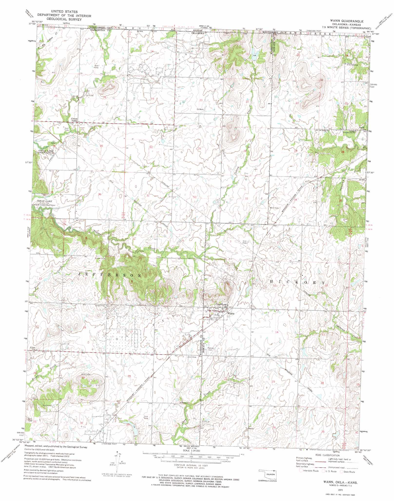
Wann Topo Map Oklahoma
To zoom in, hover over the map of Wann
USGS Topo Quad 36095h7 - 1:24,000 scale
| Topo Map Name: | Wann |
| USGS Topo Quad ID: | 36095h7 |
| Print Size: | ca. 21 1/4" wide x 27" high |
| Southeast Coordinates: | 36.875° N latitude / 95.75° W longitude |
| Map Center Coordinates: | 36.9375° N latitude / 95.8125° W longitude |
| U.S. States: | OK, KS |
| Filename: | o36095h7.jpg |
| Download Map JPG Image: | Wann topo map 1:24,000 scale |
| Map Type: | Topographic |
| Topo Series: | 7.5´ |
| Map Scale: | 1:24,000 |
| Source of Map Images: | United States Geological Survey (USGS) |
| Alternate Map Versions: |
Wann OK 1972, updated 1974 Download PDF Buy paper map Wann OK 2010 Download PDF Buy paper map Wann OK 2012 Download PDF Buy paper map Wann OK 2016 Download PDF Buy paper map |
1:24,000 Topo Quads surrounding Wann
Hale |
Caney Nw |
Bolton |
Independence |
Liberty |
Peru |
Caney |
Tyro |
Coffeyville West |
Coffeyville East |
Bowring |
Copan |
Wann |
Elliott |
South Coffeyville |
Bowring Se |
Bartlesville North |
Blue Mound |
Delaware |
Childers |
Woolaroc |
Bartlesville South |
Oglesby |
Nowata West |
Nowata East |
> Back to 36095e1 at 1:100,000 scale
> Back to 36094a1 at 1:250,000 scale
> Back to U.S. Topo Maps home
Wann topo map: Gazetteer
Wann: Dams
Cotton-Coon-Mission Creek Site 11 Dam elevation 251m 823′Cotton-Coon-Mission Creek Site 7 Dam elevation 235m 770′
Floyd Fitzsimmons Dam elevation 259m 849′
Wann: Populated Places
Cotton Valley elevation 232m 761′Wann elevation 263m 862′
Wann: Reservoirs
Cotton-Coon-Mission Creek Site 11 Reservoir elevation 251m 823′Cotton-Coon-Mission Creek Site 7 Reservoir elevation 235m 770′
Floyd Fitzsimmons Reservoir elevation 259m 849′
Wann digital topo map on disk
Buy this Wann topo map showing relief, roads, GPS coordinates and other geographical features, as a high-resolution digital map file on DVD: