Jennings Topo Map Oklahoma
To zoom in, hover over the map of Jennings
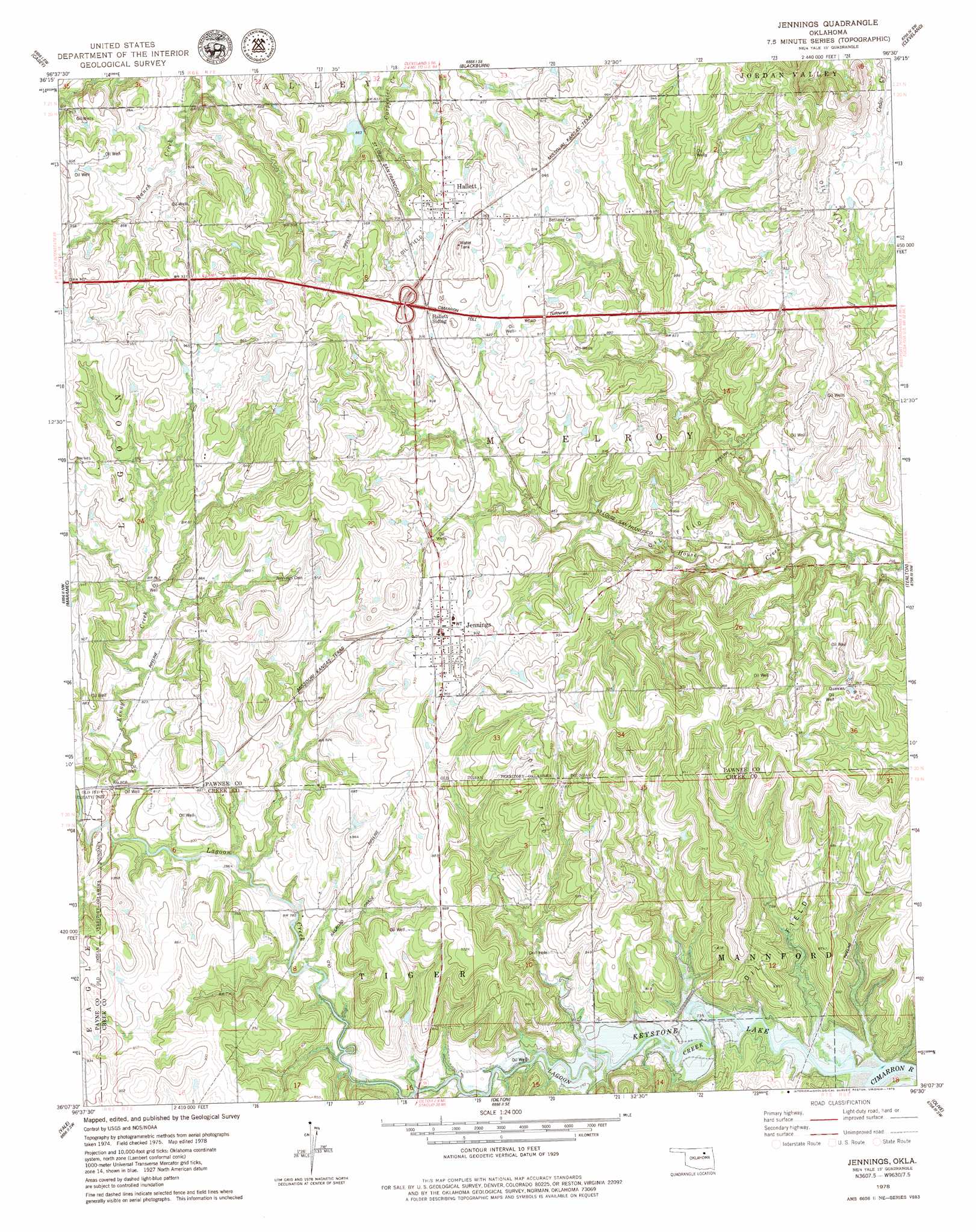
USGS Topo Quad 36096b5 - 1:24,000 scale
| Topo Map Name: | Jennings |
| USGS Topo Quad ID: | 36096b5 |
| Print Size: | ca. 21 1/4" wide x 27" high |
| Southeast Coordinates: | 36.125° N latitude / 96.5° W longitude |
| Map Center Coordinates: | 36.1875° N latitude / 96.5625° W longitude |
| U.S. State: | OK |
| Filename: | o36096b5.jpg |
| Download Map JPG Image: | Jennings topo map 1:24,000 scale |
| Map Type: | Topographic |
| Topo Series: | 7.5´ |
| Map Scale: | 1:24,000 |
| Source of Map Images: | United States Geological Survey (USGS) |
| Alternate Map Versions: |
Jennings OK 1978, updated 1979 Download PDF Buy paper map Jennings OK 2010 Download PDF Buy paper map Jennings OK 2012 Download PDF Buy paper map Jennings OK 2016 Download PDF Buy paper map |
1:24,000 Topo Quads surrounding Jennings
Masham |
Skedee |
Bug Creek |
Hominy |
Hominy Ne |
Pawnee |
Casey |
Blackburn |
Cleveland |
New Prue |
West Point |
Maramec |
Jennings |
Terlton |
Keystone Dam |
Twin Mounds |
Yale |
Oilton |
Olive |
Mannford Se |
Cushing |
North Village |
Drumright |
Bellvue |
Heyburn Reservoir |
> Back to 36096a1 at 1:100,000 scale
> Back to 36096a1 at 1:250,000 scale
> Back to U.S. Topo Maps home
Jennings topo map: Gazetteer
Jennings: Airports
Cimarron Strip elevation 273m 895′Jennings: Crossings
Hallett Interchange elevation 297m 974′Jennings: Dams
Oknoname 037001 Dam elevation 262m 859′Oknoname 117005 Dam elevation 263m 862′
Jennings: Populated Places
Hallett elevation 279m 915′Jennings elevation 284m 931′
Jennings: Reservoirs
Oknoname 037001 Reservoir elevation 262m 859′Oknoname 117005 Reservoir elevation 263m 862′
Jennings: Streams
Kenny Creek elevation 237m 777′Lagoon Creek elevation 221m 725′
Jennings digital topo map on disk
Buy this Jennings topo map showing relief, roads, GPS coordinates and other geographical features, as a high-resolution digital map file on DVD: