Avant Se Topo Map Oklahoma
To zoom in, hover over the map of Avant Se
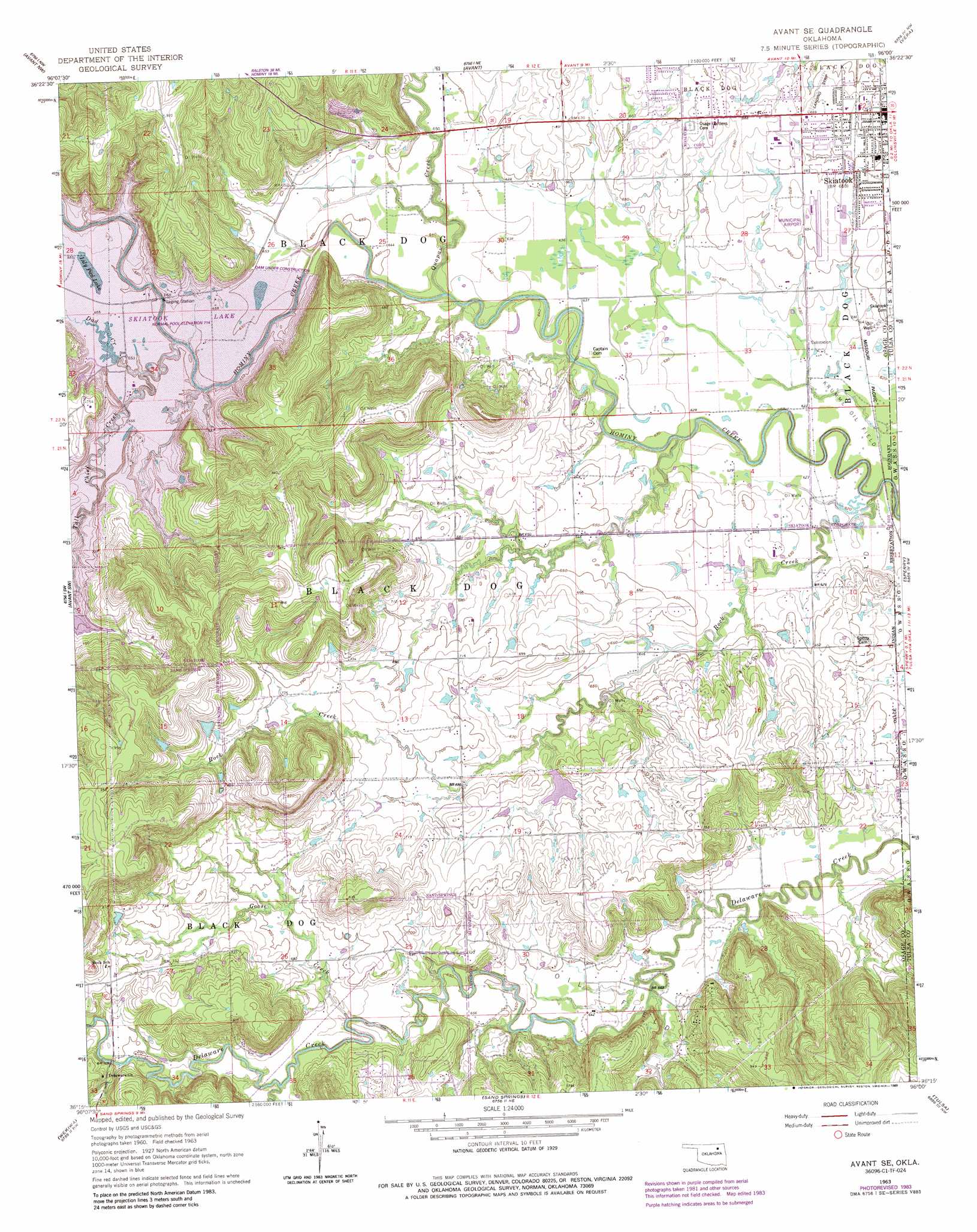
USGS Topo Quad 36096c1 - 1:24,000 scale
| Topo Map Name: | Avant Se |
| USGS Topo Quad ID: | 36096c1 |
| Print Size: | ca. 21 1/4" wide x 27" high |
| Southeast Coordinates: | 36.25° N latitude / 96° W longitude |
| Map Center Coordinates: | 36.3125° N latitude / 96.0625° W longitude |
| U.S. State: | OK |
| Filename: | o36096c1.jpg |
| Download Map JPG Image: | Avant Se topo map 1:24,000 scale |
| Map Type: | Topographic |
| Topo Series: | 7.5´ |
| Map Scale: | 1:24,000 |
| Source of Map Images: | United States Geological Survey (USGS) |
| Alternate Map Versions: |
Avant SE OK 1963, updated 1964 Download PDF Buy paper map Avant SE OK 1963, updated 1976 Download PDF Buy paper map Avant SE OK 1963, updated 1983 Download PDF Buy paper map Avant SE OK 1963, updated 1989 Download PDF Buy paper map Avant SE OK 2010 Download PDF Buy paper map Avant SE OK 2012 Download PDF Buy paper map Avant SE OK 2016 Download PDF Buy paper map |
1:24,000 Topo Quads surrounding Avant Se
Wynona |
Barnsdall |
Wolco |
Ramona |
Bartlesville Se |
Hominy Ne |
Avant Nw |
Avant |
Vera |
Collinsville Ne |
New Prue |
Avant Sw |
Avant Se |
Sperry |
Collinsville |
Keystone Dam |
Wekiwa |
Sand Springs |
Tulsa |
Mingo |
Mannford Se |
Lake Sahoma |
Sapulpa North |
Jenks |
Broken Arrow |
> Back to 36096a1 at 1:100,000 scale
> Back to 36096a1 at 1:250,000 scale
> Back to U.S. Topo Maps home
Avant Se topo map: Gazetteer
Avant Se: Airports
Skiatook Municipal Airport elevation 203m 666′Avant Se: Dams
Oknoname 113001 Dam elevation 208m 682′Avant Se: Populated Places
Skiatook elevation 197m 646′Avant Se: Reservoirs
Lily Pad Lake elevation 218m 715′Oknoname 113001 Reservoir elevation 208m 682′
Skiatook Lake elevation 218m 715′
Avant Se: Streams
Dad Creek elevation 218m 715′Goose Creek elevation 199m 652′
Quapaw Creek elevation 188m 616′
Rock Creek elevation 183m 600′
Tall Chief Creek elevation 218m 715′
Turkey Creek elevation 200m 656′
Avant Se digital topo map on disk
Buy this Avant Se topo map showing relief, roads, GPS coordinates and other geographical features, as a high-resolution digital map file on DVD: