Vera Topo Map Oklahoma
To zoom in, hover over the map of Vera
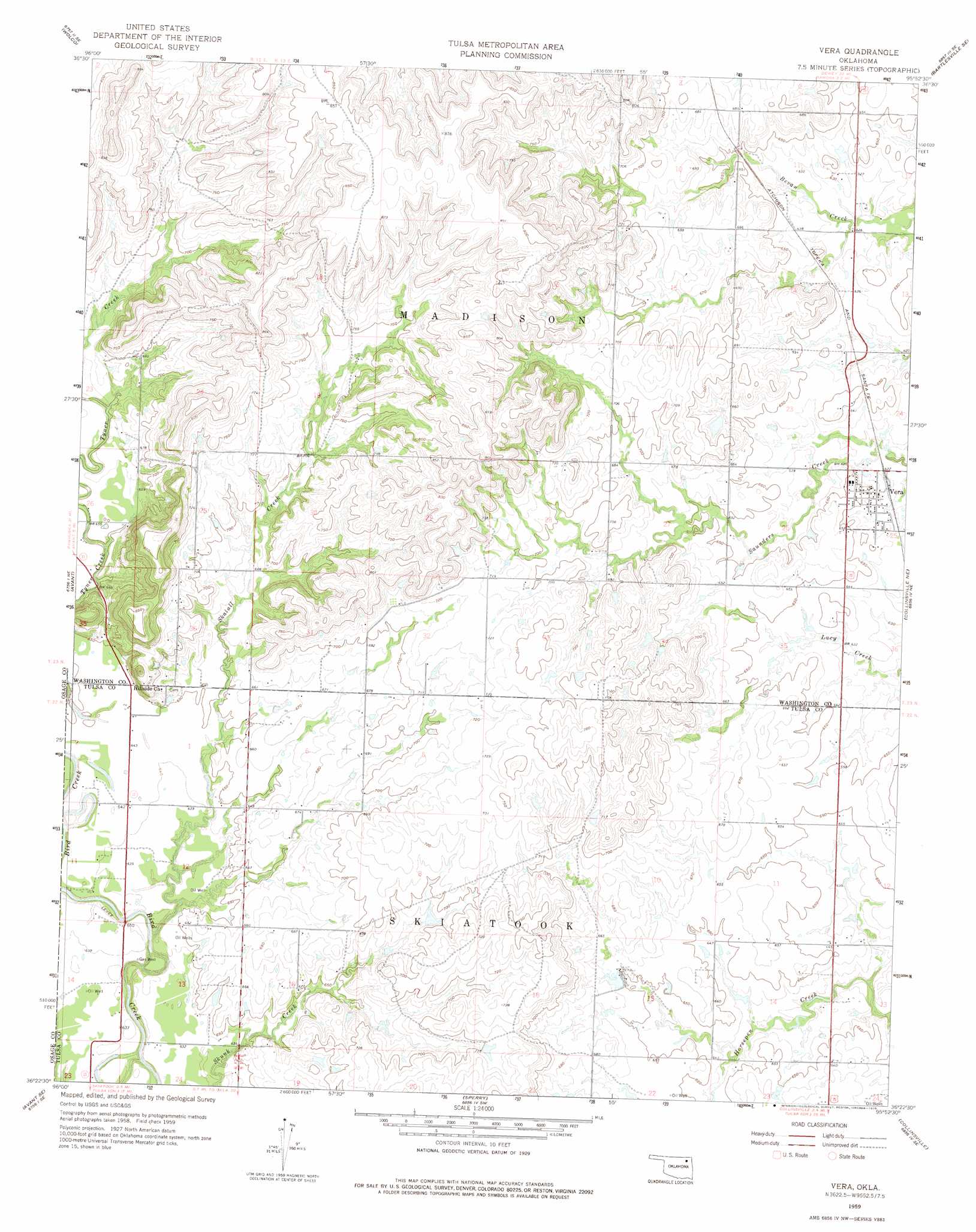
USGS Topo Quad 36095d8 - 1:24,000 scale
| Topo Map Name: | Vera |
| USGS Topo Quad ID: | 36095d8 |
| Print Size: | ca. 21 1/4" wide x 27" high |
| Southeast Coordinates: | 36.375° N latitude / 95.875° W longitude |
| Map Center Coordinates: | 36.4375° N latitude / 95.9375° W longitude |
| U.S. State: | OK |
| Filename: | o36095d8.jpg |
| Download Map JPG Image: | Vera topo map 1:24,000 scale |
| Map Type: | Topographic |
| Topo Series: | 7.5´ |
| Map Scale: | 1:24,000 |
| Source of Map Images: | United States Geological Survey (USGS) |
| Alternate Map Versions: |
Vera OK 1959, updated 1961 Download PDF Buy paper map Vera OK 1959, updated 1975 Download PDF Buy paper map Vera OK 2010 Download PDF Buy paper map Vera OK 2012 Download PDF Buy paper map Vera OK 2016 Download PDF Buy paper map |
1:24,000 Topo Quads surrounding Vera
Nelagoney |
Woolaroc |
Bartlesville South |
Oglesby |
Nowata West |
Barnsdall |
Wolco |
Ramona |
Bartlesville Se |
Talala |
Avant Nw |
Avant |
Vera |
Collinsville Ne |
Oologah |
Avant Sw |
Avant Se |
Sperry |
Collinsville |
Sageeyah |
Wekiwa |
Sand Springs |
Tulsa |
Mingo |
Catoosa |
> Back to 36095a1 at 1:100,000 scale
> Back to 36094a1 at 1:250,000 scale
> Back to U.S. Topo Maps home
Vera topo map: Gazetteer
Vera: Airports
Bluestem Airport elevation 199m 652′Vera: Populated Places
Vera elevation 195m 639′Vera: Streams
Skalall Creek elevation 187m 613′Vera digital topo map on disk
Buy this Vera topo map showing relief, roads, GPS coordinates and other geographical features, as a high-resolution digital map file on DVD: