Lacey Topo Map Oklahoma
To zoom in, hover over the map of Lacey
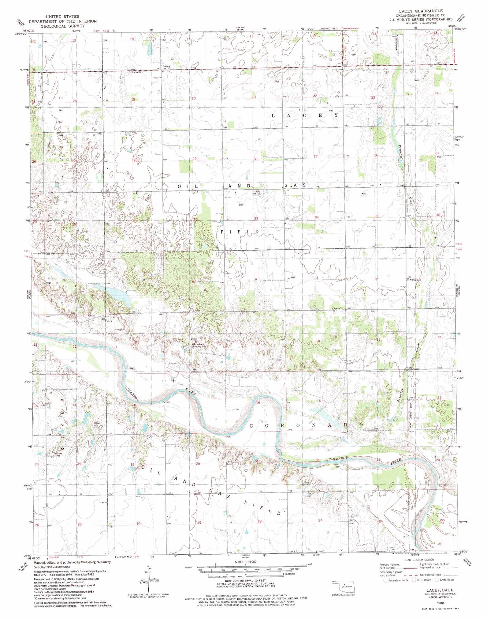
USGS Topo Quad 36098a1 - 1:24,000 scale
| Topo Map Name: | Lacey |
| USGS Topo Quad ID: | 36098a1 |
| Print Size: | ca. 21 1/4" wide x 27" high |
| Southeast Coordinates: | 36° N latitude / 98° W longitude |
| Map Center Coordinates: | 36.0625° N latitude / 98.0625° W longitude |
| U.S. State: | OK |
| Filename: | o36098a1.jpg |
| Download Map JPG Image: | Lacey topo map 1:24,000 scale |
| Map Type: | Topographic |
| Topo Series: | 7.5´ |
| Map Scale: | 1:24,000 |
| Source of Map Images: | United States Geological Survey (USGS) |
| Alternate Map Versions: |
Lacey OK 1982, updated 1983 Download PDF Buy paper map Lacey OK 2009 Download PDF Buy paper map Lacey OK 2012 Download PDF Buy paper map Lacey OK 2016 Download PDF Buy paper map |
1:24,000 Topo Quads surrounding Lacey
Fairview Se |
Ringwood Sw |
Drummond |
Waukomis |
Enid Se |
Isabella |
Ames |
Barr |
Bison |
Steinerts Lake |
Okeene |
Parvin |
Lacey |
Hennessey |
Union |
Hitchcock |
Loyal Nw |
Loyal |
Dover |
Kingfisher Ne |
Watonga Se |
Omega |
Loyal Se |
Kingfisher |
Kingfisher Se |
> Back to 36098a1 at 1:100,000 scale
> Back to 36098a1 at 1:250,000 scale
> Back to U.S. Topo Maps home
Lacey topo map: Gazetteer
Lacey: Airports
Bollenbach Landing Strip elevation 329m 1079′Huff Landing Strip elevation 330m 1082′
Lacey: Populated Places
Lacey elevation 362m 1187′Lacey: Streams
Preacher Creek elevation 322m 1056′Lacey digital topo map on disk
Buy this Lacey topo map showing relief, roads, GPS coordinates and other geographical features, as a high-resolution digital map file on DVD: