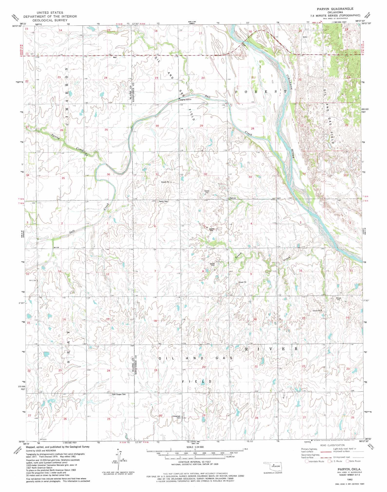
Parvin Topo Map Oklahoma
To zoom in, hover over the map of Parvin
USGS Topo Quad 36098a2 - 1:24,000 scale
| Topo Map Name: | Parvin |
| USGS Topo Quad ID: | 36098a2 |
| Print Size: | ca. 21 1/4" wide x 27" high |
| Southeast Coordinates: | 36° N latitude / 98.125° W longitude |
| Map Center Coordinates: | 36.0625° N latitude / 98.1875° W longitude |
| U.S. State: | OK |
| Filename: | o36098a2.jpg |
| Download Map JPG Image: | Parvin topo map 1:24,000 scale |
| Map Type: | Topographic |
| Topo Series: | 7.5´ |
| Map Scale: | 1:24,000 |
| Source of Map Images: | United States Geological Survey (USGS) |
| Alternate Map Versions: |
Parvin OK 1982, updated 1983 Download PDF Buy paper map Parvin OK 2010 Download PDF Buy paper map Parvin OK 2012 Download PDF Buy paper map Parvin OK 2016 Download PDF Buy paper map |
1:24,000 Topo Quads surrounding Parvin
Fairview |
Fairview Se |
Ringwood Sw |
Drummond |
Waukomis |
Homestead |
Isabella |
Ames |
Barr |
Bison |
Southard |
Okeene |
Parvin |
Lacey |
Hennessey |
Watonga Lake |
Hitchcock |
Loyal Nw |
Loyal |
Dover |
Watonga |
Watonga Se |
Omega |
Loyal Se |
Kingfisher |
> Back to 36098a1 at 1:100,000 scale
> Back to 36098a1 at 1:250,000 scale
> Back to U.S. Topo Maps home
Parvin topo map: Gazetteer
Parvin: Populated Places
Parvin elevation 346m 1135′Parvin: Streams
Pepper Creek elevation 329m 1079′Salt Creek elevation 332m 1089′
Spring Creek elevation 342m 1122′
Parvin digital topo map on disk
Buy this Parvin topo map showing relief, roads, GPS coordinates and other geographical features, as a high-resolution digital map file on DVD: