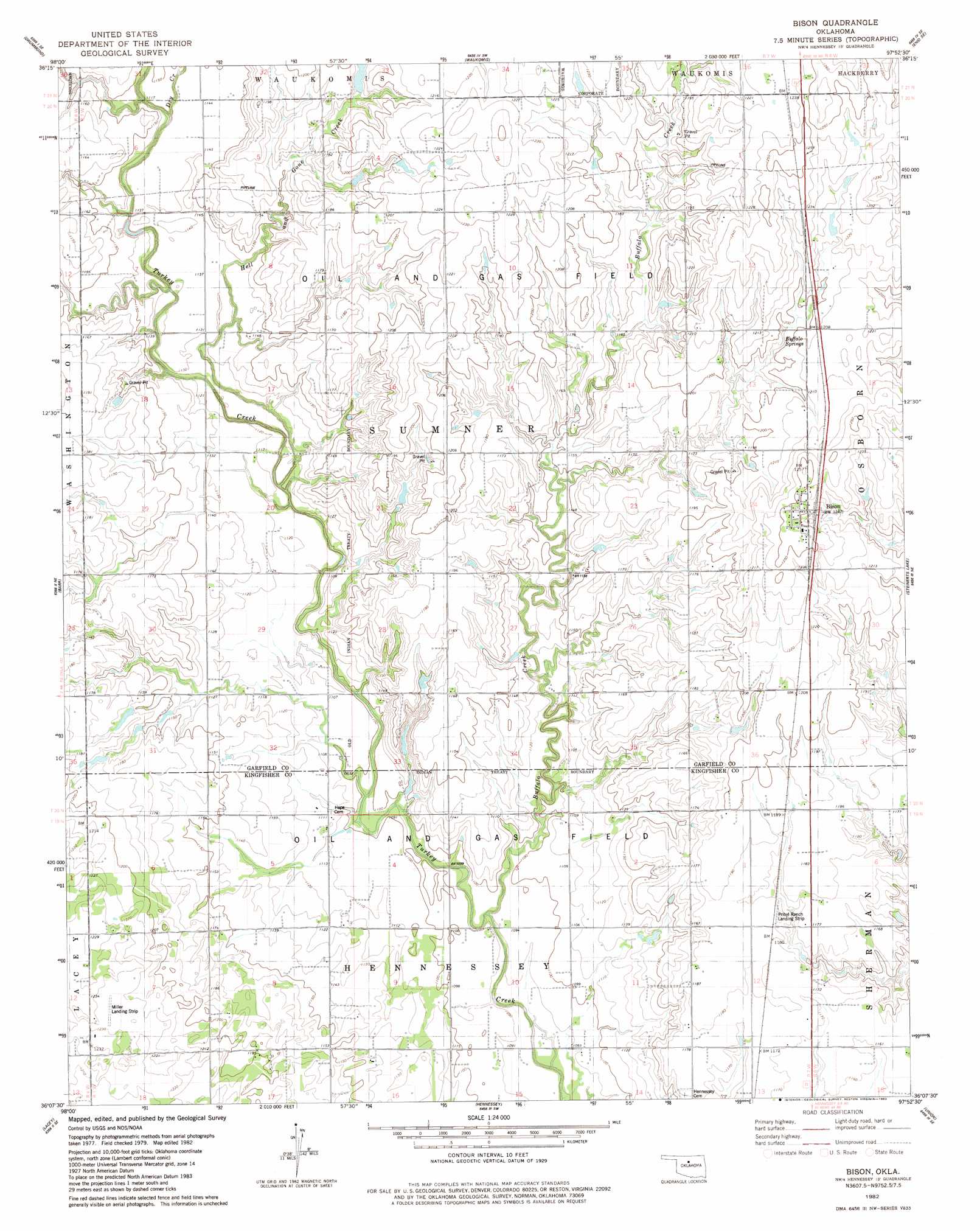
Bison Topo Map Oklahoma
To zoom in, hover over the map of Bison
USGS Topo Quad 36097b8 - 1:24,000 scale
| Topo Map Name: | Bison |
| USGS Topo Quad ID: | 36097b8 |
| Print Size: | ca. 21 1/4" wide x 27" high |
| Southeast Coordinates: | 36.125° N latitude / 97.875° W longitude |
| Map Center Coordinates: | 36.1875° N latitude / 97.9375° W longitude |
| U.S. State: | OK |
| Filename: | o36097b8.jpg |
| Download Map JPG Image: | Bison topo map 1:24,000 scale |
| Map Type: | Topographic |
| Topo Series: | 7.5´ |
| Map Scale: | 1:24,000 |
| Source of Map Images: | United States Geological Survey (USGS) |
| Alternate Map Versions: |
Bison OK 1982, updated 1982 Download PDF Buy paper map Bison OK 2009 Download PDF Buy paper map Bison OK 2012 Download PDF Buy paper map Bison OK 2016 Download PDF Buy paper map |
1:24,000 Topo Quads surrounding Bison
Ringwood |
Lahoma |
Enid West |
Enid East |
Breckinridge |
Ringwood Sw |
Drummond |
Waukomis |
Enid Se |
Fairmont |
Ames |
Barr |
Bison |
Steinerts Lake |
Marshall West |
Parvin |
Lacey |
Hennessey |
Union |
Lovell |
Loyal Nw |
Loyal |
Dover |
Kingfisher Ne |
Crescent Nw |
> Back to 36097a1 at 1:100,000 scale
> Back to 36096a1 at 1:250,000 scale
> Back to U.S. Topo Maps home
Bison topo map: Gazetteer
Bison: Airports
Miller Landing Strip elevation 374m 1227′Pribyl Ranch Landing Strip elevation 360m 1181′
Bison: Dams
Oknoname 04701 Dam elevation 348m 1141′Bison: Populated Places
Bison elevation 381m 1250′Buffalo Springs Stage Station (historical) elevation 364m 1194′
Bison: Reservoirs
Oknoname 04701 Reservoir elevation 348m 1141′Bison: Springs
Buffalo Springs elevation 363m 1190′Bison: Streams
Buffalo Creek elevation 329m 1079′Dry Creek elevation 344m 1128′
Hell and Gone Creek elevation 340m 1115′
Bison digital topo map on disk
Buy this Bison topo map showing relief, roads, GPS coordinates and other geographical features, as a high-resolution digital map file on DVD: