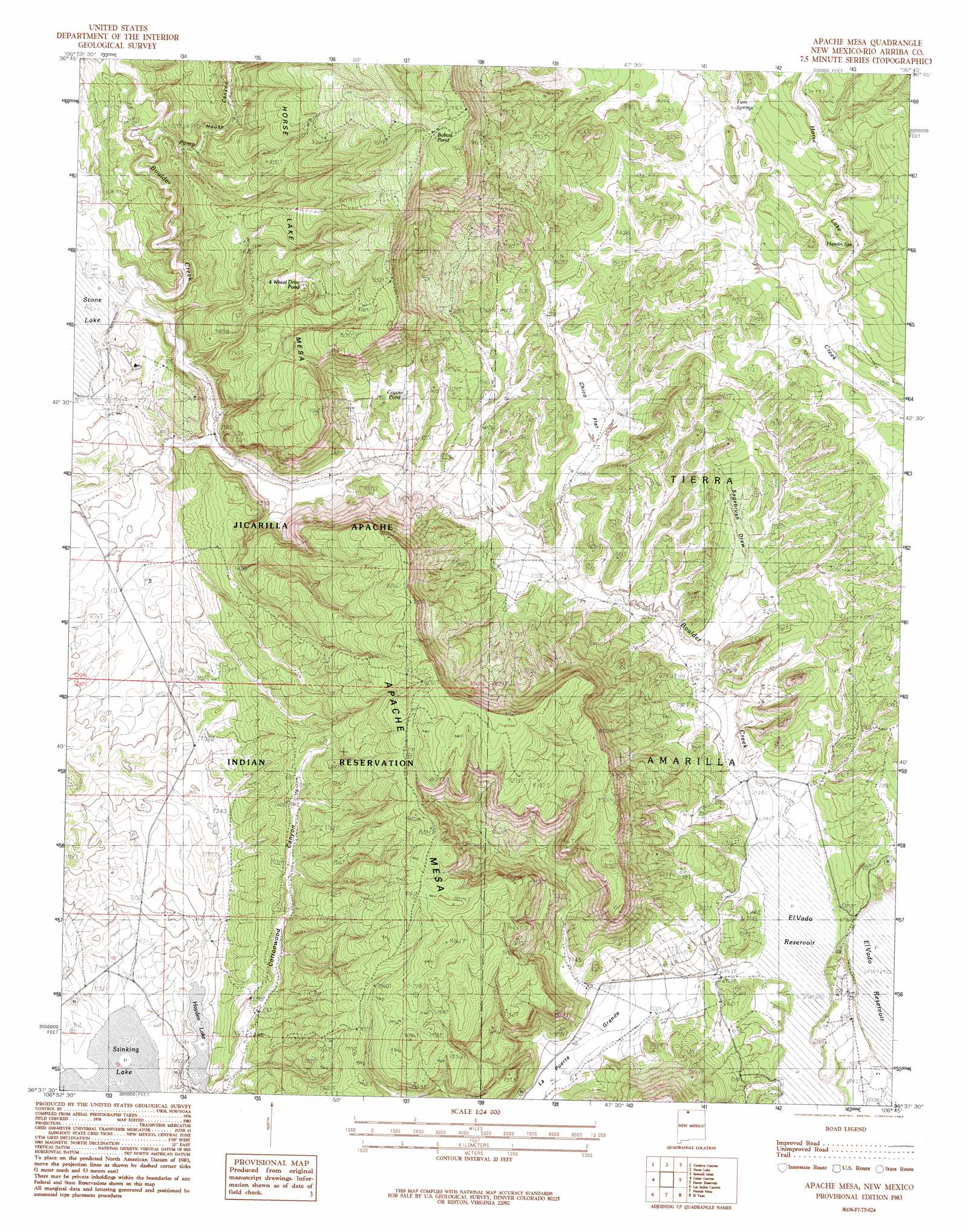
Apache Mesa Topo Map New Mexico
To zoom in, hover over the map of Apache Mesa
USGS Topo Quad 36106f7 - 1:24,000 scale
| Topo Map Name: | Apache Mesa |
| USGS Topo Quad ID: | 36106f7 |
| Print Size: | ca. 21 1/4" wide x 27" high |
| Southeast Coordinates: | 36.625° N latitude / 106.75° W longitude |
| Map Center Coordinates: | 36.6875° N latitude / 106.8125° W longitude |
| U.S. State: | NM |
| Filename: | o36106f7.jpg |
| Download Map JPG Image: | Apache Mesa topo map 1:24,000 scale |
| Map Type: | Topographic |
| Topo Series: | 7.5´ |
| Map Scale: | 1:24,000 |
| Source of Map Images: | United States Geological Survey (USGS) |
| Alternate Map Versions: |
Apache Mesa NM 1983, updated 1983 Download PDF Buy paper map Apache Mesa NM 2010 Download PDF Buy paper map Apache Mesa NM 2013 Download PDF Buy paper map |
1:24,000 Topo Quads surrounding Apache Mesa
Wirt Canyon |
Dulce |
Monero |
Chromo Mountain |
Chama |
John Mills Lake |
Cordova Canyon |
Horse Lake |
Sawmill Mesa |
Brazos |
Cement Lake |
Cedar Canyon |
Apache Mesa |
Heron Reservoir |
Tierra Amarilla |
Leavry Canyon |
Los Indios Canyon |
Pounds Mesa |
El Vado |
Las Nutrias |
Ojito |
Canada Ojitos |
Llaves |
Navajo Peak |
Alire |
> Back to 36106e1 at 1:100,000 scale
> Back to 36106a1 at 1:250,000 scale
> Back to U.S. Topo Maps home
Apache Mesa topo map: Gazetteer
Apache Mesa: Dams
Hayden Lake Dam elevation 2187m 7175′Stone Lake Dam elevation 2226m 7303′
Stone Lake Dike Number Four elevation 2210m 7250′
Stone Lake Dike Number One elevation 2211m 7253′
Stone Lake Dike Number Three elevation 2213m 7260′
Stone Lake Dike Number Two elevation 2210m 7250′
Apache Mesa: Reservoirs
Hayden Lake elevation 2187m 7175′Apache Mesa: Streams
Boulder Creek elevation 2108m 6916′Apache Mesa: Valleys
La Puerta Grande elevation 2111m 6925′Pump House Canyon elevation 2256m 7401′
Apache Mesa digital topo map on disk
Buy this Apache Mesa topo map showing relief, roads, GPS coordinates and other geographical features, as a high-resolution digital map file on DVD: