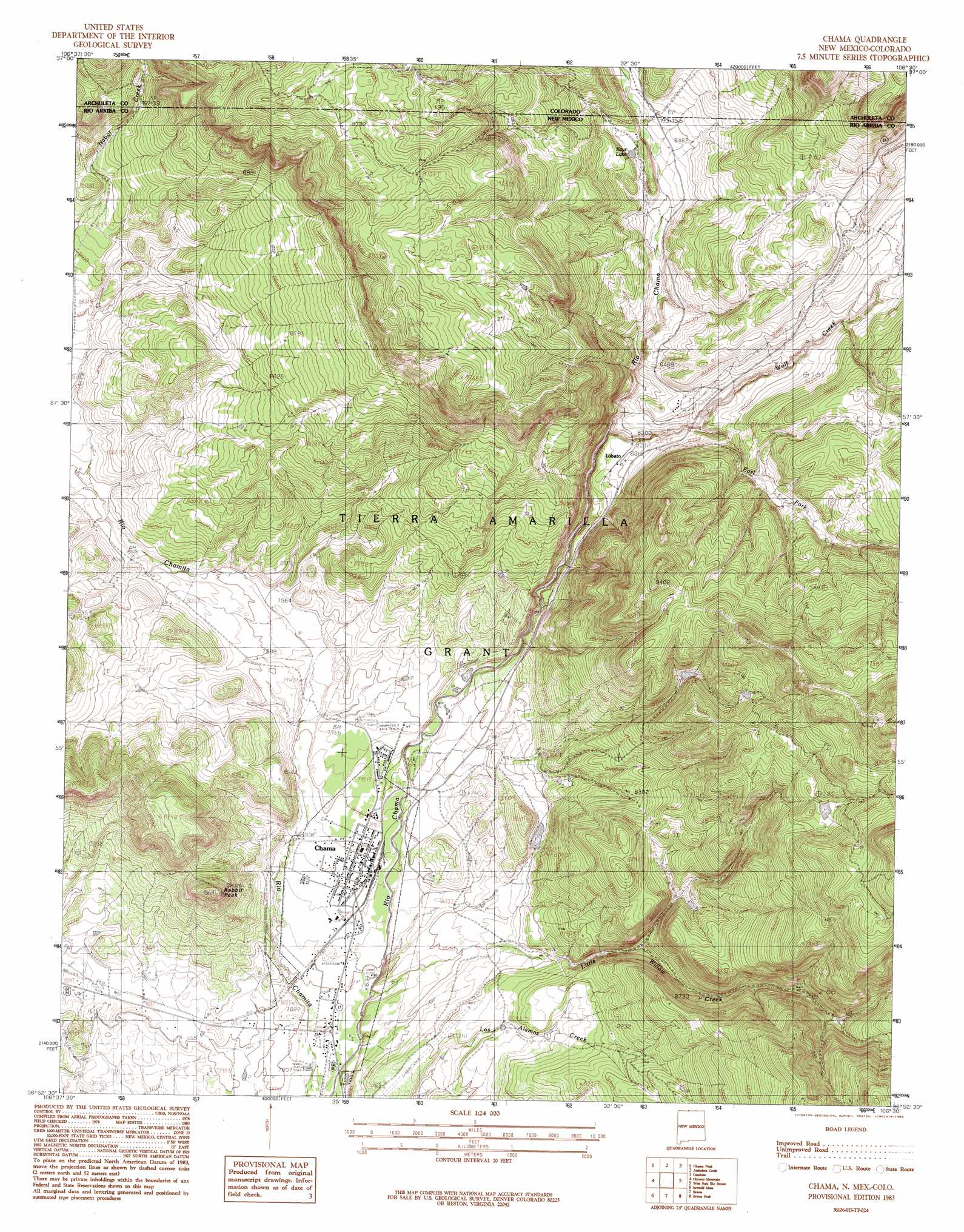
Chama Topo Map New Mexico
To zoom in, hover over the map of Chama
USGS Topo Quad 36106h5 - 1:24,000 scale
| Topo Map Name: | Chama |
| USGS Topo Quad ID: | 36106h5 |
| Print Size: | ca. 21 1/4" wide x 27" high |
| Southeast Coordinates: | 36.875° N latitude / 106.5° W longitude |
| Map Center Coordinates: | 36.9375° N latitude / 106.5625° W longitude |
| U.S. States: | NM, CO |
| Filename: | o36106h5.jpg |
| Download Map JPG Image: | Chama topo map 1:24,000 scale |
| Map Type: | Topographic |
| Topo Series: | 7.5´ |
| Map Scale: | 1:24,000 |
| Source of Map Images: | United States Geological Survey (USGS) |
| Alternate Map Versions: |
Chama NM 1983, updated 1983 Download PDF Buy paper map Chama NM 1983, updated 1983 Download PDF Buy paper map Chama NM 2010 Download PDF Buy paper map Chama NM 2013 Download PDF Buy paper map Chama NM 2017 Download PDF Buy paper map |
1:24,000 Topo Quads surrounding Chama
Harris Lake |
Elephant Head Rock |
Victoria Lake |
Spectacle Lake |
La Jara Canyon |
Chromo |
Chama Peak |
Archuleta Creek |
Cumbres |
Osier |
Monero |
Chromo Mountain |
Chama |
West Fork Rio Brazos |
Toltec Mesa |
Horse Lake |
Sawmill Mesa |
Brazos |
Brazos Peak |
Lagunitas Creek |
Apache Mesa |
Heron Reservoir |
Tierra Amarilla |
Penasco Amarillo |
East Gavilan Canyon |
> Back to 36106e1 at 1:100,000 scale
> Back to 36106a1 at 1:250,000 scale
> Back to U.S. Topo Maps home
Chama topo map: Gazetteer
Chama: Canals
M B Ditch elevation 2393m 7851′Chama: Parks
Chama Historical Marker elevation 2399m 7870′Cumbres and Toltec Scenic Railroad Historical Marker elevation 2399m 7870′
Cumbres Pass Historical Marker elevation 2399m 7870′
Chama: Populated Places
Chama elevation 2399m 7870′Lobato elevation 2528m 8293′
Chama: Post Offices
Chama Post Office elevation 2399m 7870′Chama: Reservoirs
Kays Lake elevation 2593m 8507′Chama: Streams
East Fork Wolf Creek elevation 2533m 8310′Little Willow Creek elevation 2373m 7785′
Wolf Creek elevation 2495m 8185′
Wolf Creek elevation 2496m 8188′
Chama: Summits
Rabbit Peak elevation 2622m 8602′Chama: Wells
Water Well 3 elevation 2382m 7814′Chama digital topo map on disk
Buy this Chama topo map showing relief, roads, GPS coordinates and other geographical features, as a high-resolution digital map file on DVD: