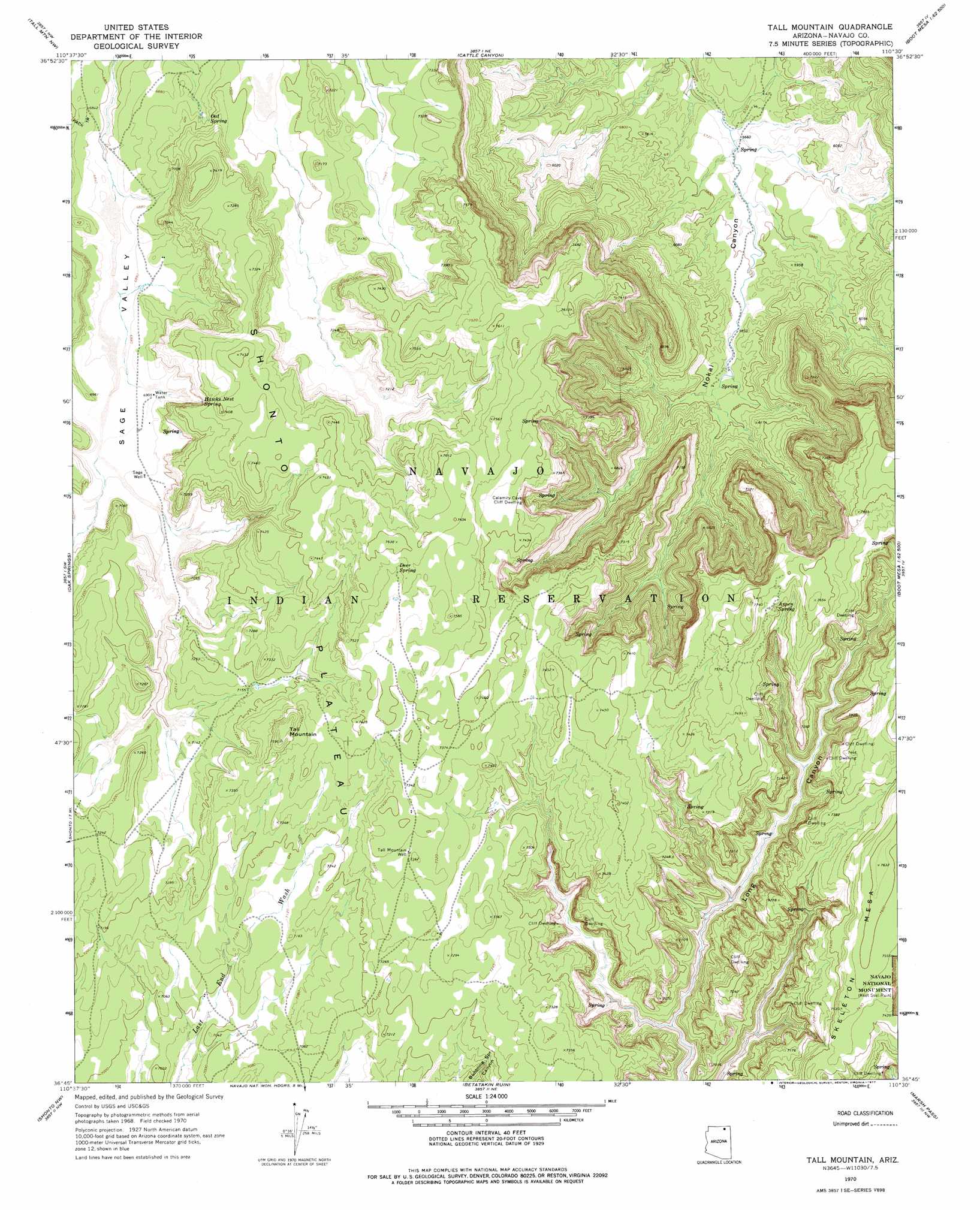
Tall Mountain Topo Map Arizona
To zoom in, hover over the map of Tall Mountain
USGS Topo Quad 36110g5 - 1:24,000 scale
| Topo Map Name: | Tall Mountain |
| USGS Topo Quad ID: | 36110g5 |
| Print Size: | ca. 21 1/4" wide x 27" high |
| Southeast Coordinates: | 36.75° N latitude / 110.5° W longitude |
| Map Center Coordinates: | 36.8125° N latitude / 110.5625° W longitude |
| U.S. State: | AZ |
| Filename: | o36110g5.jpg |
| Download Map JPG Image: | Tall Mountain topo map 1:24,000 scale |
| Map Type: | Topographic |
| Topo Series: | 7.5´ |
| Map Scale: | 1:24,000 |
| Source of Map Images: | United States Geological Survey (USGS) |
| Alternate Map Versions: |
Tall Mountain AZ 1970, updated 1973 Download PDF Buy paper map Tall Mountain AZ 1970, updated 1977 Download PDF Buy paper map Tall Mountain AZ 2011 Download PDF Buy paper map Tall Mountain AZ 2014 Download PDF Buy paper map |
1:24,000 Topo Quads surrounding Tall Mountain
Navajo Begay |
Deep Canyon South |
No Mans Mesa South |
Jacobs Monument |
Oljeto |
Chaiyahi Rim Ne |
Tall Mountain Nw |
Cattle Canyon |
Big Point |
Boot Mesa |
Chaiyahi Rim Se |
Oak Springs |
Tall Mountain |
Keet Seel Ruin |
Tseyi-Hatsosi |
Inscription House Ruin |
Shonto Nw |
Betatakin Ruin |
Marsh Pass |
Kayenta West |
Whirlwind Rock |
Shonto |
Shonto Se |
Long House Valley |
Marsh Pass Se |
> Back to 36110e1 at 1:100,000 scale
> Back to 36110a1 at 1:250,000 scale
> Back to U.S. Topo Maps home
Tall Mountain topo map: Gazetteer
Tall Mountain: Springs
Aspen Spring elevation 2282m 7486′Deer Spring elevation 2296m 7532′
Hawks Nest Spring elevation 2156m 7073′
Oat Spring elevation 2120m 6955′
Tall Mountain: Summits
Tall Mountain elevation 2302m 7552′Zilnez Mesa elevation 2184m 7165′
Tall Mountain: Valleys
Sage Valley elevation 0m 0′Tall Mountain: Wells
Tall Mountain Well elevation 2243m 7358′Tall Mountain digital topo map on disk
Buy this Tall Mountain topo map showing relief, roads, GPS coordinates and other geographical features, as a high-resolution digital map file on DVD: