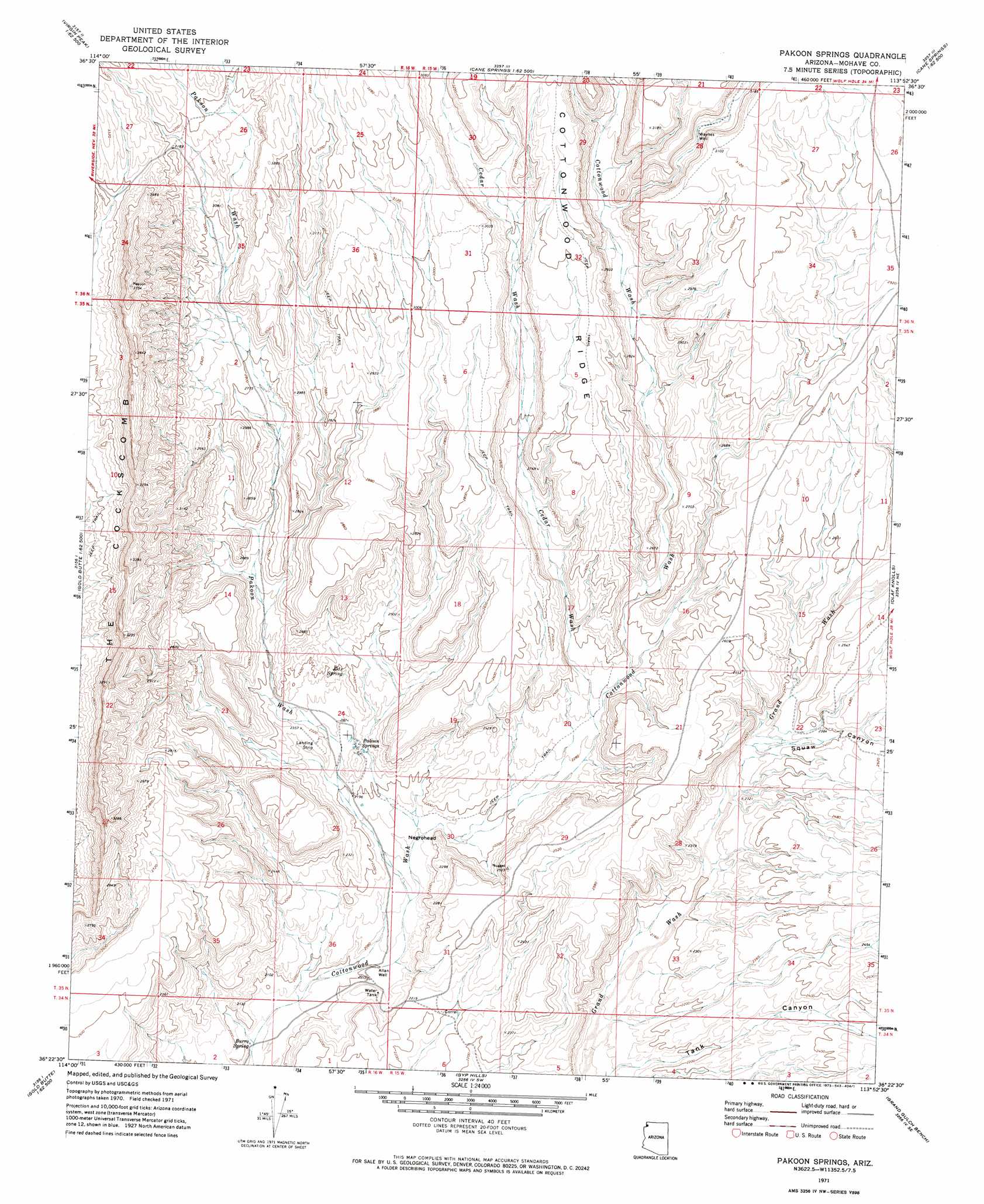
Pakoon Springs Topo Map Arizona
To zoom in, hover over the map of Pakoon Springs
USGS Topo Quad 36113d8 - 1:24,000 scale
| Topo Map Name: | Pakoon Springs |
| USGS Topo Quad ID: | 36113d8 |
| Print Size: | ca. 21 1/4" wide x 27" high |
| Southeast Coordinates: | 36.375° N latitude / 113.875° W longitude |
| Map Center Coordinates: | 36.4375° N latitude / 113.9375° W longitude |
| U.S. State: | AZ |
| Filename: | o36113d8.jpg |
| Download Map JPG Image: | Pakoon Springs topo map 1:24,000 scale |
| Map Type: | Topographic |
| Topo Series: | 7.5´ |
| Map Scale: | 1:24,000 |
| Source of Map Images: | United States Geological Survey (USGS) |
| Alternate Map Versions: |
Pakoon Springs AZ 1971, updated 1973 Download PDF Buy paper map Pakoon Springs AZ 2011 Download PDF Buy paper map Pakoon Springs AZ 2014 Download PDF Buy paper map |
1:24,000 Topo Quads surrounding Pakoon Springs
Riverside |
Hen Spring |
Jacobs Well |
Cane Springs |
Mustang Knoll |
Whitney Pocket |
Virgin Peak |
Red Pockets |
Cane Springs Se |
Saint George Canyon |
Devils Throat |
Saint Thomas Gap |
Pakoon Springs |
Olaf Knolls |
Last Chance Canyon |
Gold Butte |
Azure Ridge |
Gyp Hills |
Grand Gulch Bench |
Mustang Point |
Jumbo Peak |
Iceberg Canyon |
Snap Canyon West |
Snap Canyon East |
Snap Draw |
> Back to 36113a1 at 1:100,000 scale
> Back to 36112a1 at 1:250,000 scale
> Back to U.S. Topo Maps home
Pakoon Springs topo map: Gazetteer
Pakoon Springs: Reservoirs
Pakoon Tank elevation 689m 2260′Pakoon Springs: Ridges
Cottonwood Ridge elevation 902m 2959′The Cockscomb elevation 1027m 3369′
Pakoon Springs: Springs
Burro Spring elevation 584m 1916′Eds Spring elevation 719m 2358′
Pakoon Springs elevation 697m 2286′
Pakoon Springs: Summits
Negrohead elevation 710m 2329′Pakoon Springs: Valleys
Cedar Wash elevation 700m 2296′Pakoon Wash elevation 629m 2063′
Squaw Canyon elevation 706m 2316′
Pakoon Springs: Wells
Allan Well elevation 611m 2004′Waynes Well elevation 880m 2887′
Pakoon Springs digital topo map on disk
Buy this Pakoon Springs topo map showing relief, roads, GPS coordinates and other geographical features, as a high-resolution digital map file on DVD: