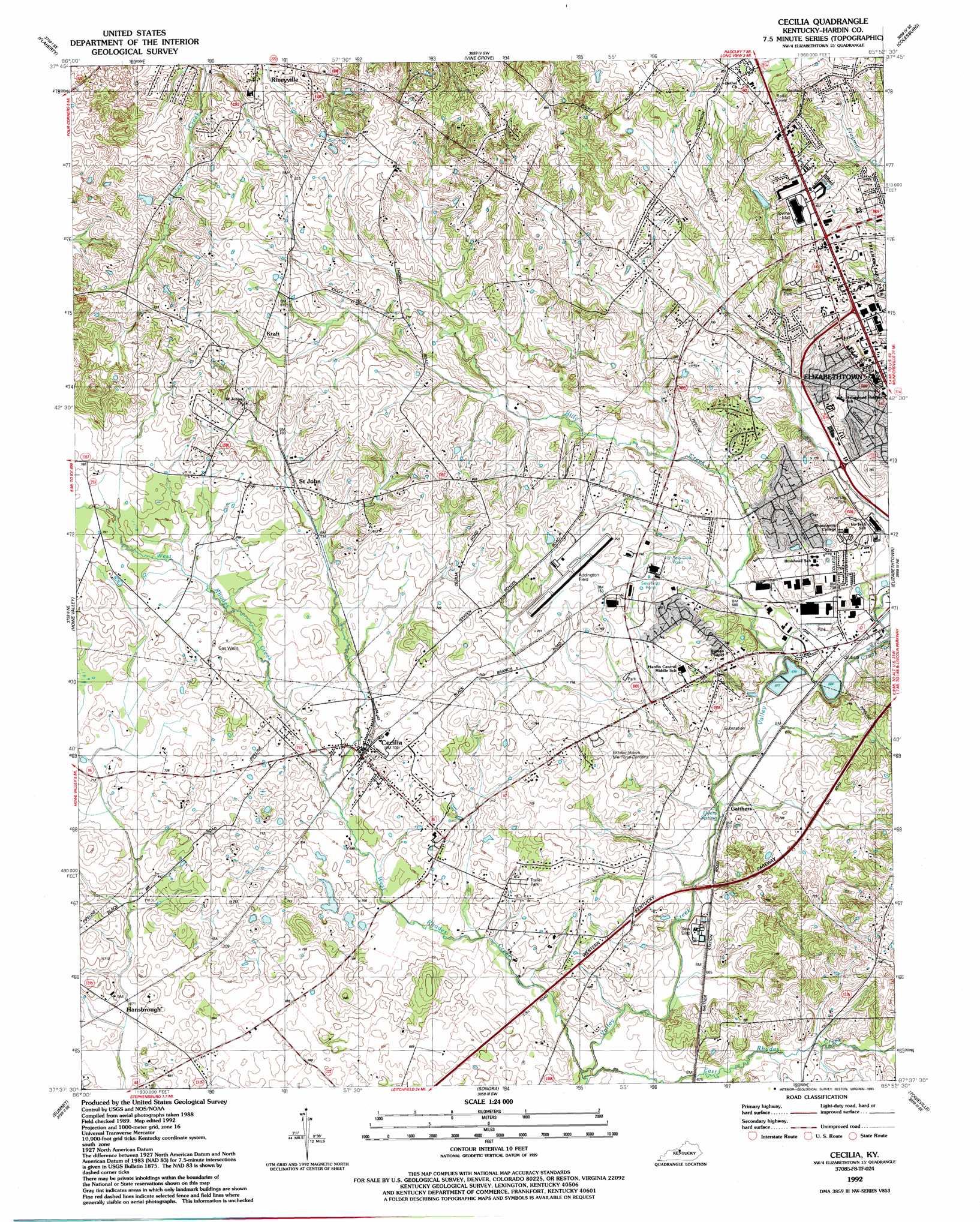
Cecilia Topo Map Kentucky
To zoom in, hover over the map of Cecilia
USGS Topo Quad 37085f8 - 1:24,000 scale
| Topo Map Name: | Cecilia |
| USGS Topo Quad ID: | 37085f8 |
| Print Size: | ca. 21 1/4" wide x 27" high |
| Southeast Coordinates: | 37.625° N latitude / 85.875° W longitude |
| Map Center Coordinates: | 37.6875° N latitude / 85.9375° W longitude |
| U.S. State: | KY |
| Filename: | o37085f8.jpg |
| Download Map JPG Image: | Cecilia topo map 1:24,000 scale |
| Map Type: | Topographic |
| Topo Series: | 7.5´ |
| Map Scale: | 1:24,000 |
| Source of Map Images: | United States Geological Survey (USGS) |
| Alternate Map Versions: |
Cecilia KY 1948, updated 1953 Download PDF Buy paper map Cecilia KY 1960, updated 1961 Download PDF Buy paper map Cecilia KY 1967, updated 1968 Download PDF Buy paper map Cecilia KY 1967, updated 1980 Download PDF Buy paper map Cecilia KY 1967, updated 1982 Download PDF Buy paper map Cecilia KY 1967, updated 1987 Download PDF Buy paper map Cecilia KY 1992, updated 1993 Download PDF Buy paper map Cecilia KY 2010 Download PDF Buy paper map Cecilia KY 2013 Download PDF Buy paper map Cecilia KY 2016 Download PDF Buy paper map |
1:24,000 Topo Quads surrounding Cecilia
Guston |
Rock Haven |
Fort Knox |
Pitts Point |
Shepherdsville |
Big Spring |
Flaherty |
Vine Grove |
Colesburg |
Lebanon Junction |
Constantine |
Howe Valley |
Cecilia |
Elizabethtown |
Nelsonville |
Big Clifty |
Summit |
Sonora |
Tonieville |
Hodgenville |
Clarkson |
Millerstown |
Upton |
Hammonville |
Magnolia |
> Back to 37085e1 at 1:100,000 scale
> Back to 37084a1 at 1:250,000 scale
> Back to U.S. Topo Maps home
Cecilia topo map: Gazetteer
Cecilia: Airports
Addington Field elevation 235m 770′Cecilia: Parks
University Park elevation 213m 698′Cecilia: Populated Places
Cecilia elevation 215m 705′Gaithers elevation 212m 695′
Hansbrough elevation 205m 672′
Kraft elevation 250m 820′
Rineyville elevation 238m 780′
Saint John elevation 230m 754′
Cecilia: Springs
Dyers Spring elevation 204m 669′Elizabethtown Spring elevation 207m 679′
Cecilia: Streams
Billy Creek elevation 204m 669′East Rhudes Creek elevation 198m 649′
West Rhudes Creek elevation 198m 649′
Cecilia digital topo map on disk
Buy this Cecilia topo map showing relief, roads, GPS coordinates and other geographical features, as a high-resolution digital map file on DVD: