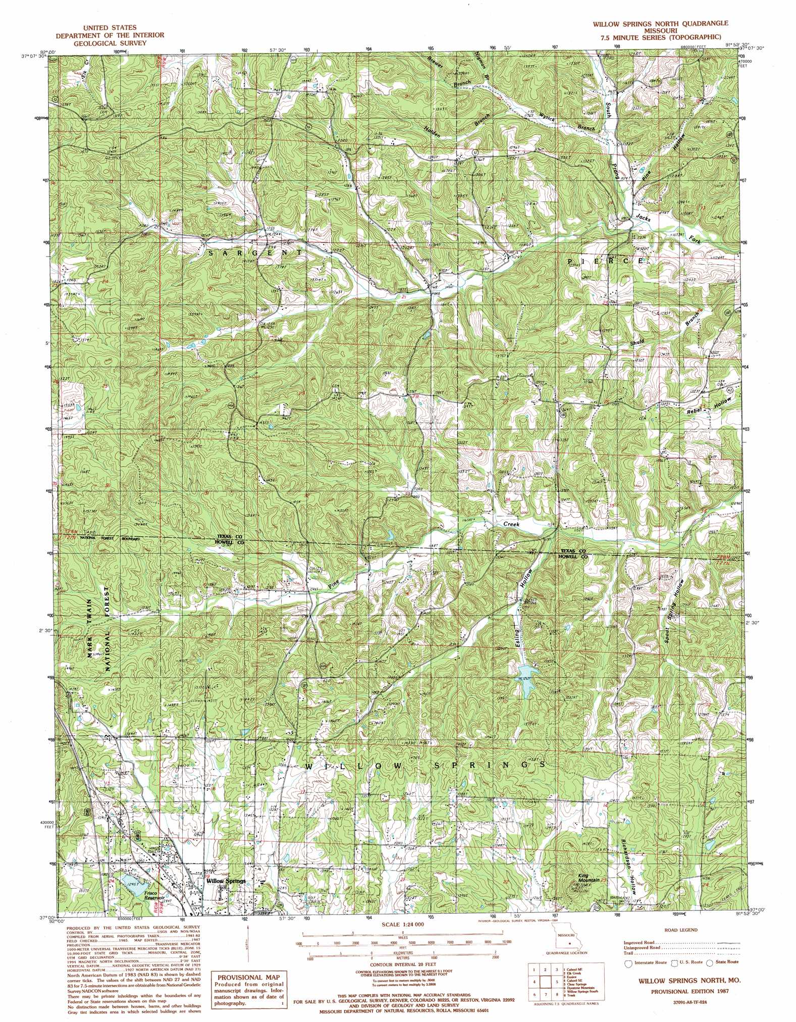
Willow Springs North Topo Map Missouri
To zoom in, hover over the map of Willow Springs North
USGS Topo Quad 37091a8 - 1:24,000 scale
| Topo Map Name: | Willow Springs North |
| USGS Topo Quad ID: | 37091a8 |
| Print Size: | ca. 21 1/4" wide x 27" high |
| Southeast Coordinates: | 37° N latitude / 91.875° W longitude |
| Map Center Coordinates: | 37.0625° N latitude / 91.9375° W longitude |
| U.S. State: | MO |
| Filename: | o37091a8.jpg |
| Download Map JPG Image: | Willow Springs North topo map 1:24,000 scale |
| Map Type: | Topographic |
| Topo Series: | 7.5´ |
| Map Scale: | 1:24,000 |
| Source of Map Images: | United States Geological Survey (USGS) |
| Alternate Map Versions: |
Willow Springs North MO 1987, updated 1987 Download PDF Buy paper map Willow Springs North MO 1987, updated 1994 Download PDF Buy paper map Willow Springs North MO 2004, updated 2006 Download PDF Buy paper map Willow Springs North MO 2012 Download PDF Buy paper map Willow Springs North MO 2015 Download PDF Buy paper map |
| FStopo: | US Forest Service topo Willow Springs North is available: Download FStopo PDF Download FStopo TIF |
1:24,000 Topo Quads surrounding Willow Springs North
Huggins |
Bucyrus |
Houston |
Raymondville |
Hartshorn |
Cabool Nw |
Cabool Ne |
Elk Creek |
Eunice |
Summersville |
Cabool Sw |
Cabool Se |
Willow Springs North |
Clear Springs |
Pine Crest |
Nichols Knob |
Dyestone Mountain |
Willow Springs South |
Trask |
Mountain View |
Dora |
Siloam Springs |
Pomona |
White Church |
Peace Valley |
> Back to 37091a1 at 1:100,000 scale
> Back to 37090a1 at 1:250,000 scale
> Back to U.S. Topo Maps home
Willow Springs North topo map: Gazetteer
Willow Springs North: Dams
Raikos Lake Dam elevation 420m 1377′Willow Springs Hunting Club Dam elevation 394m 1292′
Willow Springs North: Populated Places
Varvol elevation 395m 1295′Willow Springs North: Reservoirs
Frisco Reservoir elevation 394m 1292′Little Cannon Lake elevation 420m 1377′
Willow Springs North: Streams
Brewer Branch elevation 364m 1194′Holden Branch elevation 359m 1177′
Nigman Branch elevation 364m 1194′
Wyrick Branch elevation 340m 1115′
Willow Springs North: Summits
King Mountain elevation 463m 1519′Queens Mountain elevation 446m 1463′
Willow Springs North: Valleys
Esling Hollow elevation 348m 1141′Pine Hollow elevation 336m 1102′
Spout Spr Hollow elevation 340m 1115′
Willow Springs North digital topo map on disk
Buy this Willow Springs North topo map showing relief, roads, GPS coordinates and other geographical features, as a high-resolution digital map file on DVD: